Chest opened
+${chestReward.xp} XP
Explorer
NOUVEAU ×${chestReward.collectible.quantity}
tapez pour fermer
Chest locked

Open chests in the app

Around Us is built for your phone — chests unlock when you walk, explore and capture nearby places.

Enable Location

We need your location to show you interesting places around you

Discover nearby places

Find interesting locations and hidden gems around you

Precise directions

Get accurate directions and distances to places

Your location is never shared with other users. It's only used when you tap the location button.

Log in to your account

Start exploring — it's free

Trusted by 72,886 travelers worldwide

Continue with Google
Continue with Apple
or

We will send you a code to connect

By continuing, you accept our Terms and Conditions and our Privacy Policy

Check your inbox

We've sent a pincode in your inbox. Please enter the code below.

Brandywine Hundred
Discussion Reviews Photo
6.3k Popularity

Brandywine Hundred, Administrative subdivision in Delaware, US

Brandywine Hundred is a hundred, a type of administrative district, located north and northeast of Wilmington in Delaware. It borders Pennsylvania to the north and is bounded to the west by Brandywine Creek.

The district was established in 1682 as one of the first hundreds in Delaware and took its name from Brandywine Creek. Over the centuries, it sent representatives to the Delaware General Assembly, playing a steady role in local governance.

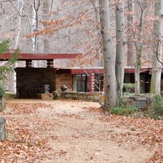
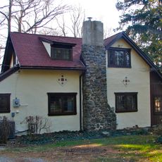
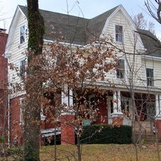
The area is home to a mix of residential streets, shopping centers, and public parks that give it a suburban feel typical of northern Delaware. Local libraries and community centers serve as meeting points where people gather for everyday activities.

The district sits just north of Wilmington and is easy to reach by road, with several major highways passing through or nearby. A car is the most practical option for getting around, as public transit coverage is limited in many parts of the area.

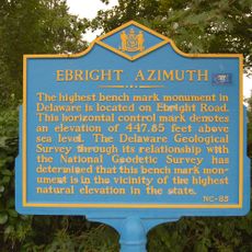
Ebright Azimuth, the highest point in Delaware at around 450 feet (137 meters) above sea level, sits quietly in a residential neighborhood near the northern edge of the district. Most people drive past it without noticing, as it looks like an ordinary street corner with a small marker.

The community of curious travelers

AroundUs brings together thousands of curated places, local tips, and hidden gems, enriched daily by 60,000 contributors worldwide.

Start exploring
Location
GPS coordinates
39.79178,-75.51631
Latest update
March 3, 2026 10:09
Around this place
Ebright Azimuth
United States of America

Ebright Azimuth

4.9 km
Nemours Mansion and Gardens
United States of America

Nemours Mansion and Gardens

4 km
Bellevue State Park
United States of America

Bellevue State Park

2.2 km
Alapocas Run State Park
United States of America

Alapocas Run State Park

3.1 km
Brandywine Zoo
United States of America

Brandywine Zoo

4.9 km
Dudley Spencer House
United States of America

Dudley Spencer House

2 km
Wilmington Park
United States of America

Wilmington Park

4.5 km
Brandywine Park
United States of America

Brandywine Park

5 km
P. S. Dupont High School
United States of America

P. S. Dupont High School

3.4 km
Fox Point State Park
United States of America

Fox Point State Park

4.6 km
Lombardy Hall
United States of America

Lombardy Hall

2.7 km
Marcus Hook Range Rear Light
United States of America

Marcus Hook Range Rear Light

3.5 km
Baynard Boulevard Historic District
United States of America

Baynard Boulevard Historic District

4.7 km
Mount Lebanon Methodist Episcopal Church
United States of America

Mount Lebanon Methodist Episcopal Church

4.5 km
Cherry Island Range Rear Light
United States of America

Cherry Island Range Rear Light

4 km
Abner Cloud House
United States of America

Abner Cloud House

4 km
Riverview Cemetery
United States of America

Riverview Cemetery

3.9 km
William Young House
United States of America

William Young House

4.2 km
Mount Pleasant Methodist Episcopal Church and Parsonage
United States of America

Mount Pleasant Methodist Episcopal Church and Parsonage

2.6 km
William Talley House
United States of America

William Talley House

1.9 km
Joshua Pyle House and Wagon Barn
United States of America

Joshua Pyle House and Wagon Barn

4.3 km
Nemours Estate
United States of America

Nemours Estate

4 km
Ivyside Farm
United States of America

Ivyside Farm

4.7 km
Ardens Historic District
United States of America

Ardens Historic District

3.3 km
Rosemont
United States of America

Rosemont

3.1 km
Alapocas Run State Park
United States of America

Alapocas Run State Park

4.2 km
Brookwood II
United States of America

Brookwood II

3.6 km
Blue Ball Barn
United States of America

Blue Ball Barn

3 km
Show the full map
Reviews
Share your experience

No review yet

Discussions
Start a discussion...

No discussion yet

« Brandywine Hundred - Administrative subdivision in Delaware, US » is provided by Around Us (aroundus.com). Images and texts are derived from Wikimedia project under a Creative Commons license. You are allowed to copy, distribute, and modify copies of this page, under the conditions set by the license, as long as this note is clearly visible.

Discover hidden gems everywhere you go!

From secret cafés to breathtaking viewpoints, skip the crowded tourist spots and find places that match your style. Our app makes it easy with voice search, smart filtering, route optimization, and insider tips from travelers worldwide. Download now for the complete mobile experience.

Around Us App Screenshot

A unique approach to discovering new places

Le Figaro

All the places worth exploring

France Info

A tailor-made excursion in just a few clicks

20 Minutes

Around Us
Travel Guide & Maps
Download

Send to your phone

QR Code
1

Open the camera app on your mobile.

2

Point at the QR code with your camera. A notification will appear.

3

Tap the notification to open the link.