Enable Location

We need your location to show you interesting places around you

Discover nearby places

Find interesting locations and hidden gems around you

Precise directions

Get accurate directions and distances to places

Your location is never shared with other users. It's only used when you tap the location button.

Bulls Island Recreation Area

Log in to your account

Save your favorite places
Create custom travel routes
Rate and review places
Access the full interactive map
Continue with Google
Continue with Apple
Continue with email
By continuing, you accept our Terms and Conditions and our Privacy Policy
Create an account

Bulls Island Recreation Area

Add to collection
Map
Suggest a change
Share

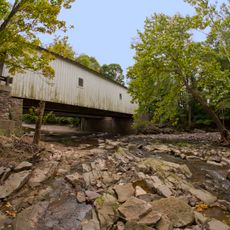
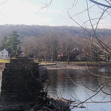
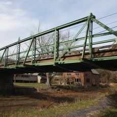
Bulls Island Recreation Area, Forested island park in New Jersey, United States.

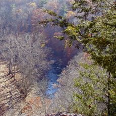
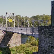
Bulls Island Recreation Area is a forested island park along the Delaware River covering about 80 acres. The landscape features lowland floodplain forest with sycamore, silver maple, and tulip poplar trees, with several trails for exploring the grounds.

The area is part of the Delaware and Raritan Canal State Park, which received National Recreation Trail designation in 1992. This recognition marked its importance as a historic and ecological corridor in the region.

The site serves as a stopping point for migrating birds in spring, where visitors watch warblers, flycatchers, and swallows along the riverbank. People come here to experience the variety of bird life and observe nature up close.

Boaters and paddlers need to obtain launch permits for Delaware River access between Memorial Day and Labor Day. The best time to visit is outside this season when the park is less crowded and access is unrestricted.

The trail system extends over 70 miles along the historic Delaware and Raritan Canal, connecting multiple state parks across central New Jersey. This continuous pathway allows visitors to explore different protected areas and habitats along a single long route.

Location: New Jersey

Website: http://state.nj.us/dep/parksandforests/parks/bull.html

GPS coordinates: 40.41045,-75.03480

Latest update: December 12, 2025 14:40

Photos
Around this place
Treasure Island Scout Reservation
United States of America

Treasure Island Scout Reservation

7.4 km
Ralph Stover State Park
United States of America

Ralph Stover State Park

6 km
Lumberville – Raven Rock Bridge
United States of America

Lumberville – Raven Rock Bridge

364 m
Green Sergeant's Covered Bridge
United States of America

Green Sergeant's Covered Bridge

6.9 km
Buckingham Friends Meeting House
United States of America

Buckingham Friends Meeting House

6.9 km
Centre Bridge–Stockton Bridge
United States of America

Centre Bridge–Stockton Bridge

4.8 km
Cintra
United States of America

Cintra

8.2 km
Point Pleasant-Byram Bridge
United States of America

Point Pleasant-Byram Bridge

2.6 km
Loux Covered Bridge
United States of America

Loux Covered Bridge

8 km
Longland
United States of America

Longland

7.7 km
Stover-Myers Mill
United States of America

Stover-Myers Mill

8.1 km
Bridge in Tinicum Township
United States of America

Bridge in Tinicum Township

3 km
Covered Bridge Historic District
United States of America

Covered Bridge Historic District

7.2 km
Carversville Historic District
United States of America

Carversville Historic District

3.5 km
Phillips Mill Historic District
United States of America

Phillips Mill Historic District

6.3 km
Cuttalossa Valley Historic District
United States of America

Cuttalossa Valley Historic District

2.1 km
Center Bridge Historic District
United States of America

Center Bridge Historic District

4.8 km
Bridge in Solebury Township
United States of America

Bridge in Solebury Township

3.7 km
Springdale Historic District
United States of America

Springdale Historic District

8.1 km
Rhoads Homestead
United States of America

Rhoads Homestead

8.3 km
Raven Rock Historic District
United States of America

Raven Rock Historic District

106 m
Point Pleasant Historic District
United States of America

Point Pleasant Historic District

3 km
Lumberville Historic District
United States of America

Lumberville Historic District

725 m
Mechanicsville Village Historic District
United States of America

Mechanicsville Village Historic District

8.2 km
District No. 98 Schoolhouse
United States of America

District No. 98 Schoolhouse

5.1 km
Upper Aquetong Valley Historic District
United States of America

Upper Aquetong Valley Historic District

6.1 km
Gardenville-North Branch Rural Historic District
United States of America

Gardenville-North Branch Rural Historic District

7.8 km
New Hope – Lambertville Toll Bridge
United States of America

New Hope – Lambertville Toll Bridge

7.6 km
Show the full map
Reviews

Visited this place? Tap the stars to rate it and share your experience / photos with the community! Try now! You can cancel it anytime.

« Bulls Island Recreation Area - Forested island park in New Jersey, United States » is provided by Around Us (aroundus.com). Images and texts are derived from Wikimedia project under a Creative Commons license. You are allowed to copy, distribute, and modify copies of this page, under the conditions set by the license, as long as this note is clearly visible.

Discover hidden gems everywhere you go!

From secret cafés to breathtaking viewpoints, skip the crowded tourist spots and find places that match your style. Our app makes it easy with voice search, smart filtering, route optimization, and insider tips from travelers worldwide. Download now for the complete mobile experience.

Around Us App Screenshot

A unique approach to discovering new places

Le Figaro

All the places worth exploring

France Info

A tailor-made excursion in just a few clicks

20 Minutes