Enable Location

We need your location to show you interesting places around you

Discover nearby places

Find interesting locations and hidden gems around you

Precise directions

Get accurate directions and distances to places

Your location is never shared with other users. It's only used when you tap the location button.

Log in to your account

Start exploring — it's free

Trusted by 61,380 travelers worldwide

Continue with Google
Continue with Apple
or

We will send you a code to connect

By continuing, you accept our Terms and Conditions and our Privacy Policy

Check your inbox

We've sent a pincode in your inbox. Please enter the code below.

Burntside State Forest

Burntside State Forest, State forest in northeastern Minnesota, United States

Description

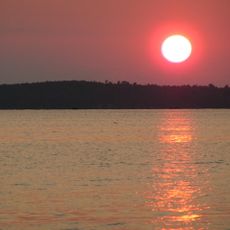
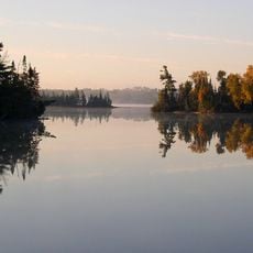
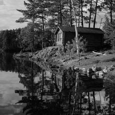
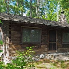
Burntside State Forest is a state forest in northeastern Minnesota covering thousands of acres of forested land. The terrain is rough and dotted with numerous lakes, creating a landscape dominated by pine and aspen trees.

History

The forest was established in 1905 following major landscape changes caused by a large wildfire in 1874. This fire eliminated most of the original forest and allowed new growth of pine and aspen species.

Culture

The Minnesota Department of Natural Resources organizes educational programs and guided nature walks to promote understanding of local ecosystems.

Practical

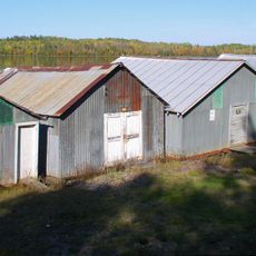
Several public access points around Burntside Lake let visitors reach the water for fishing or wildlife viewing. The forested terrain is best explored on foot or by canoe.

Did you know?

Much of this forest sits within a protected wilderness area that is part of a larger national forest system. This setting creates a remote experience where visitors encounter fewer people and more untouched landscape.

Location
Location
GPS coordinates
47.91970,-92.10140
Latest update
December 14, 2025 16:44

AroundUs brings together thousands of curated places, local tips, and hidden gems, enriched daily by 60,000 contributors worldwide. Discover all places nearby (St. Louis County).

Around this place
Lake Vermilion
United States of America

Lake Vermilion

16.3 km
Lake Vermilion-Soudan Underground Mine State Park
United States of America

Lake Vermilion-Soudan Underground Mine State Park

14.8 km
Bear Head Lake State Park
United States of America

Bear Head Lake State Park

14 km
Hegman Lake Pictograph
United States of America

Hegman Lake Pictograph

21 km
Burntside Lodge
United States of America

Burntside Lodge

11.3 km
Listening Point
United States of America

Listening Point

6.6 km
Iron Range Off-Highway Vehicle State Recreation Area
United States of America

Iron Range Off-Highway Vehicle State Recreation Area

49.5 km
Stuntz Bay Boathouse Historic District
United States of America

Stuntz Bay Boathouse Historic District

14.5 km
Alex Seitaniemi Housebarn
United States of America

Alex Seitaniemi Housebarn

23.8 km
Alango School
United States of America

Alango School

54.2 km
Hartley Building
United States of America

Hartley Building

25.2 km
Finnish Sauna
United States of America

Finnish Sauna

54.7 km
State Theater
United States of America

State Theater

17.9 km
Virginia–Rainy Lake Lumber Company Office
United States of America

Virginia–Rainy Lake Lumber Company Office

54.9 km
Longyear Drill Site
United States of America

Longyear Drill Site

40.3 km
Olcott Park Greenhouse
United States of America

Olcott Park Greenhouse

54.9 km
Kaleva Hall
United States of America

Kaleva Hall

54.4 km
Anna and Mikko Pyhala Farm
United States of America

Anna and Mikko Pyhala Farm

29.3 km
Camp Esquagama
United States of America

Camp Esquagama

52.9 km
Lincoln School Building
United States of America

Lincoln School Building

54.7 km
Jukola Boardinghouse
United States of America

Jukola Boardinghouse

54.6 km
Charles Lenont House
United States of America

Charles Lenont House

54.9 km
Erick and Kristina Nelimark Sauna
United States of America

Erick and Kristina Nelimark Sauna

29.5 km
LaSalle Apartments
United States of America

LaSalle Apartments

54.8 km
Virginia Commercial Historic District
United States of America

Virginia Commercial Historic District

54.8 km
Waino Tanttari Field Hay Barn
United States of America

Waino Tanttari Field Hay Barn

23.7 km
Dorothy Molter Museum
United States of America

Dorothy Molter Museum

20.1 km
Jasper Peak Fire Tower
United States of America

Jasper Peak Fire Tower

14.6 km
Show the full map
« Burntside State Forest - State forest in northeastern Minnesota, United States » is provided by Around Us (aroundus.com). Images and texts are derived from Wikimedia project under a Creative Commons license. You are allowed to copy, distribute, and modify copies of this page, under the conditions set by the license, as long as this note is clearly visible.

Discover hidden gems everywhere you go!

From secret cafés to breathtaking viewpoints, skip the crowded tourist spots and find places that match your style. Our app makes it easy with voice search, smart filtering, route optimization, and insider tips from travelers worldwide. Download now for the complete mobile experience.

Around Us App Screenshot

A unique approach to discovering new places

Le Figaro

All the places worth exploring

France Info

A tailor-made excursion in just a few clicks

20 Minutes

Around Us
Travel Guide & Maps
Download

Send to your phone

QR Code
1

Open the camera app on your mobile.

2

Point at the QR code with your camera. A notification will appear.

3

Tap the notification to open the link.