Campbell's Ledge, Natural landmark in Duryea, Pennsylvania, United States
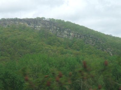
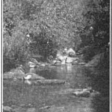
Campbell's Ledge is a rock cliff that rises above the Susquehanna River, dominating the landscape of the Wyoming Valley. The formation provides views across the surrounding terrain and sits within a forested area that gives the place its character.
Early settlers originally called this location Dial Rock because sunlight illuminated the cliff face at noon in a way that made it function like a natural timekeeper. The place later took its current name from a local story that residents connected to the site.
The cliff carries the name of a local legend about a man named Campbell, whose story residents have passed down through generations. This tradition remains woven into how people understand and speak about the place today.
The terrain is steep and requires good footwear and physical preparation for the hike. Visit during dry weather when paths are safer and views are clearest.
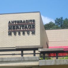
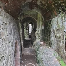
The cliff contains abandoned mine shafts that are now fenced for safety, revealing signs of the region's mining heritage. The surrounding forest is home to black bears, hawks, and white-tailed deer that move through the area regularly.
Location: Pennsylvania
GPS coordinates: 41.35920,-75.79470
Latest update: December 12, 2025 12:05
Union Pacific 4012
11.6 km
Frances Slocum State Park
8.4 km
Electric City Trolley Museum
11.6 km
Wyoming Monument
7.3 km
Scranton City Hall
12.5 km
Pennsylvania Anthracite Heritage Museum
9 kmFarley's Eatery and Pub
12.5 km
McDade Park
9.4 km
St. Stanislaus Cathedral in Scranton, Pennsylvania
11.2 km
St. Peter's Cathedral
12.3 km
Lackawanna County Courthouse
12.3 km
Denison House
8.8 km
William J. Nealon Federal Building and United States Courthouse
12.3 km
Delaware, Lackawanna and Western Railroad Yard-Dickson Manufacturing Co. Site
11.7 km
Swetland Homestead
8 km
Nesbitt Reservoir
12.3 km
Terence V. Powderly House
12 km
Firefighters' Memorial Bridge
3.9 km
Forty Fort Meetinghouse
10.5 km
Lackawanna Avenue Commercial Historic District
12.1 km
Grand Army of the Republic Building
12.2 km
Roger Williams Public School No. 10
11.4 km
Dime Bank Building
12.1 km
Laurel Run
12.1 km
Luzerne Presbyterial Institute
6.7 km
Scranton Iron Furnaces
12.1 km
Anthracite Heritage Museum
9.2 km
Forty Fort Theater
10.1 kmVisited this place? Tap the stars to rate it and share your experience / photos with the community! Try now! You can cancel it anytime.
Discover hidden gems everywhere you go!
From secret cafés to breathtaking viewpoints, skip the crowded tourist spots and find places that match your style. Our app makes it easy with voice search, smart filtering, route optimization, and insider tips from travelers worldwide. Download now for the complete mobile experience.
A unique approach to discovering new places❞
— Le Figaro
All the places worth exploring❞
— France Info
A tailor-made excursion in just a few clicks❞
— 20 Minutes