Chest opened
+${chestReward.xp} XP
Explorer
NOUVEAU ×${chestReward.collectible.quantity}
tapez pour fermer
Chest locked

Open chests in the app

Around Us is built for your phone — chests unlock when you walk, explore and capture nearby places.

Enable Location

We need your location to show you interesting places around you

Discover nearby places

Find interesting locations and hidden gems around you

Precise directions

Get accurate directions and distances to places

Your location is never shared with other users. It's only used when you tap the location button.

Catoctin Mountain Park

Log in to your account

Start exploring — it's free

Trusted by 72,878 travelers worldwide

Continue with Google
Continue with Apple
or

We will send you a code to connect

By continuing, you accept our Terms and Conditions and our Privacy Policy

Check your inbox

We've sent a pincode in your inbox. Please enter the code below.

Discussion Reviews 3 Photos
26.9k Popularity

Catoctin Mountain Park, National nature reserve in Frederick County and Washington County, Maryland

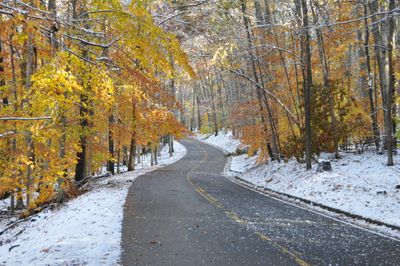
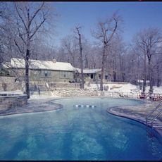
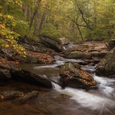
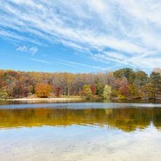
Catoctin Mountain Park is a forested reserve in Maryland spanning Frederick and Washington counties, with streams, rock outcrops, and overlooks toward the Monocacy Valley. The eastern hardwood forest covers rolling terrain with waterfalls and natural springs that flow year-round.

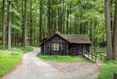
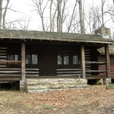
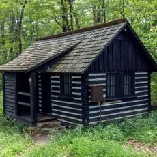
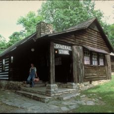
The Civilian Conservation Corps and Works Progress Administration shaped the land during the 1930s before the National Park Service took over the northern section in 1936. That period of restoration transformed the terrain into a publicly accessible park with visitor infrastructure.

The park maintains 25 miles of hiking paths, multiple camping areas, and educational programs focused on forest conservation and environmental protection.

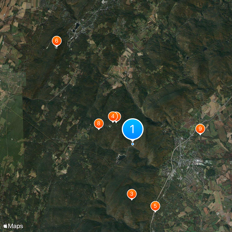
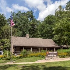
The park has a visitor center with maps, restrooms, and information about trails and camping areas. It is best reached by car, and most routes can be explored on foot or by bicycle.

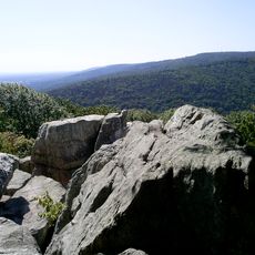
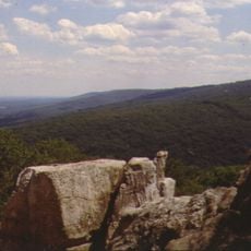
The park contains rock formations like Chimney Rock and Wolf Rock that offer distinctive viewpoints for photographers and hikers. These jutting features are easily reached via trails and provide unexpected views of the surrounding woodland.

The community of curious travelers

AroundUs brings together thousands of curated places, local tips, and hidden gems, enriched daily by 60,000 contributors worldwide.

Start exploring
Location
Inception
February 7, 1935
Architectural style
National Park Service rustic
Fee
No
Operator
National Park Service
GPS coordinates
39.63444,-77.45000
Latest update
February 8, 2026 09:32
Around this place
Camp David
United States of America

Camp David

1.9 km
Cunningham Falls State Park
United States of America

Cunningham Falls State Park

3.9 km
Catoctin Mountain
United States of America

Catoctin Mountain

2.1 km
Catoctin Wildlife Preserve and Zoo
United States of America

Catoctin Wildlife Preserve and Zoo

5 km
Quirauk Mountain
United States of America

Quirauk Mountain

8.8 km
Camp Misty Mount Historic District
United States of America

Camp Misty Mount Historic District

839 m
Camp Greentop Historic District
United States of America

Camp Greentop Historic District

2.6 km
Roddy Road Covered Bridge
United States of America

Roddy Road Covered Bridge

4.8 km
Victor Cullen Center, Old Administration Building
United States of America

Victor Cullen Center, Old Administration Building

8.6 km
Victor Cullen School Power House
United States of America

Victor Cullen School Power House

9 km
Tipahato
United States of America

Tipahato

8.2 km
Catoctin Mountain Park Visitor Center
United States of America

Catoctin Mountain Park Visitor Center

38 m
Chimney Rock
United States of America

Chimney Rock

1.6 km
South Beach
United States of America

South Beach

1.3 km
Catoctin Mountain Park Resource Management Office
United States of America

Catoctin Mountain Park Resource Management Office

3.3 km
Mt. Moriah Lutheran Church
United States of America

Mt. Moriah Lutheran Church

4.3 km
Raven Rock Shelter
United States of America

Raven Rock Shelter

8.1 km
United States of America

North Bob's Hill Overlook

4.2 km
United States of America

Scenic viewpoint

4.4 km
United States of America

South Bob's Hill Overlook

4.4 km
United States of America

Cunningham Falls

1.8 km
United States of America

Scenic viewpoint

1.8 km
United States of America

Thurmont Vista

1.6 km
United States of America

Chimney Rock

1.6 km
United States of America

Blue Ridge Summit Vista

1.7 km
United States of America

Hog Rock

1.2 km
United States of America

Scenic viewpoint

7.9 km
United States of America

Cunningham Falls

1.8 km
Show the full map
Reviews
Share your experience

No review yet

Discussions
Start a discussion...

No discussion yet

« Catoctin Mountain Park - National nature reserve in Frederick County and Washington County, Maryland » is provided by Around Us (aroundus.com). Images and texts are derived from Wikimedia project under a Creative Commons license. You are allowed to copy, distribute, and modify copies of this page, under the conditions set by the license, as long as this note is clearly visible.

Discover hidden gems everywhere you go!

From secret cafés to breathtaking viewpoints, skip the crowded tourist spots and find places that match your style. Our app makes it easy with voice search, smart filtering, route optimization, and insider tips from travelers worldwide. Download now for the complete mobile experience.

Around Us App Screenshot

A unique approach to discovering new places

Le Figaro

All the places worth exploring

France Info

A tailor-made excursion in just a few clicks

20 Minutes

Around Us
Travel Guide & Maps
Download

Send to your phone

QR Code
1

Open the camera app on your mobile.

2

Point at the QR code with your camera. A notification will appear.

3

Tap the notification to open the link.