Cedar Point Light

Log in to your account

AroundUs is a community-driven map of interesting places, built by curious explorers like you. It grows with every review, story, and photo you share.
Connect to save your favorite spots, contribute locations, and create personalized routes.
Continue with Google
Continue with Apple
Continue with X
Continue with Facebook
Continue with email
By continuing, you accept our Terms and Conditions and our Privacy Policy
Create an account
Add to collection
Map
Suggest a change
Share

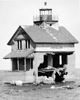
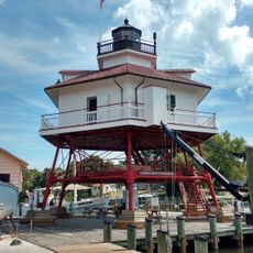
Cedar Point Light, Maritime navigation structure at Cedar Point, St. Mary's County, US

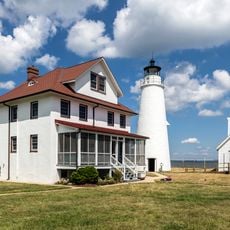
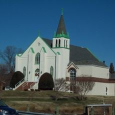
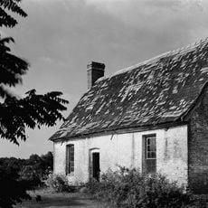
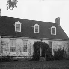
Cedar Point Light was a two-story brick house with an attached tower that rose approximately 50 feet (15 meters) above water level at the junction where the Patuxent River meets Chesapeake Bay. The structure served as a navigation aid for vessels passing through this busy waterway.

The structure was built in 1896 to guide sailors at a critical waterway intersection, and the Coast Guard abandoned it in 1928. This closure marked the shift when newer navigation technology began replacing older methods that relied on visible structures like this one.

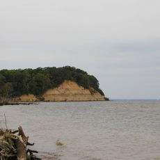
The lighthouse represents a time when local sailors and fishermen depended on traditional navigation aids to safely move through the bay's waters. It stands as a reminder of the connection between people and the waterways that shaped their livelihoods.

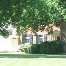
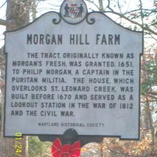
The site is best accessed through Lexington Park, where a historical marker commemorates the original lighthouse. A visit requires no special preparation, though the area is primarily residential with limited parking options nearby.

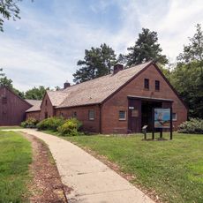
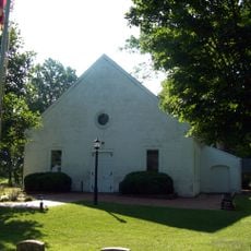
The lighthouse cupola was preserved and now resides in the Patuxent Naval Air Station museum, allowing visitors to view a piece of the original structure. This salvaged element represents one of the few tangible remnants of this distinctive building style.

Location: St. Mary's County

GPS coordinates: 38.29939,-76.36775

Latest update: December 14, 2025 11:03

Photos
Around this place
Calvert Cliffs State Park
United States of America

Calvert Cliffs State Park

12.4 km
Governor Thomas Johnson Bridge
United States of America

Governor Thomas Johnson Bridge

9.5 km
Patuxent River Naval Air Museum
United States of America

Patuxent River Naval Air Museum

8.8 km
Calvert Marine Museum
United States of America

Calvert Marine Museum

9.1 km
St. Ignatius Roman Catholic Church
United States of America

St. Ignatius Roman Catholic Church

17.3 km
Flag Ponds Nature Park
United States of America

Flag Ponds Nature Park

18.2 km
Cove Point Light
United States of America

Cove Point Light

9.7 km
Drum Point Light
United States of America

Drum Point Light

9 km
Point No Point Light
United States of America

Point No Point Light

20.2 km
Hooper Island Light
United States of America

Hooper Island Light

11.4 km
Porto Bello
United States of America

Porto Bello

15.8 km
Our Lady Star of the Sea Catholic Church
United States of America

Our Lady Star of the Sea Catholic Church

8.6 km
Jefferson Patterson Park & Museum
United States of America

Jefferson Patterson Park & Museum

16.5 km
Resurrection Manor
United States of America

Resurrection Manor

13.1 km
Greenwell State Park
United States of America

Greenwell State Park

16.1 km
William B. Tennison
United States of America

William B. Tennison

8.6 km
United States Colored Troops Memorial Monument
United States of America

United States Colored Troops Memorial Monument

8.3 km
West St. Mary's Manor
United States of America

West St. Mary's Manor

14.4 km
J. C. Lore Oyster House
United States of America

J. C. Lore Oyster House

8.6 km
Cross Manor
United States of America

Cross Manor

16.1 km
Morgan Hill Farm
United States of America

Morgan Hill Farm

15.7 km
Preston-on-the-Patuxent
United States of America

Preston-on-the-Patuxent

13.1 km
St. George's Episcopal Church
United States of America

St. George's Episcopal Church

17.7 km
Cecil's Mill Historic District
United States of America

Cecil's Mill Historic District

13.6 km
Ridgeton Farm
United States of America

Ridgeton Farm

18.7 km
James P. Muldoon River Center
United States of America

James P. Muldoon River Center

13.6 km
Historic St. Mary's City
United States of America

Historic St. Mary's City

14.3 km
Drum Point Lighthouse
United States of America

Drum Point Lighthouse

9.1 km
Show the full map
Reviews

Visited this place? Tap the stars to rate it and share your experience / photos with the community! Try now! You can cancel it anytime.

« Cedar Point Light - Maritime navigation structure at Cedar Point, St. Mary's County, US » is provided by Around Us (aroundus.com). Images and texts are derived from Wikimedia project under a Creative Commons license. You are allowed to copy, distribute, and modify copies of this page, under the conditions set by the license, as long as this note is clearly visible.

Discover hidden gems everywhere you go!

From secret cafés to breathtaking viewpoints, skip the crowded tourist spots and find places that match your style. Our app makes it easy with voice search, smart filtering, route optimization, and insider tips from travelers worldwide. Download now for the complete mobile experience.

Around Us App Screenshot

A unique approach to discovering new places

Le Figaro

All the places worth exploring

France Info

A tailor-made excursion in just a few clicks

20 Minutes