Enable Location

We need your location to show you interesting places around you

Discover nearby places

Find interesting locations and hidden gems around you

Precise directions

Get accurate directions and distances to places

Your location is never shared with other users. It's only used when you tap the location button.

City Point

Log in to your account

Start exploring — it's free

Trusted by 63,003 travelers worldwide

Continue with Google
Continue with Apple
or

We will send you a code to connect

By continuing, you accept our Terms and Conditions and our Privacy Policy

Check your inbox

We've sent a pincode in your inbox. Please enter the code below.

Discussion Reviews 1 Photos
2.5k Popularity

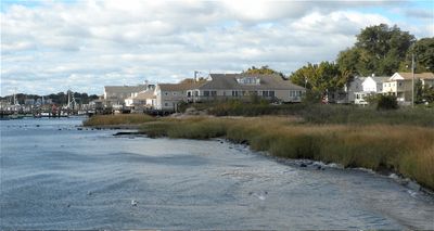
City Point, Historic district in New Haven, Connecticut

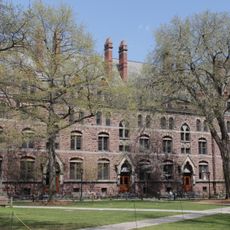
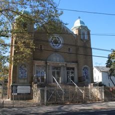
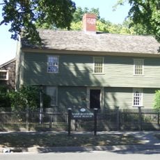
City Point is a historic district stretching along New Haven Harbor with about 30 acres of residential and waterfront structures built in Byzantine Revival style. The area displays a mix of architectural influences that reflect its development across several generations.

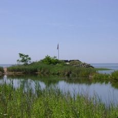
The area was originally known as Oyster Point and became a maritime center with a strong oyster fishing industry that thrived between 1840 and 1925. This fishing tradition shaped the early economic foundation and growth of the district.

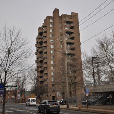
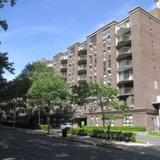
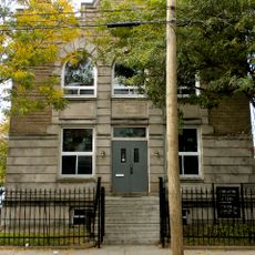
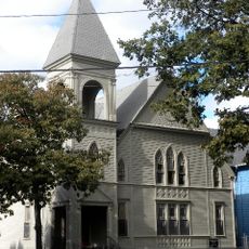
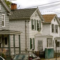
The neighborhood preserves nearly 100 residential buildings that showcase Greek Revival, Italianate, Queen Anne, and Colonial Revival styles from different time periods, reflecting the layers of its development.

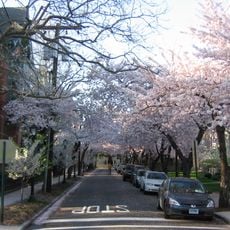
Howard Avenue serves as the main route through the district, with easy access to Greenwich Avenue, Sixth Street, and Hallock Avenue for navigation. Visitors can walk through different sections and appreciate the architectural variety at their own pace.

Bayview Park and the former Boulevard Sewage Treatment Plant mark the northeastern boundary of the district next to Interstate 95. These landmarks help visitors understand where the historic area begins and ends.

The community of curious travelers

AroundUs brings together thousands of curated places, local tips, and hidden gems, enriched daily by 60,000 contributors worldwide.

Start exploring
Location
Architectural style
Byzantine Revival architecture
GPS coordinates
41.28306,-72.92972
Latest update
December 12, 2025 17:41
Around this place
Hotel Marcel
United States of America

Hotel Marcel

1.8 km
Knights of Columbus Building
United States of America

Knights of Columbus Building

2.2 km
Wooster Square
United States of America

Wooster Square

2.6 km
Fort Nathan Hale
United States of America

Fort Nathan Hale

2.6 km
Harvey Cushing/John Hay Whitney Medical Library
United States of America

Harvey Cushing/John Hay Whitney Medical Library

2.2 km
Durfee Hall
United States of America

Durfee Hall

2.7 km
360 State Street
United States of America

360 State Street

2.5 km
Connecticut Financial Center
United States of America

Connecticut Financial Center

2.7 km
New Haven City Hall and County Courthouse
United States of America

New Haven City Hall and County Courthouse

2.7 km
Richard C. Lee United States Courthouse
United States of America

Richard C. Lee United States Courthouse

2.7 km
Strouse, Adler Company Corset Factory
United States of America

Strouse, Adler Company Corset Factory

2.6 km
Ninth Square Historic District
United States of America

Ninth Square Historic District

2.5 km
Statue of Christopher Columbus
United States of America

Statue of Christopher Columbus

2.5 km
Crawford Manor
United States of America

Crawford Manor

2.7 km
Tomlinson Lift Bridge
United States of America

Tomlinson Lift Bridge

2.7 km
Crown Towers
United States of America

Crown Towers

2.6 km
Wooster Square Historic District
United States of America

Wooster Square Historic District

2.6 km
Anchor
United States of America

Anchor

2.7 km
Chapel Street Historic District
United States of America

Chapel Street Historic District

2.5 km
West Haven Green Historic District
United States of America

West Haven Green Historic District

2.2 km
New Haven Jewish Home for the Aged
United States of America

New Haven Jewish Home for the Aged

2.3 km
Beth Israel Synagogue
United States of America

Beth Israel Synagogue

1.9 km
United States of America

Ward-Heitman House

2 km
Ahavas Sholem Synagogue
United States of America

Ahavas Sholem Synagogue

1.9 km
Howard Avenue Historic District
United States of America

Howard Avenue Historic District

1 km
Trowbridge Square Historic District
United States of America

Trowbridge Square Historic District

1.5 km
Ward-Heitmann House
United States of America

Ward-Heitmann House

2 km
West Haven City Hall
United States of America

West Haven City Hall

2.1 km
Show the full map
Reviews
Share your experience

No review yet

Discussions
Start a discussion...

No discussion yet

« City Point - Historic district in New Haven, Connecticut » is provided by Around Us (aroundus.com). Images and texts are derived from Wikimedia project under a Creative Commons license. You are allowed to copy, distribute, and modify copies of this page, under the conditions set by the license, as long as this note is clearly visible.

Discover hidden gems everywhere you go!

From secret cafés to breathtaking viewpoints, skip the crowded tourist spots and find places that match your style. Our app makes it easy with voice search, smart filtering, route optimization, and insider tips from travelers worldwide. Download now for the complete mobile experience.

Around Us App Screenshot

A unique approach to discovering new places

Le Figaro

All the places worth exploring

France Info

A tailor-made excursion in just a few clicks

20 Minutes

Around Us
Travel Guide & Maps
Download

Send to your phone

QR Code
1

Open the camera app on your mobile.

2

Point at the QR code with your camera. A notification will appear.

3

Tap the notification to open the link.