Enable Location

We need your location to show you interesting places around you

Discover nearby places

Find interesting locations and hidden gems around you

Precise directions

Get accurate directions and distances to places

Your location is never shared with other users. It's only used when you tap the location button.

Coolidge State Park

Log in to your account

Start exploring — it's free

Trusted by 63,105 travelers worldwide

Continue with Google
Continue with Apple
or

We will send you a code to connect

By continuing, you accept our Terms and Conditions and our Privacy Policy

Check your inbox

We've sent a pincode in your inbox. Please enter the code below.

Discussion Reviews 1 Photos
2.1k Popularity

Coolidge State Park, State park in Plymouth, United States

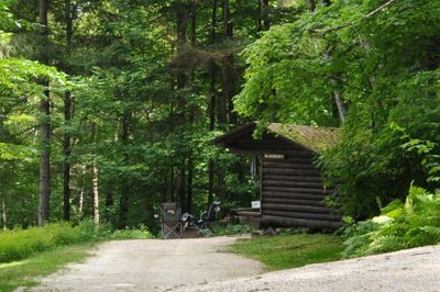
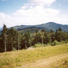
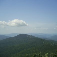
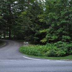
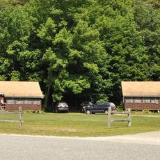
Coolidge State Park is a state forest reserve in Plymouth covering thousands of acres of mixed hardwood stands on sloping terrain. The property includes camping facilities with tent sites and shelter structures accessible from multiple entry roads.

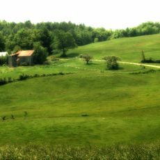
The land was once cleared farmland with stone walls and building foundations before becoming a protected forest. During the 1930s, the Civilian Conservation Corps built a work camp and developed most of the roads and facilities that visitors use today.

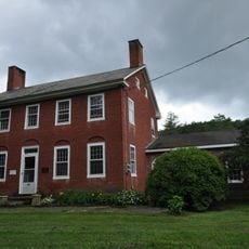
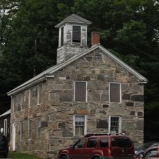
The park holds numerous stone walls and foundations that reveal its agricultural past, when the land was cleared and farmed before becoming a protected forest.

The park is open from late May through early October and provides tent sites and lean-to shelters for overnight stays. The entry roads and walking paths are accessible on foot, though the hillside terrain requires some climbing and physical effort.

An abandoned stone quarry sits at the junction of two entry roads where visitors can explore its features. Gold panning is permitted in certain water areas within the property.

The community of curious travelers

AroundUs brings together thousands of curated places, local tips, and hidden gems, enriched daily by 60,000 contributors worldwide.

Start exploring
Location
Architectural style
National Park Service rustic
GPS coordinates
43.55310,-72.70030
Latest update
December 13, 2025 17:01
Around this place
Killington Peak
United States of America

Killington Peak

11.2 km
Marsh-Billings-Rockefeller National Historical Park
United States of America

Marsh-Billings-Rockefeller National Historical Park

16.1 km
Coolidge Homestead
United States of America

Coolidge Homestead

2.6 km
Jenne Farm
United States of America

Jenne Farm

11.8 km
Pico Peak
United States of America

Pico Peak

14.6 km
Gifford Woods State Park
United States of America

Gifford Woods State Park

16.3 km
George Perkins Marsh Boyhood Home
United States of America

George Perkins Marsh Boyhood Home

16.9 km
Crowley Cheese Factory
United States of America

Crowley Cheese Factory

16 km
Lincoln Covered Bridge
United States of America

Lincoln Covered Bridge

11.8 km
King Farm
United States of America

King Farm

14.7 km
Camp Plymouth State Park
United States of America

Camp Plymouth State Park

8.6 km
Brook Farm
United States of America

Brook Farm

12.9 km
United States of America

Shrewsbury Peak

8.9 km
Laurel Glen Mausoleum-Laurel Hall
United States of America

Laurel Glen Mausoleum-Laurel Hall

16.4 km
West Woodstock Bridge
United States of America

West Woodstock Bridge

14.4 km
Anthony Scoville House
United States of America

Anthony Scoville House

13.9 km
Billings Farm Museum
United States of America

Billings Farm Museum

17.3 km
Aaron Jr. and Susan Parker Farm
United States of America

Aaron Jr. and Susan Parker Farm

16.5 km
Woodstock Warren Through Truss Bridge
United States of America

Woodstock Warren Through Truss Bridge

10.4 km
South Reading Schoolhouse
United States of America

South Reading Schoolhouse

12.1 km
Plymouth Historic District
United States of America

Plymouth Historic District

1.7 km
Saddlebow Farm
United States of America

Saddlebow Farm

9.4 km
Bridgewater Corners Bridge
United States of America

Bridgewater Corners Bridge

5.1 km
Kendron Brook Bridge
United States of America

Kendron Brook Bridge

15.3 km
Wales N. Johnson House
United States of America

Wales N. Johnson House

13.8 km
Rev. George Daman House
United States of America

Rev. George Daman House

12.7 km
Reading Town Hall
United States of America

Reading Town Hall

17 km
Woodstock Middle Bridge
United States of America

Woodstock Middle Bridge

16.5 km
Show the full map
Reviews
Share your experience

No review yet

Discussions
Start a discussion...

No discussion yet

« Coolidge State Park - State park in Plymouth, United States » is provided by Around Us (aroundus.com). Images and texts are derived from Wikimedia project under a Creative Commons license. You are allowed to copy, distribute, and modify copies of this page, under the conditions set by the license, as long as this note is clearly visible.

Discover hidden gems everywhere you go!

From secret cafés to breathtaking viewpoints, skip the crowded tourist spots and find places that match your style. Our app makes it easy with voice search, smart filtering, route optimization, and insider tips from travelers worldwide. Download now for the complete mobile experience.

Around Us App Screenshot

A unique approach to discovering new places

Le Figaro

All the places worth exploring

France Info

A tailor-made excursion in just a few clicks

20 Minutes

Around Us
Travel Guide & Maps
Download

Send to your phone

QR Code
1

Open the camera app on your mobile.

2

Point at the QR code with your camera. A notification will appear.

3

Tap the notification to open the link.