Gifford Woods State Park

Log in to your account

AroundUs is a community-driven map of interesting places, built by curious explorers like you. It grows with every review, story, and photo you share.
Connect to save your favorite spots, contribute locations, and create personalized routes.
Continue with Google
Continue with Apple
Continue with X
Continue with Facebook
Continue with email
By continuing, you accept our Terms and Conditions and our Privacy Policy
Create an account
Add to collection
Map
Suggest a change
Share

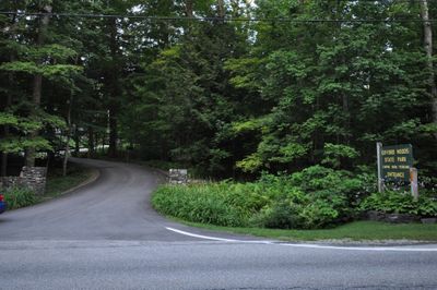
Gifford Woods State Park, State park and historic site in Killington, United States

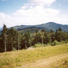
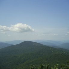
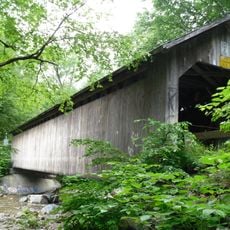
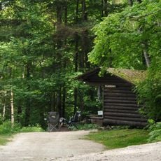
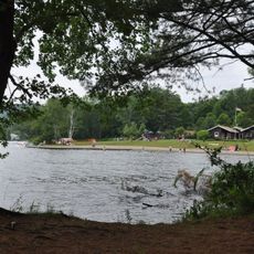
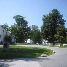
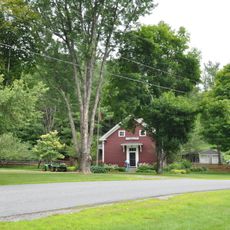
Gifford Woods State Park is a woodland reserve with multiple campsites, rustic shelters, and rental cabins located near Pico Peak in central Vermont. The grounds span about 285 acres and feature amenities for both overnight camping and day-use activities such as hiking and picnicking.

The park facilities were constructed in 1933 by the Civilian Conservation Corps, including the office, ranger residence, and initial trail network. This building program reflected broader efforts during the economic crisis to create public works projects that preserved natural areas.

The park serves as a gateway to the Appalachian Trail, making it a familiar meeting point for hikers preparing for or continuing long-distance journeys through the eastern mountains. Visitors regularly gather here to connect with others on the trail network.

The park provides restrooms with flush toilets, hot showers, and running water throughout the grounds, with firewood and ice available for purchase at the park store. Planning ahead helps visitors know what services to expect, as availability can vary by season.

The protected area contains one of Vermont's final remaining stands of old-growth mixed forest featuring sugar maple, beech, yellow birch, and hemlock trees. Walking beneath these ancient trees gives visitors a sense of the original forest landscape that once covered the region.

Location: Killington

Inception: 1931

Website: https://vtstateparks.com/gifford.html

GPS coordinates: 43.67620,-72.81090

Latest update: December 9, 2025 12:20

Photos
Around this place
Killington Peak
United States of America

Killington Peak

8 km
Coolidge Homestead
United States of America

Coolidge Homestead

17.2 km
Pico Peak
United States of America

Pico Peak

4.6 km
Brown Covered Bridge
United States of America

Brown Covered Bridge

15.1 km
Coolidge State Park
United States of America

Coolidge State Park

16.3 km
Daniel Gay House
United States of America

Daniel Gay House

14.5 km
Paramount Theatre
United States of America

Paramount Theatre

15.6 km
Silver Lake State Park
United States of America

Silver Lake State Park

16.8 km
St. Peter's Church and Mount St. Joseph Convent Complex
United States of America

St. Peter's Church and Mount St. Joseph Convent Complex

16.3 km
Thomas H. Palmer House
United States of America

Thomas H. Palmer House

16.1 km
Cooley Covered Bridge
United States of America

Cooley Covered Bridge

17.6 km
United States of America

Shrewsbury Peak

10.9 km
Linden Terrace
United States of America

Linden Terrace

15.4 km
Rutland Jewish Center
United States of America

Rutland Jewish Center

15.5 km
Chaffee-Moloney Houses
United States of America

Chaffee-Moloney Houses

16.4 km
Proctor-Clement House
United States of America

Proctor-Clement House

15.2 km
Longfellow School
United States of America

Longfellow School

15.4 km
Colburn Bridge
United States of America

Colburn Bridge

17.3 km
Cold River Bridge
United States of America

Cold River Bridge

17.2 km
Watkins School
United States of America

Watkins School

16.8 km
Plymouth Historic District
United States of America

Plymouth Historic District

16.9 km
Stockbridge Common Historic District
United States of America

Stockbridge Common Historic District

13.1 km
Rutland Courthouse Historic District
United States of America

Rutland Courthouse Historic District

15.3 km
Saddlebow Farm
United States of America

Saddlebow Farm

17 km
Arthur Perkins House
United States of America

Arthur Perkins House

15.8 km
Bridgewater Corners Bridge
United States of America

Bridgewater Corners Bridge

15.9 km
Stockbridge Four Corners Bridge
United States of America

Stockbridge Four Corners Bridge

12.5 km
Wonderfeet Kid's Museum
United States of America

Wonderfeet Kid's Museum

15.6 km
Show the full map
Reviews

Visited this place? Tap the stars to rate it and share your experience / photos with the community! Try now! You can cancel it anytime.

« Gifford Woods State Park - State park and historic site in Killington, United States » is provided by Around Us (aroundus.com). Images and texts are derived from Wikimedia project under a Creative Commons license. You are allowed to copy, distribute, and modify copies of this page, under the conditions set by the license, as long as this note is clearly visible.

Discover hidden gems everywhere you go!

From secret cafés to breathtaking viewpoints, skip the crowded tourist spots and find places that match your style. Our app makes it easy with voice search, smart filtering, route optimization, and insider tips from travelers worldwide. Download now for the complete mobile experience.

Around Us App Screenshot

A unique approach to discovering new places

Le Figaro

All the places worth exploring

France Info

A tailor-made excursion in just a few clicks

20 Minutes