Enable Location

We need your location to show you interesting places around you

Discover nearby places

Find interesting locations and hidden gems around you

Precise directions

Get accurate directions and distances to places

Your location is never shared with other users. It's only used when you tap the location button.

Cross River Reservoir

Log in to your account

Start exploring — it's free

Trusted by 62,172 travelers worldwide

Continue with Google
Continue with Apple
or

We will send you a code to connect

By continuing, you accept our Terms and Conditions and our Privacy Policy

Check your inbox

We've sent a pincode in your inbox. Please enter the code below.

Cross River Reservoir

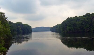
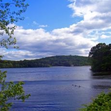
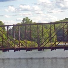
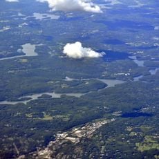
Cross River Reservoir, body of water
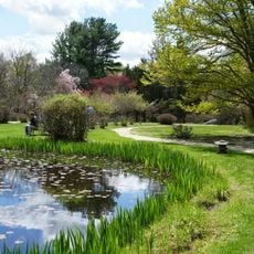
Cross River Reservoir is a large body of water in Westchester County, New York, located about 1 mile east of Katonah. It extends roughly 3.2 miles in length with an average depth of about 36 meters (120 feet) and a shoreline stretching over 12 miles, surrounded by forests and open space.

The reservoir was completed in 1908 to improve water supply for New York City as the city expanded rapidly. It became part of the Croton system comprising multiple reservoirs that have supplied drinking water to the region for over a century.

The reservoir serves as a protected water source where local visitors engage in fishing and nature observation while respecting strict access rules designed to preserve water quality. This reflects the community's ongoing relationship with natural resource management and outdoor recreation in the region.

Access requires a free permit from the New York City Department of Environmental Protection, and activities like swimming are restricted to preserve water quality. Visitors should check current regulations and respect designated pathways, particularly if interested in fishing or bird watching.

Water flows through a hidden network of multiple reservoirs and aqueducts before reaching millions of people in the city, traveling more than 24 miles through the system. This infrastructure demonstrates how New York manages its water supply from a distance, making this one location part of a much larger network.

The community of curious travelers

AroundUs brings together thousands of curated places, local tips, and hidden gems, enriched daily by 60,000 contributors worldwide.

Start exploring
Location
GPS coordinates
41.25430,-73.63290
Latest update
February 7, 2026 11:00
Around this place
IBM Somers Office Complex
United States of America

IBM Somers Office Complex

8.3 km
Elephant Hotel
United States of America

Elephant Hotel

9.3 km
Stepping Stones
United States of America

Stepping Stones

5.7 km
Titicus Reservoir
United States of America

Titicus Reservoir

8.8 km
Caramoor Center for Music and the Arts
United States of America

Caramoor Center for Music and the Arts

2.1 km
Mianus River Gorge
United States of America

Mianus River Gorge

7.7 km
United States of America

Lasdon Park and Arboretum

8.8 km
Bedford Village Historic District
United States of America

Bedford Village Historic District

5.7 km
Bridge L-158
United States of America

Bridge L-158

6.3 km
Richard H. Mandel House
United States of America

Richard H. Mandel House

7.9 km
Hammond Museum and Japanese Stroll Garden
United States of America

Hammond Museum and Japanese Stroll Garden

9.6 km
The Woodpile
United States of America

The Woodpile

8.6 km
Mount Kisco Municipal Complex
United States of America

Mount Kisco Municipal Complex

9.8 km
St. Mark's Episcopal Church
United States of America

St. Mark's Episcopal Church

9.4 km
Joseph Purdy Homestead
United States of America

Joseph Purdy Homestead

8.5 km
United Methodist Church and Parsonage
United States of America

United Methodist Church and Parsonage

9.9 km
The Homestead
United States of America

The Homestead

4.5 km
Katonah Village Historic District
United States of America

Katonah Village Historic District

4.3 km
Stonecrest
United States of America

Stonecrest

8.6 km
North Salem Town Hall
United States of America

North Salem Town Hall

8.8 km
Pound Ridge Historic District
United States of America

Pound Ridge Historic District

6.9 km
Somers Hamlet Historic District
United States of America

Somers Hamlet Historic District

9.4 km
Osborn-Bouton-Mead House
United States of America

Osborn-Bouton-Mead House

5.7 km
Palmer-Lewis Estate
United States of America

Palmer-Lewis Estate

2.9 km
Katonah Museum of Art
United States of America

Katonah Museum of Art

3.5 km
Stepping Stones - Historic Home of Bill and Lois Wilson
United States of America

Stepping Stones - Historic Home of Bill and Lois Wilson

5.8 km
John Jay Homestead State Historic Site
United States of America

John Jay Homestead State Historic Site

2.2 km
Muscoot Reservoir
United States of America

Muscoot Reservoir

6.4 km
Show the full map
« Cross River Reservoir - body of water » is provided by Around Us (aroundus.com). Images and texts are derived from Wikimedia project under a Creative Commons license. You are allowed to copy, distribute, and modify copies of this page, under the conditions set by the license, as long as this note is clearly visible.

Discover hidden gems everywhere you go!

From secret cafés to breathtaking viewpoints, skip the crowded tourist spots and find places that match your style. Our app makes it easy with voice search, smart filtering, route optimization, and insider tips from travelers worldwide. Download now for the complete mobile experience.

Around Us App Screenshot

A unique approach to discovering new places

Le Figaro

All the places worth exploring

France Info

A tailor-made excursion in just a few clicks

20 Minutes

Around Us
Travel Guide & Maps
Download

Send to your phone

QR Code
1

Open the camera app on your mobile.

2

Point at the QR code with your camera. A notification will appear.

3

Tap the notification to open the link.