Enable Location

We need your location to show you interesting places around you

Discover nearby places

Find interesting locations and hidden gems around you

Precise directions

Get accurate directions and distances to places

Your location is never shared with other users. It's only used when you tap the location button.

Log in to your account

Start exploring — it's free

Trusted by 62,484 travelers worldwide

Continue with Google
Continue with Apple
or

We will send you a code to connect

By continuing, you accept our Terms and Conditions and our Privacy Policy

Check your inbox

We've sent a pincode in your inbox. Please enter the code below.

Cranks Creek Lake

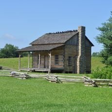
Cranks Creek Lake, body of water

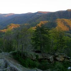
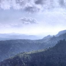
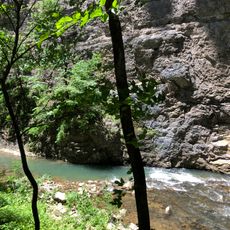
Cranks Creek Lake, also known as Herb Smith Lake, is a small reservoir in Harlan County, Kentucky that covers about 219 acres. Built in 1963 on a creek that feeds into the Martins Fork River, it is surrounded by hardwood forests and steep hillsides, with boat ramps and shoreline trails for exploration.

The lake was built in the early 1960s with an earthen dam completed in 1963, standing about 120 feet high to control flooding. The area has recovered from earlier mining damage through restoration efforts that include forest replanting and stream rehabilitation to improve water quality.

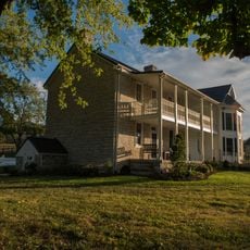
The lake's name comes from the creek that feeds it, tied to the area's mining heritage. Today, it serves as a quiet gathering place where families and anglers come to spend unhurried time surrounded by water and forest.

Wear sturdy shoes for trails and bring sunscreen and water for sunny days, as the shoreline paths can be steep and exposed. The lake has two boat ramps and rental boats are available; motorboats over ten horsepower must move at slow speeds to protect the environment and water quality.

The lake is regularly stocked with rainbow trout by conservation agencies several times each year, making it a favorite spot for anglers seeking this species. Few visitors realize the water level changes seasonally depending on rainfall and water management needs, which can affect fishing conditions and boat access.

The community of curious travelers

AroundUs brings together thousands of curated places, local tips, and hidden gems, enriched daily by 60,000 contributors worldwide.

Start exploring
Location
GPS coordinates
36.74310,-83.22950
Latest update
February 9, 2026 08:20
Around this place
United States Penitentiary
United States of America

United States Penitentiary

20.8 km
Black Mountain
United States of America

Black Mountain

35.5 km
Hensley Settlement
United States of America

Hensley Settlement

27.9 km
United States of America

Wilderness Road State Park

28.9 km
Pine Mountain Settlement School
United States of America

Pine Mountain Settlement School

23.2 km
Black Mountain Off-Road Adventure Area
United States of America

Black Mountain Off-Road Adventure Area

16 km
Kentucky Coal Mining Museum
United States of America

Kentucky Coal Mining Museum

34.9 km
Vardy Community School
United States of America

Vardy Community School

18.1 km
Southwest Virginia Museum Historical State Park
United States of America

Southwest Virginia Museum Historical State Park

42.2 km
The Cedars Natural Area Preserve
United States of America

The Cedars Natural Area Preserve

10.2 km
United States of America

Overton Lodge

42.1 km
Price Public Elementary School
United States of America

Price Public Elementary School

42.1 km
John Shell Cabin
United States of America

John Shell Cabin

27.6 km
St. Marks Presbyterian Church
United States of America

St. Marks Presbyterian Church

42.1 km
Terrace Park Girl Scout Cabin
United States of America

Terrace Park Girl Scout Cabin

42.3 km
Jonesville Methodist Campground
United States of America

Jonesville Methodist Campground

10.2 km
Derby Historic District
United States of America

Derby Historic District

42 km
Dickinson-Milbourn House
United States of America

Dickinson-Milbourn House

11.3 km
William Sayers Homestead
United States of America

William Sayers Homestead

33.7 km
Pineville Courthouse Square Historic District
United States of America

Pineville Courthouse Square Historic District

41.6 km
Laurel Fork
United States of America

Laurel Fork

42.3 km
Harlan Commercial District
United States of America

Harlan Commercial District

14.2 km
Benham Historic District
United States of America

Benham Historic District

34.9 km
Lynch Historic District
United States of America

Lynch Historic District

37.1 km
Hale Springs Inn
United States of America

Hale Springs Inn

42.4 km
Cumberland Central Business District
United States of America

Cumberland Central Business District

33.5 km
Wilderness Road State Park
United States of America

Wilderness Road State Park

29.3 km
Kesterson-Watkins House
United States of America

Kesterson-Watkins House

36.5 km
Show the full map
« Cranks Creek Lake - body of water » is provided by Around Us (aroundus.com). Images and texts are derived from Wikimedia project under a Creative Commons license. You are allowed to copy, distribute, and modify copies of this page, under the conditions set by the license, as long as this note is clearly visible.

Discover hidden gems everywhere you go!

From secret cafés to breathtaking viewpoints, skip the crowded tourist spots and find places that match your style. Our app makes it easy with voice search, smart filtering, route optimization, and insider tips from travelers worldwide. Download now for the complete mobile experience.

Around Us App Screenshot

A unique approach to discovering new places

Le Figaro

All the places worth exploring

France Info

A tailor-made excursion in just a few clicks

20 Minutes

Around Us
Travel Guide & Maps
Download

Send to your phone

QR Code
1

Open the camera app on your mobile.

2

Point at the QR code with your camera. A notification will appear.

3

Tap the notification to open the link.