Enable Location

We need your location to show you interesting places around you

Discover nearby places

Find interesting locations and hidden gems around you

Precise directions

Get accurate directions and distances to places

Your location is never shared with other users. It's only used when you tap the location button.

Log in to your account

Start exploring — it's free

Trusted by 62,399 travelers worldwide

Continue with Google
Continue with Apple
or

We will send you a code to connect

By continuing, you accept our Terms and Conditions and our Privacy Policy

Check your inbox

We've sent a pincode in your inbox. Please enter the code below.

Cut Foot Sioux Trail

Cut Foot Sioux Trail, trail in Minnesota

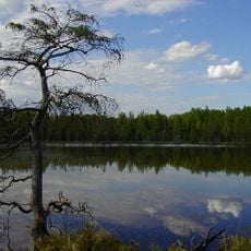
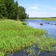
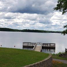
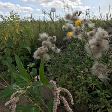
Cut Foot Sioux Trail is a loop of about 22 miles through the Chippewa National Forest that follows old gravel and sand roads. The path passes by several lakes and moves through forests of tall white and red pine trees, wetlands, and gentle hills that make up this northern Minnesota landscape.

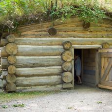
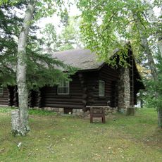
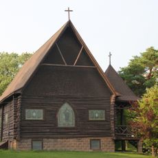
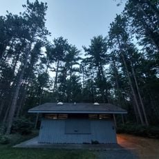
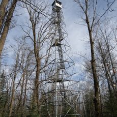
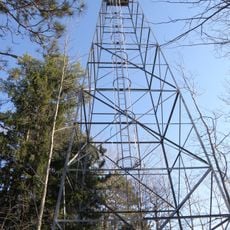
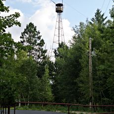
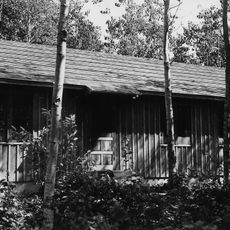
The trail was added to the National Recreation Trail system in 1980 to recognize its outdoor recreation value. Near the area stands a ranger station built in 1904 that was used until 1918 and has been restored to show how early forest management worked in this region.

The trail's name comes from the nearby Sioux River and connects visitors to the Native American history of the area. Today, people traveling here can learn about the land's past while enjoying the forest and water around them.

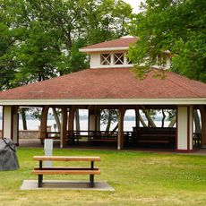
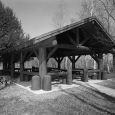
The trail is easy to reach from the visitor center on Minnesota State Highway 46 located on the Leech Lake Indian Reservation. Bring your own water and supplies since there are no facilities or shops along the route, and come prepared for changing weather conditions.

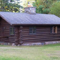
The area includes the Cut Foot Experimental Forest where scientists study pine forest management and develop methods for keeping the forest healthy. Visitors often spot eagles, osprey, and loons on the lakes and in the trees, adding wildlife and sound to the peaceful surroundings.

The community of curious travelers

AroundUs brings together thousands of curated places, local tips, and hidden gems, enriched daily by 60,000 contributors worldwide.

Start exploring
Location
GPS coordinates
47.52000,-94.07000
Latest update
February 9, 2026 07:42
Around this place
Lake Winnibigoshish
United States of America

Lake Winnibigoshish

11.4 km
Lake Bemidji State Park
United States of America

Lake Bemidji State Park

56.4 km
Waldsee
United States of America

Waldsee

50.4 km
Scenic State Park
United States of America

Scenic State Park

43.7 km
United States of America

The Big Fish

23.9 km
Rabideau CCC Camp
United States of America

Rabideau CCC Camp

38.3 km
Forest History Center
United States of America

Forest History Center

49.8 km
Schoolcraft State Park
United States of America

Schoolcraft State Park

38.7 km
Bowstring State Forest
United States of America

Bowstring State Forest

11.4 km
Marcell Ranger Station
United States of America

Marcell Ranger Station

30 km
Bigfork Village Hall
United States of America

Bigfork Village Hall

39.9 km
Coleraine Methodist Episcopal Church
United States of America

Coleraine Methodist Episcopal Church

54.9 km
Church of the Good Shepherd
United States of America

Church of the Good Shepherd

54.8 km
Diamond Point Beach
United States of America

Diamond Point Beach

60.3 km
Thunder Alley XL
United States of America

Thunder Alley XL

52.8 km
Remer State Forest
United States of America

Remer State Forest

46.6 km
Scenic State Park CCC/WPA/Rustic Style Historic Resources
United States of America

Scenic State Park CCC/WPA/Rustic Style Historic Resources

43.7 km
Lake Bemidji State Park CCC/NYA/Rustic Style Historic Resources
United States of America

Lake Bemidji State Park CCC/NYA/Rustic Style Historic Resources

56.9 km
Sandtrap Golf Course
United States of America

Sandtrap Golf Course

44.9 km
Tioga Pit Beach
United States of America

Tioga Pit Beach

47.8 km
Norway Beach Swimming Area
United States of America

Norway Beach Swimming Area

37.5 km
Cuba Hill Lookout Tower
United States of America

Cuba Hill Lookout Tower

37.3 km
Rabideau Civilian Conservation Corps Camp Picnic Shelter
United States of America

Rabideau Civilian Conservation Corps Camp Picnic Shelter

38.5 km
Nymore Beach
United States of America

Nymore Beach

60.1 km
Blackduck Lookout Tower
United States of America

Blackduck Lookout Tower

40.8 km
Farley Hill Lookout Tower
United States of America

Farley Hill Lookout Tower

7.5 km
Coleraine Fire Lookout Tower
United States of America

Coleraine Fire Lookout Tower

53.9 km
Ruby Lake Camp
United States of America

Ruby Lake Camp

39.2 km
Show the full map
« Cut Foot Sioux Trail - trail in Minnesota » is provided by Around Us (aroundus.com). Images and texts are derived from Wikimedia project under a Creative Commons license. You are allowed to copy, distribute, and modify copies of this page, under the conditions set by the license, as long as this note is clearly visible.

Discover hidden gems everywhere you go!

From secret cafés to breathtaking viewpoints, skip the crowded tourist spots and find places that match your style. Our app makes it easy with voice search, smart filtering, route optimization, and insider tips from travelers worldwide. Download now for the complete mobile experience.

Around Us App Screenshot

A unique approach to discovering new places

Le Figaro

All the places worth exploring

France Info

A tailor-made excursion in just a few clicks

20 Minutes

Around Us
Travel Guide & Maps
Download

Send to your phone

QR Code
1

Open the camera app on your mobile.

2

Point at the QR code with your camera. A notification will appear.

3

Tap the notification to open the link.