Enable Location

We need your location to show you interesting places around you

Discover nearby places

Find interesting locations and hidden gems around you

Precise directions

Get accurate directions and distances to places

Your location is never shared with other users. It's only used when you tap the location button.

Log in to your account

Start exploring — it's free

Trusted by 64,610 travelers worldwide

Continue with Google
Continue with Apple
or

We will send you a code to connect

By continuing, you accept our Terms and Conditions and our Privacy Policy

Check your inbox

We've sent a pincode in your inbox. Please enter the code below.

Devil's Den Preserve
Discussion Reviews Photo
5k Popularity

Devil's Den Preserve, Nature preserve in Weston and Redding, Connecticut.

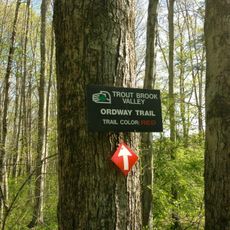
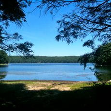
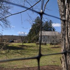
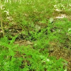
Devil's Den Preserve is a forested protected area in Weston and Redding, Connecticut, crossed by the Saugatuck River and made up of dense woodland, wetlands, and rocky outcrops. A network of trails runs through the property, connecting these different parts of the landscape.

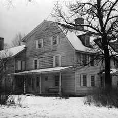
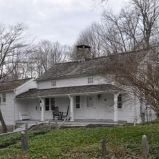
The land was used by Native peoples for hunting and gathering for a long time before European settlers arrived, and some traces of that presence remain visible on the ground. In the 20th century, the Nature Conservancy gradually acquired the parcels to protect them permanently.

The preserve is managed by the Nature Conservancy and is free to enter, which makes it a popular spot for families and locals who want to spend time outdoors. People come here to hike, watch birds, or simply walk through the woods at their own pace.

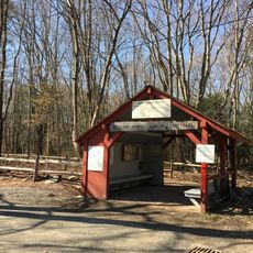
The main entrance is on Pent Road in Weston, where there is a parking area and trail maps are available. The trails vary in difficulty, so it is worth checking the map before setting off to find a route that suits your pace.

The Saugatuck River, which runs through the preserve, is home to rare freshwater mussel species that are almost gone from most of the region. These mussels are a sign of clean water and are considered a reliable indicator of river health.

The community of curious travelers

AroundUs brings together thousands of curated places, local tips, and hidden gems, enriched daily by 60,000 contributors worldwide.

Start exploring
Location
GPS coordinates
41.23650,-73.39600
Latest update
March 3, 2026 08:15
Around this place
Merritt Parkway
United States of America

Merritt Parkway

9.3 km
Stormfield
United States of America

Stormfield

6.1 km
Saugatuck Reservoir
United States of America

Saugatuck Reservoir

4.1 km
Keeler Tavern
United States of America

Keeler Tavern

9.4 km
Aldrich Contemporary Art Museum
United States of America

Aldrich Contemporary Art Museum

9.6 km
Ida Tarbell House
United States of America

Ida Tarbell House

9.5 km
Trout Brook Valley State Park Reserve
United States of America

Trout Brook Valley State Park Reserve

4.6 km
Cannondale Historic District
United States of America

Cannondale Historic District

3 km
Bradley-Hubbell House
United States of America

Bradley-Hubbell House

6.4 km
Georgetown Historic District
United States of America

Georgetown Historic District

3.6 km
United States of America

Westport Observatory

9.1 km
Connecticut Audubon Society Center at Fairfield
United States of America

Connecticut Audubon Society Center at Fairfield

9.5 km
Redding Center Historic District
United States of America

Redding Center Historic District

7.6 km
Centennial Watershed State Forest
United States of America

Centennial Watershed State Forest

4.2 km
Ridgefield Center Historic District
United States of America

Ridgefield Center Historic District

9.6 km
Wilton Center Historic District
United States of America

Wilton Center Historic District

5.8 km
Hurlbutt Street School
United States of America

Hurlbutt Street School

4.1 km
Norfield Historic District
United States of America

Norfield Historic District

4.2 km
David Lambert House
United States of America

David Lambert House

6.6 km
Benedict House and Shop
United States of America

Benedict House and Shop

9 km
Aaron Barlow House
United States of America

Aaron Barlow House

9.7 km
Marvin Tavern
United States of America

Marvin Tavern

4.1 km
Hugh Cain Fulling Mill and Elias Glover Woolen Mill Archeological Site
United States of America

Hugh Cain Fulling Mill and Elias Glover Woolen Mill Archeological Site

8.6 km
Umpawaug District School
United States of America

Umpawaug District School

9.2 km
Kettle Creek Historic District
United States of America

Kettle Creek Historic District

5.9 km
Bradley Edge Tool Company Historic District
United States of America

Bradley Edge Tool Company Historic District

5.6 km
Sloan-Raymond-Fitch House
United States of America

Sloan-Raymond-Fitch House

5.9 km
Daniel and Esther Bartlett House
United States of America

Daniel and Esther Bartlett House

8.3 km
Show the full map
Reviews
Share your experience

No review yet

Discussions
Start a discussion...

No discussion yet

« Devil's Den Preserve - Nature preserve in Weston and Redding, Connecticut » is provided by Around Us (aroundus.com). Images and texts are derived from Wikimedia project under a Creative Commons license. You are allowed to copy, distribute, and modify copies of this page, under the conditions set by the license, as long as this note is clearly visible.

Discover hidden gems everywhere you go!

From secret cafés to breathtaking viewpoints, skip the crowded tourist spots and find places that match your style. Our app makes it easy with voice search, smart filtering, route optimization, and insider tips from travelers worldwide. Download now for the complete mobile experience.

Around Us App Screenshot

A unique approach to discovering new places

Le Figaro

All the places worth exploring

France Info

A tailor-made excursion in just a few clicks

20 Minutes

Around Us
Travel Guide & Maps
Download

Send to your phone

QR Code
1

Open the camera app on your mobile.

2

Point at the QR code with your camera. A notification will appear.

3

Tap the notification to open the link.