Enable Location

We need your location to show you interesting places around you

Discover nearby places

Find interesting locations and hidden gems around you

Precise directions

Get accurate directions and distances to places

Your location is never shared with other users. It's only used when you tap the location button.

Ellerbusch Site

Log in to your account

Start exploring — it's free

Trusted by 62,173 travelers worldwide

Continue with Google
Continue with Apple
or

We will send you a code to connect

By continuing, you accept our Terms and Conditions and our Privacy Policy

Check your inbox

We've sent a pincode in your inbox. Please enter the code below.

Ellerbusch Site, Archaeological site in southwestern Indiana, United States.

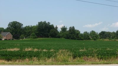
The Ellerbusch Site is an archaeological location in southwestern Indiana situated on a bluff near the intersection of State Road 662 and Ellerbusch Road. The roughly 0.8 acre area contains the remains of multiple houses and numerous artifacts that document the lives of prehistoric people.

Archaeologists began excavations in 1957 and discovered multiple houses and artifacts that sparked research interest. The site was added to the National Register of Historic Places in 1991 due to its importance for understanding settlement patterns in the region.

Pottery made with shell fragments and stone tools tell the story of how people here crafted their belongings. The finds suggest that different groups chose this location for settlement across different centuries.

The site sits at a publicly accessible road location and can be viewed by visitors from the surrounding area. Those seeking detailed information about excavations and discoveries should contact local archives, nearby museums, or the National Park Service.

Analysis of recovered items shows two distinct occupation periods around 200 to 320 AD and again around 990 to 1110 AD. These large gaps between the phases suggest that people returned to settle this location repeatedly over the course of centuries.

The community of curious travelers

AroundUs brings together thousands of curated places, local tips, and hidden gems, enriched daily by 60,000 contributors worldwide.

Start exploring
Location
GPS coordinates
37.95220,-87.42560
Latest update
December 14, 2025 16:43
Around this place
Angel Mounds
United States of America

Angel Mounds

2.9 km
Bi-State Vietnam Gold Star Bridges
United States of America

Bi-State Vietnam Gold Star Bridges

12.2 km
Wesselman Woods Nature Preserve
United States of America

Wesselman Woods Nature Preserve

7.9 km
St. Benedict Cathedral
United States of America

St. Benedict Cathedral

10.3 km
Newburgh Lock and Dam
United States of America

Newburgh Lock and Dam

5.2 km
United States of America

Haynies Corner Arts District

12.4 km
Yankeetown Site
United States of America

Yankeetown Site

12 km
Bayard Park Neighborhood
United States of America

Bayard Park Neighborhood

11 km
Alhambra Theatorium
United States of America

Alhambra Theatorium

12.4 km
Washington Avenue Historic District
United States of America

Washington Avenue Historic District

11.7 km
Bernardin-Johnson House
United States of America

Bernardin-Johnson House

8.8 km
Liberty Baptist Church
United States of America

Liberty Baptist Church

12.3 km
Old Newburgh Presbyterian Church
United States of America

Old Newburgh Presbyterian Church

1.9 km
Independence Historic District
United States of America

Independence Historic District

11.7 km
Edgar A. Igleheart House
United States of America

Edgar A. Igleheart House

5.5 km
Hose House No. 10
United States of America

Hose House No. 10

12.4 km
John W. Boehne House
United States of America

John W. Boehne House

10.6 km
Roberts-Morton House
United States of America

Roberts-Morton House

3.4 km
Original Newburgh Historic District
United States of America

Original Newburgh Historic District

2 km
Firestone Tire and Rubber Store
United States of America

Firestone Tire and Rubber Store

12.6 km
Peter Augustus Maier House
United States of America

Peter Augustus Maier House

12.2 km
Koester/Patburg House
United States of America

Koester/Patburg House

12.5 km
Hooker-Ensle-Pierce House
United States of America

Hooker-Ensle-Pierce House

11.9 km
William Bedford Sr. House
United States of America

William Bedford Sr. House

11.1 km
Michael Schaeffer House
United States of America

Michael Schaeffer House

12.2 km
Parson and Scoville Building
United States of America

Parson and Scoville Building

12.5 km
Lincolnshire Historic District
United States of America

Lincolnshire Historic District

12.2 km
Riverside Historic District
United States of America

Riverside Historic District

11.5 km
Show the full map
« Ellerbusch Site - Archaeological site in southwestern Indiana, United States » is provided by Around Us (aroundus.com). Images and texts are derived from Wikimedia project under a Creative Commons license. You are allowed to copy, distribute, and modify copies of this page, under the conditions set by the license, as long as this note is clearly visible.

Discover hidden gems everywhere you go!

From secret cafés to breathtaking viewpoints, skip the crowded tourist spots and find places that match your style. Our app makes it easy with voice search, smart filtering, route optimization, and insider tips from travelers worldwide. Download now for the complete mobile experience.

Around Us App Screenshot

A unique approach to discovering new places

Le Figaro

All the places worth exploring

France Info

A tailor-made excursion in just a few clicks

20 Minutes

Around Us
Travel Guide & Maps
Download

Send to your phone

QR Code
1

Open the camera app on your mobile.

2

Point at the QR code with your camera. A notification will appear.

3

Tap the notification to open the link.