Enable Location

We need your location to show you interesting places around you

Discover nearby places

Find interesting locations and hidden gems around you

Precise directions

Get accurate directions and distances to places

Your location is never shared with other users. It's only used when you tap the location button.

Log in to your account

Start exploring — it's free

Trusted by 60,637 travelers worldwide

Continue with Google
Continue with Apple
or

We will send you a code to connect

By continuing, you accept our Terms and Conditions and our Privacy Policy

Check your inbox

We've sent a pincode in your inbox. Please enter the code below.

Empire Corridor

Empire Corridor, Railroad corridor in New York, US

Description

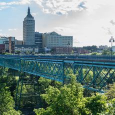
The Empire Corridor is a rail line that connects New York City with Niagara Falls, passing through the Hudson Valley and several major cities along the way. Amtrak operates passenger trains along this route, stopping at communities and regional centers that line the tracks.

History

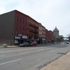
The route traces back to the New York Central Railroad, which operated trains between New York and Buffalo starting in the 1800s. This historical transportation link continues to shape how people move through the region today.

Culture

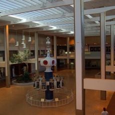
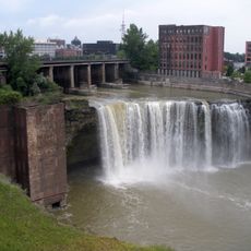
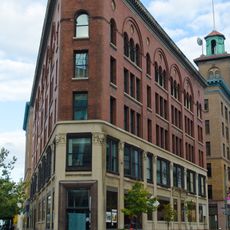
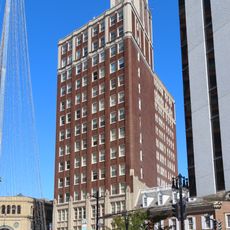
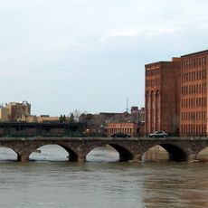
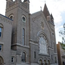
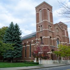
The line links communities to cultural institutions scattered across the Hudson Valley and Finger Lakes region that grew around rail access. It remains a symbol of New York's historical role as a major transportation crossroads for people traveling between the Northeast and beyond.

Practical

The line offers train service for people traveling from New York City toward northern destinations, with departures scheduled throughout the day. Travelers should know that some towns are easier to reach during peak hours and that connections to other routes are available.

Did you know?

The corridor is being upgraded for higher-speed rail service, with designs that will cut travel times between major cities significantly. This modernization project aims to make the route more efficient while opening new commuting options for regional travelers.

Location
Part of
Amtrak
GPS coordinates
43.16322,-77.60803
Latest update
December 17, 2025 10:25

AroundUs brings together thousands of curated places, local tips, and hidden gems, enriched daily by 60,000 contributors worldwide. Discover all places nearby (New York).

Around this place
Midtown Plaza
United States of America

Midtown Plaza

793 m
High Falls
United States of America

High Falls

485 m
The Metropolitan
United States of America

The Metropolitan

799 m
Eastman Theatre
United States of America

Eastman Theatre

817 m
Tower 280
United States of America

Tower 280

896 m
Hyatt Regency Rochester
United States of America

Hyatt Regency Rochester

749 m
Sibley's, Lindsay and Curr Building
United States of America

Sibley's, Lindsay and Curr Building

602 m
Rochester City Hall
United States of America

Rochester City Hall

899 m
United States of America

Rochester Contemporary Art Center

923 m
Rochester Savings Bank
United States of America

Rochester Savings Bank

569 m
Sibley Triangle Building
United States of America

Sibley Triangle Building

738 m
Pont de Rennes
United States of America

Pont de Rennes

600 m
Brown's Race Historic District
United States of America

Brown's Race Historic District

741 m
State Street Historic District
United States of America

State Street Historic District

867 m
St. Joseph's Church and Rectory
United States of America

St. Joseph's Church and Rectory

435 m
Reynolds Arcade
United States of America

Reynolds Arcade

890 m
Main Street Bridge
United States of America

Main Street Bridge

824 m
Our Lady of Victory Roman Catholic Church
United States of America

Our Lady of Victory Roman Catholic Church

491 m
Chamber of Commerce
United States of America

Chamber of Commerce

627 m
First National Bank of Rochester-Old Monroe County Savings Bank Building
United States of America

First National Bank of Rochester-Old Monroe County Savings Bank Building

912 m
Temple Building
United States of America

Temple Building

632 m
Andrews Street Bridge
United States of America

Andrews Street Bridge

604 m
English Evangelical Church of the Reformation and Parish House
United States of America

English Evangelical Church of the Reformation and Parish House

615 m
German United Evangelical Church Complex
United States of America

German United Evangelical Church Complex

318 m
Leopold Street Shule
United States of America

Leopold Street Shule

336 m
Jewish Young Men's and Women's Association
United States of America

Jewish Young Men's and Women's Association

438 m
Teoronto Block Historic District
United States of America

Teoronto Block Historic District

916 m
East Main Street Historic District
United States of America

East Main Street Historic District

668 m
Show the full map
« Empire Corridor - Railroad corridor in New York, US » is provided by Around Us (aroundus.com). Images and texts are derived from Wikimedia project under a Creative Commons license. You are allowed to copy, distribute, and modify copies of this page, under the conditions set by the license, as long as this note is clearly visible.

Discover hidden gems everywhere you go!

From secret cafés to breathtaking viewpoints, skip the crowded tourist spots and find places that match your style. Our app makes it easy with voice search, smart filtering, route optimization, and insider tips from travelers worldwide. Download now for the complete mobile experience.

Around Us App Screenshot

A unique approach to discovering new places

Le Figaro

All the places worth exploring

France Info

A tailor-made excursion in just a few clicks

20 Minutes

Around Us
Travel Guide & Maps
Download

Send to your phone

QR Code
1

Open the camera app on your mobile.

2

Point at the QR code with your camera. A notification will appear.

3

Tap the notification to open the link.