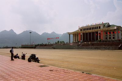
Lai Châu, provincial city of Lai Chau, Vietnam
Location: Lai Châu
Inception: October 10, 2004
GPS coordinates: 22.39911,103.43926
Latest update: April 11, 2025 15:19
Fansipan
36.2 km
Bao Ha Temple
97.5 km
Honghe Hani Rice Terraces
103.8 km
Hoang Lien National Park
36.2 km
Zhou's House
108.1 km
Pa Uon Bridge
80.6 km
南湖瀛洲亭
107.7 km
Former Mengzi Customs House
107.8 km
Cốc Lếu Bridge
55.7 km
Bisezhai Railway Station
118.7 km
Faux Namti Bridge
96.9 km
Phu Si Lung
71.6 km
Jianshui Confucian Temple
149.8 km
Chaoyang Gate (Jianshui)
149.5 km
Main Hall of Zhilin Temple
149.2 km
Cát Cát waterfall
40.9 km
Pho Lu Bridge
76.9 km
Kim Thanh Bridge
53.5 km
Datunhai reservoir
115.5 km
Wenbi Tower (Jianshui)
146.9 km
河口海关旧址
55.3 km
Datunhai reservoir
115.8 km
Đồi D1
120.1 km
蒙自玉皇阁
108.2 km
Duoyishu Viewpoint
101.6 km
同盟会河口起义纪念馆
55.3 km
Hoang Su Phi Terraced Rice Fields
129.4 km
Honghe Hani and Yi Autonomous Prefecture Museum
108.2 kmReviews
Visited this place? Tap the stars to rate it and share your experience / photos with the community! Try now! You can cancel it anytime.
Discover hidden gems everywhere you go!
From secret cafés to breathtaking viewpoints, skip the crowded tourist spots and find places that match your style. Our app makes it easy with voice search, smart filtering, route optimization, and insider tips from travelers worldwide. Download now for the complete mobile experience.
A unique approach to discovering new places❞
— Le Figaro
All the places worth exploring❞
— France Info
A tailor-made excursion in just a few clicks❞
— 20 Minutes