Enable Location

We need your location to show you interesting places around you

Discover nearby places

Find interesting locations and hidden gems around you

Precise directions

Get accurate directions and distances to places

Your location is never shared with other users. It's only used when you tap the location button.

Sentraltind

Log in to your account

Start exploring — it's free

Trusted by 62,801 travelers worldwide

Continue with Google
Continue with Apple
or

We will send you a code to connect

By continuing, you accept our Terms and Conditions and our Privacy Policy

Check your inbox

We've sent a pincode in your inbox. Please enter the code below.

Sentraltind

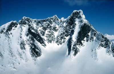
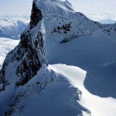
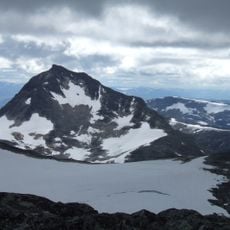
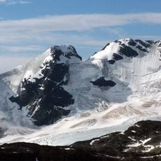
Sentraltind, Mountain summit in Luster Municipality, Norway

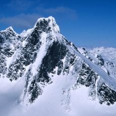
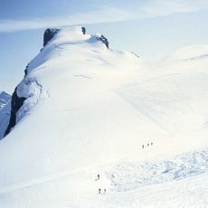
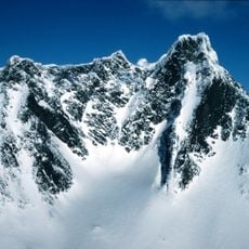
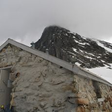
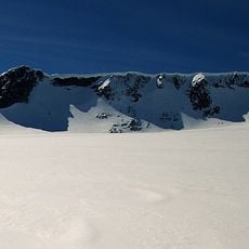
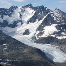
Sentraltind is a mountain summit rising to 2,348 meters within Jotunheimen National Park, marked by steep rock walls and multiple climbing routes on its eastern slopes. The peak sits on a ridge connecting neighboring summits and features exposed rock passages that define the climbing experience.

The first recorded ascent took place on August 7, 1885, when climbers Carl Hall, Mathias Soggemoen, and Torger Sulheim reached the summit. This early climb opened the peak to the wider mountaineering community and established the climbing routes that are still used today.

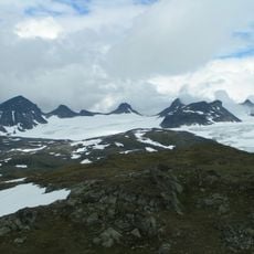
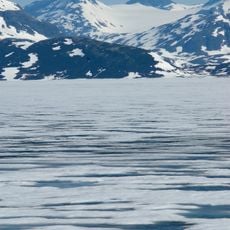
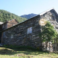
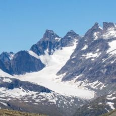
The mountain's name comes from Norwegian words 'sentral' meaning central and 'tind' meaning peak, reflecting its location within the Hurrungane range. For climbers visiting the region, it serves as a landmark that marks their progress through this famous alpine area.

Climbing this peak requires mountaineering skill and proper gear for the exposed rock sections. The climbing season runs from June to September when weather is most stable and snow has melted from lower elevations.

This peak ranks among Norway's ten highest summits at 2,348 meters. Many visitors focus on reaching the top but overlook how the journey along the connecting ridge between neighboring peaks is equally rewarding.

The community of curious travelers

AroundUs brings together thousands of curated places, local tips, and hidden gems, enriched daily by 60,000 contributors worldwide.

Start exploring
Elevation above the sea
2,348 m
GPS coordinates
61.46361,7.88250
Latest update
December 14, 2025 16:45
« Sentraltind - Mountain summit in Luster Municipality, Norway » is provided by Around Us (aroundus.com). Images and texts are derived from Wikimedia project under a Creative Commons license. You are allowed to copy, distribute, and modify copies of this page, under the conditions set by the license, as long as this note is clearly visible.

Discover hidden gems everywhere you go!

From secret cafés to breathtaking viewpoints, skip the crowded tourist spots and find places that match your style. Our app makes it easy with voice search, smart filtering, route optimization, and insider tips from travelers worldwide. Download now for the complete mobile experience.

Around Us App Screenshot

A unique approach to discovering new places

Le Figaro

All the places worth exploring

France Info

A tailor-made excursion in just a few clicks

20 Minutes

Around Us
Travel Guide & Maps
Download

Send to your phone

QR Code
1

Open the camera app on your mobile.

2

Point at the QR code with your camera. A notification will appear.

3

Tap the notification to open the link.