Enable Location

We need your location to show you interesting places around you

Discover nearby places

Find interesting locations and hidden gems around you

Precise directions

Get accurate directions and distances to places

Your location is never shared with other users. It's only used when you tap the location button.

Log in to your account

Start exploring — it's free

Trusted by 63,422 travelers worldwide

Continue with Google
Continue with Apple
or

We will send you a code to connect

By continuing, you accept our Terms and Conditions and our Privacy Policy

Check your inbox

We've sent a pincode in your inbox. Please enter the code below.

Pandacan
Discussion Reviews Photo
15.8k Popularity

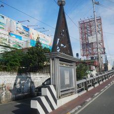
Pandacan, Administrative district in Manila, Philippines.

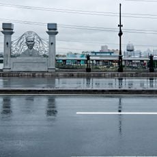
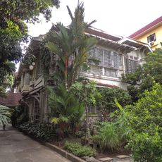
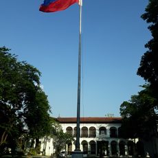
Pandacan is an administrative district in Manila that stretches along the Pasig River, encompassing residential areas, local markets, schools, and community centers. The district presents a mix of dense urban development and everyday commercial life.

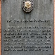
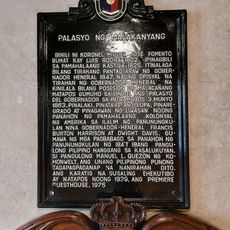
The district began in 1574 when Franciscan missionaries established their first mission, transforming agricultural land into an industrial center. This early settlement shaped its role as an economic hub.

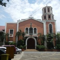
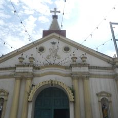
The Santo Niño de Pandacan Parish Church serves as a focal point where residents gather for spiritual life and annual celebrations. This place reflects how faith remains woven into the daily rhythm of the neighborhood.

The district connects to central Manila through multiple bus routes and jeepney services, with direct access to major thoroughfares. Visitors should expect local transportation that runs frequently throughout the day.

The district earned the nickname Little Venice during the Spanish era because of its canal network that connected residential areas to the Pasig River. These water-based structures continue to shape the area's geography today.

The community of curious travelers

AroundUs brings together thousands of curated places, local tips, and hidden gems, enriched daily by 60,000 contributors worldwide.

Start exploring
Location
GPS coordinates
14.59400,121.00700
Latest update
December 7, 2025 19:29
Around this place
Malacañang Palace
Philippines

Malacañang Palace

1.3 km
Commission on the Filipino Language
Philippines

Commission on the Filipino Language

1.1 km
Mabini Shrine
Philippines

Mabini Shrine

646 m
Ayala Bridge
Philippines

Ayala Bridge

924 m
Lichauco Heritage House
Philippines

Lichauco Heritage House

1.5 km
Mabini Bridge
Philippines

Mabini Bridge

638 m
Pandacan Church
Philippines

Pandacan Church

324 m
Legarda Ancestral House
Philippines

Legarda Ancestral House

1.4 km
Kalayaan Hall
Philippines

Kalayaan Hall

1.3 km
First Shot in Filipino–American War historical marker
Philippines

First Shot in Filipino–American War historical marker

1.4 km
Father Jacinto Zamora historical marker
Philippines

Father Jacinto Zamora historical marker

555 m
Commission on the Filipino Language historical marker
Philippines

Commission on the Filipino Language historical marker

1.2 km
Apolinario Mabini Shrine historical marker
Philippines

Apolinario Mabini Shrine historical marker

633 m
Church of Our Lady of Peñafrancia
Philippines

Church of Our Lady of Peñafrancia

1.4 km
Tomas Earnshaw historical marker
Philippines

Tomas Earnshaw historical marker

1.4 km
Ladislao Bonus historical marker
Philippines

Ladislao Bonus historical marker

453 m
Apolinario Mabini  historical marker
Philippines

Apolinario Mabini historical marker

632 m
Florentino P. Cayco historical marker
Philippines

Florentino P. Cayco historical marker

1.3 km
Church of Our Lady of Peñafrancia historical marker
Philippines

Church of Our Lady of Peñafrancia historical marker

1.4 km
Polytechnic University of the Philippines historical marker
Philippines

Polytechnic University of the Philippines historical marker

595 m
The Church of Pandacan historical marker
Philippines

The Church of Pandacan historical marker

347 m
Mabini Bridge historical marker
Philippines

Mabini Bridge historical marker

601 m
Eulogio “Amang” Rodriguez Institute of Science and Technology historical marker
Philippines

Eulogio “Amang” Rodriguez Institute of Science and Technology historical marker

895 m
Kalayaan Hall historical marker
Philippines

Kalayaan Hall historical marker

1.3 km
Liberation of Manila historical marker
Philippines

Liberation of Manila historical marker

1.4 km
Malacañang Palace historical marker
Philippines

Malacañang Palace historical marker

1.4 km
House where Apolinario Mabini died historical marker
Philippines

House where Apolinario Mabini died historical marker

639 m
Santa Catalina College historical marker
Philippines

Santa Catalina College historical marker

1.3 km
Show the full map
Reviews
Share your experience

No review yet

Discussions
Start a discussion...

No discussion yet

« Pandacan - Administrative district in Manila, Philippines » is provided by Around Us (aroundus.com). Images and texts are derived from Wikimedia project under a Creative Commons license. You are allowed to copy, distribute, and modify copies of this page, under the conditions set by the license, as long as this note is clearly visible.

Discover hidden gems everywhere you go!

From secret cafés to breathtaking viewpoints, skip the crowded tourist spots and find places that match your style. Our app makes it easy with voice search, smart filtering, route optimization, and insider tips from travelers worldwide. Download now for the complete mobile experience.

Around Us App Screenshot

A unique approach to discovering new places

Le Figaro

All the places worth exploring

France Info

A tailor-made excursion in just a few clicks

20 Minutes

Around Us
Travel Guide & Maps
Download

Send to your phone

QR Code
1

Open the camera app on your mobile.

2

Point at the QR code with your camera. A notification will appear.

3

Tap the notification to open the link.