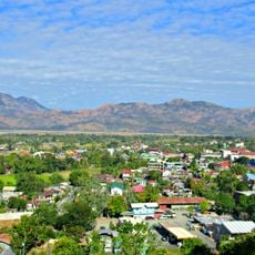
Mount Binuluan, Active stratovolcano in Kalinga province, Philippines
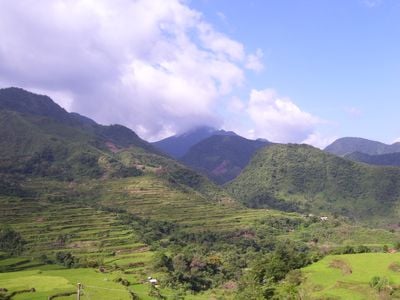
Mount Binuluan is an active stratovolcano in the Cordillera Central mountain range that rises above 2,300 meters with multiple fumarole fields and hot springs on its slopes. The volcano contains extensive geothermal features that make it a complex thermal system with visible steam vents and mineral-rich water flows.
A phreatic eruption in 1952 caused debris flows that affected nearby villages and demonstrated the volcano's potential for destruction. This event marked one of the most significant recent volcanic hazards in the region.
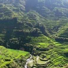
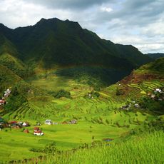
The Bu-ot Fumarole Field reflects the Balatoc community's relationship with this volcanic environment and the thermal features they have known for generations. Visitors can observe how local people interact with the hot springs and steaming vents that emerge from the slopes.
Climbing requires solid preparation because the terrain is difficult and infrastructure is limited throughout the region. Visitors should check local conditions beforehand since access can vary depending on the season and weather patterns.
The mountain is currently being studied for geothermal energy potential, revealing how its volcanic features could possibly fuel future power generation in the region. The research covers areas spanning multiple municipalities with active thermal zones.
Elevation above the sea: 2,329 m
GPS coordinates: 17.31667,121.10000
Latest update: December 9, 2025 18:42
Banaue Rice Terraces
42.7 km
Rice Terraces of the Philippine Cordilleras
42.8 km
Santa Maria Church
65.8 km
Basilica of Our Lady of Piat
66.1 km
Cassamata Hill National Park
59.3 km
Saint Catherine of Alexandria Parish Church
58.1 km
Bangued Cathedral
60 km
Balbalasang-Balbalan National Park
14.8 km
Malaueg Church
64.3 km
Candon Church
70.5 km
Batad Rice Terraces
42.7 km
Isabelo Abaya historical marker
70.6 km
Bontoc Cathedral
28.3 km
Cry of Candon historical marker
70.6 km
Church of Sta. Maria historical marker
65.8 km
The Battle of Bessang Pass historical marker
61.5 km
Memorare historical marker (Gregorio del Pilar)
53.7 km
Sumaguing Cave
34.8 km
Church of Narvacan historical marker
67.2 km
Battle of Tirad Pass historical marker
53.7 km
Tabuk Cathedral
38.2 km
Quintin Paredes historical marker
59.9 km
Quintin Paredes Ancestral House
59.9 km
Church of Candon historical marker
70.6 km
Surrender of General Yamashita historical marker
60.1 km
Hanging Coffins of Sagada
33.4 km
William Henry Scott historical marker
33.6 km
Church of Sta. Maria historical marker
65.8 kmVisited this place? Tap the stars to rate it and share your experience / photos with the community! Try now! You can cancel it anytime.
Discover hidden gems everywhere you go!
From secret cafés to breathtaking viewpoints, skip the crowded tourist spots and find places that match your style. Our app makes it easy with voice search, smart filtering, route optimization, and insider tips from travelers worldwide. Download now for the complete mobile experience.
A unique approach to discovering new places❞
— Le Figaro
All the places worth exploring❞
— France Info
A tailor-made excursion in just a few clicks❞
— 20 Minutes