See the monuments around you in AROpen chests in the app
Around Us is built for your phone — point your camera at the streets and discover the monuments and places around you in augmented reality.Around Us is built for your phone — chests unlock when you walk, explore and capture nearby places.
The world's largest rivers flow across continents and shape entire regions through their power and reach. The Amazon stretches 6,992 kilometers through South America, the Nile covers 6,852 kilometers across Egypt and Sudan, while the Yangtze River measures 6,300 kilometers in China. These waterways sustain agriculture, support fisheries, and enable transportation for millions of people. Each river creates its own landscape: the Amazon with its vast rainforest system, the Nile with its fertile banks, the Yangtze with its deep gorges, and the Congo with its powerful rapids. In North America, the Mississippi defines the heartland, while in Siberia, the Yenisei, Lena, and Ob flow through wilderness. Across Asia, the Amur and Mekong connect different cultures, the Yellow River shapes life in China, and the Murray supports Australia's inland regions. The Niger winds through West Africa, and the Mackenzie cuts across Canada's northern landscape. Together, these rivers form a global network that sustains ecosystems and connects human communities across the world.
The world's largest rivers flow across continents and shape entire regions through their power and reach. The Amazon stretches 6,992 kilometers through South America, the Nile covers 6,852 kilometers across Egypt and Sudan, while the Yangtze River measures 6,300 kilometers in China. These waterways sustain agriculture, support fisheries, and enable transportation for millions of people. Each river creates its own landscape: the Amazon with its vast rainforest system, the Nile with its fertile banks, the Yangtze with its deep gorges, and the Congo with its powerful rapids. In North America, the Mississippi defines the heartland, while in Siberia, the Yenisei, Lena, and Ob flow through wilderness. Across Asia, the Amur and Mekong connect different cultures, the Yellow River shapes life in China, and the Murray supports Australia's inland regions. The Niger winds through West Africa, and the Mackenzie cuts across Canada's northern landscape. Together, these rivers form a global network that sustains ecosystems and connects human communities across the world.
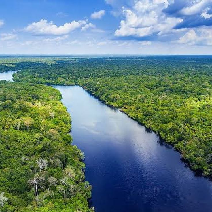
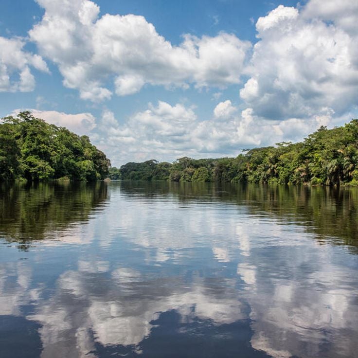
The Amazon is the largest river in the world by water discharge. It stretches 6,992 kilometers across Peru, Colombia, and Brazil. The river shapes the landscape with countless meandering curves and bends. It is part of the global network of major rivers that cross continents and connect countries. The Amazon supports agriculture, enables transportation, and sustains one of the world's most important ecosystems.
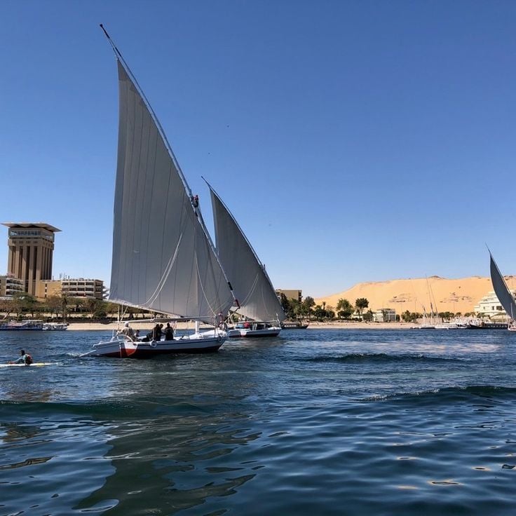
The Nile is the longest river in Africa and crosses ten countries over 6,852 kilometers, from Lake Victoria to the Mediterranean Sea. This river shapes the landscape and supports agriculture and trade in one of the world's driest regions. The Nile creates the famous delta and connects different cultures and regions together.
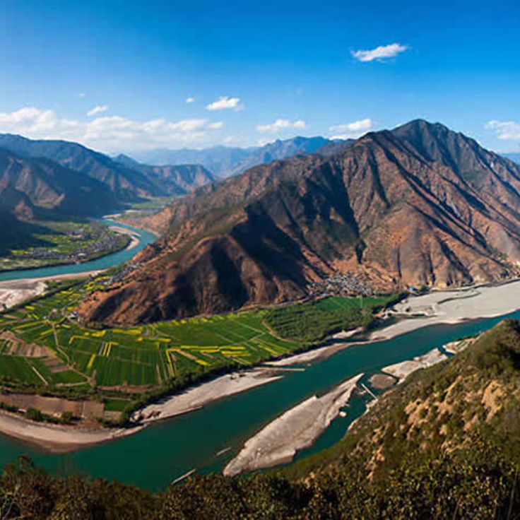
The Yangtze River is the world's third longest river, stretching 6,300 kilometers across China. It flows from the high plateaus of Tibet to the eastern regions, shaping the landscapes of numerous provinces. This river is essential to the collection of the world's largest rivers, as it supplies water to millions of people, supports agriculture, and carries thousands of boats annually. The Yangtze connects inland areas with coastal regions, enabling trade and transportation throughout its entire course.
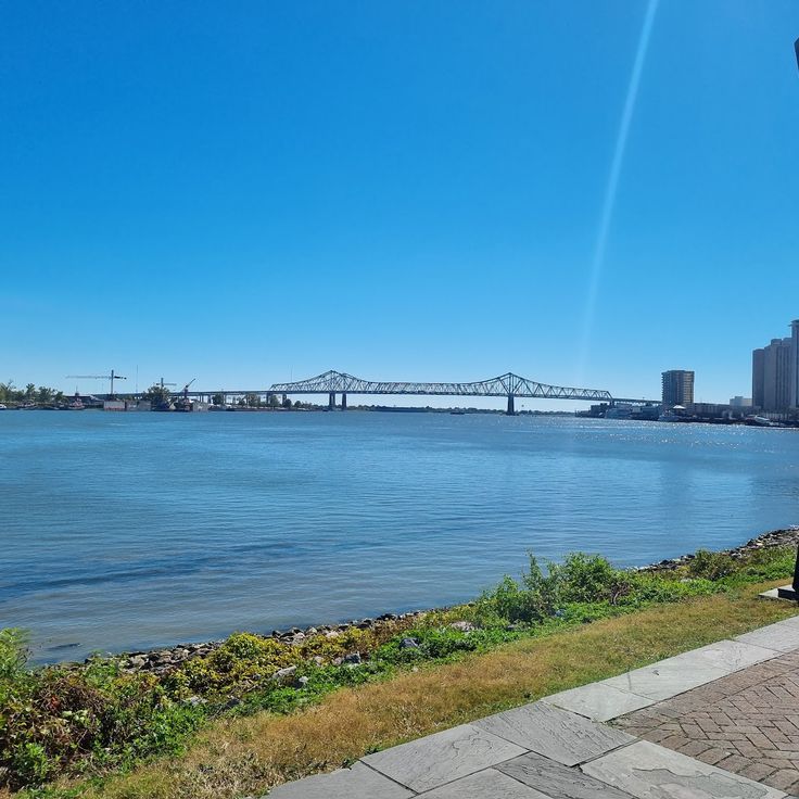
The Mississippi is a major river that flows over 6,210 kilometers from Minnesota to the Gulf of Mexico. In this collection of the world's largest rivers, the Mississippi ranks among the most significant waterways that shape continents. The river receives water from numerous tributaries, most notably the Missouri River. The Mississippi supports commerce and transportation across the central United States, sustains agriculture in the surrounding regions, and shapes the daily life of communities along its banks. Its large delta creates distinctive landscapes as it reaches the ocean.
The Yenisei belongs to the world's major river systems explored in this collection. It originates in the Sayan Mountains and flows northward through Siberia until it reaches the Arctic Ocean. This river shapes the landscape it crosses and supports life along its course. Like other great rivers of the planet, the Yenisei influences transportation routes and the natural environments that depend on its waters.
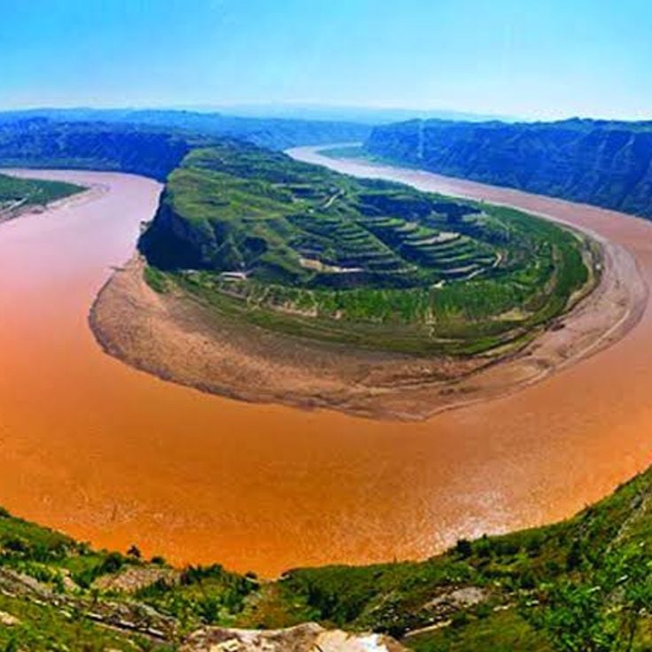
The Yellow River is part of the world's major river networks and stretches 5,464 kilometers across northern China from west to east. This waterway shapes landscapes, supports agriculture, and enables transportation throughout the region. Its drainage basin covers an extensive area, making it one of the most important waterways in Asia.
The Ob is one of the world's largest rivers, flowing 3,650 kilometers through the tundra and forests of Siberia. This river shapes the northern Russian landscape and empties into the Kara Sea. The Ob connects different regions and plays an important role for the people who depend on its waters.
Central Africa, Democratic Republic of the Congo; Republic of the Congo; Angola; Zambia; Tanzania; Burundi
The Congo is the second longest river in Africa, flowing through six countries. This river belongs to the major waterways of our planet that cross continents and countries, creating essential river networks. The Congo shapes the landscapes along its course and enables the transport of people and goods. The river forms a broad mouth before emptying into the Atlantic Ocean, placing it among the most important rivers on Earth.
The Amur is one of the world's largest rivers and a key example within this collection of the planet's major waterways. Stretching 4,444 kilometers, this river forms a natural boundary between Russia and China while flowing through eastern Siberia. The Amur's basin covers 2,052,000 square kilometers and supports diverse ecosystems that sustain both wildlife and human communities across the region.
The Lena is one of the world's major rivers and part of the essential waterways that cross continents and countries. Stretching about 4,400 kilometers, this river originates in the mountains near Lake Baikal and flows through eastern Siberia toward the Laptev Sea. The Lena shapes the landscape, supports agriculture, and enables transportation in this remote region.
The Volga is Europe's longest river and stretches 3,690 kilometers entirely within Russia. It irrigates eleven major cities and forms a delta in the Caspian Sea. As part of the world's major river networks, the Volga plays an essential role in shaping the Russian landscape and supporting agriculture and transportation across the region.
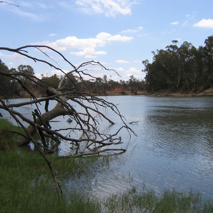
The Murray is Australia's longest river and flows through the states of Victoria, New South Wales, and South Australia before draining into the Indian Ocean. It shapes the landscape and supports agriculture and transportation as part of this collection of the world's largest rivers.
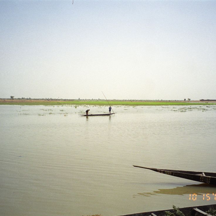
The Niger is the third longest river in Africa and flows through countries of West Africa. It originates in Guinea and travels 4,184 kilometers (2,600 miles) across the Sahel to the Niger Delta. This river is part of the world's major waterway networks that shape landscapes and connect communities. The Niger supports transportation and agriculture for millions of people living along its banks.
The Mackenzie is a major Canadian river that flows for 4,241 kilometers and ranks among the world's largest waterways. It originates from the Great Slave Lake and travels north through the Northwest Territories to the Arctic Ocean. This river shapes the northern landscape and serves as an important transportation route for the region.
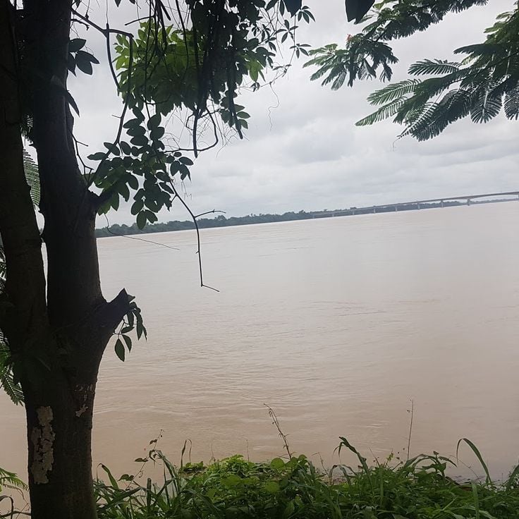
The Mekong is a 4,350-kilometer river that originates in Tibet and flows through six countries in Southeast Asia before emptying into the South China Sea. As one of the world's major rivers, the Mekong shapes the landscapes and supports agriculture and transportation across the region.
The Amazon is the largest river in the world by water discharge. It stretches 6,992 kilometers across Peru, Colombia, and Brazil. The river shapes the landscape with countless meandering curves and bends. It is part of the global network of major rivers that cross continents and connect countries. The Amazon supports agriculture, enables transportation, and sustains one of the world's most important ecosystems.
The Nile is the longest river in Africa and crosses ten countries over 6,852 kilometers, from Lake Victoria to the Mediterranean Sea. This river shapes the landscape and supports agriculture and trade in one of the world's driest regions. The Nile creates the famous delta and connects different cultures and regions together.
The Yangtze River is the world's third longest river, stretching 6,300 kilometers across China. It flows from the high plateaus of Tibet to the eastern regions, shaping the landscapes of numerous provinces. This river is essential to the collection of the world's largest rivers, as it supplies water to millions of people, supports agriculture, and carries thousands of boats annually. The Yangtze connects inland areas with coastal regions, enabling trade and transportation throughout its entire course.
The Mississippi is a major river that flows over 6,210 kilometers from Minnesota to the Gulf of Mexico. In this collection of the world's largest rivers, the Mississippi ranks among the most significant waterways that shape continents. The river receives water from numerous tributaries, most notably the Missouri River. The Mississippi supports commerce and transportation across the central United States, sustains agriculture in the surrounding regions, and shapes the daily life of communities along its banks. Its large delta creates distinctive landscapes as it reaches the ocean.
The Yenisei belongs to the world's major river systems explored in this collection. It originates in the Sayan Mountains and flows northward through Siberia until it reaches the Arctic Ocean. This river shapes the landscape it crosses and supports life along its course. Like other great rivers of the planet, the Yenisei influences transportation routes and the natural environments that depend on its waters.
The Yellow River is part of the world's major river networks and stretches 5,464 kilometers across northern China from west to east. This waterway shapes landscapes, supports agriculture, and enables transportation throughout the region. Its drainage basin covers an extensive area, making it one of the most important waterways in Asia.
The Ob is one of the world's largest rivers, flowing 3,650 kilometers through the tundra and forests of Siberia. This river shapes the northern Russian landscape and empties into the Kara Sea. The Ob connects different regions and plays an important role for the people who depend on its waters.
Central Africa, Democratic Republic of the Congo; Republic of the Congo; Angola; Zambia; Tanzania; Burundi
The Congo is the second longest river in Africa, flowing through six countries. This river belongs to the major waterways of our planet that cross continents and countries, creating essential river networks. The Congo shapes the landscapes along its course and enables the transport of people and goods. The river forms a broad mouth before emptying into the Atlantic Ocean, placing it among the most important rivers on Earth.
The Amur is one of the world's largest rivers and a key example within this collection of the planet's major waterways. Stretching 4,444 kilometers, this river forms a natural boundary between Russia and China while flowing through eastern Siberia. The Amur's basin covers 2,052,000 square kilometers and supports diverse ecosystems that sustain both wildlife and human communities across the region.
The Lena is one of the world's major rivers and part of the essential waterways that cross continents and countries. Stretching about 4,400 kilometers, this river originates in the mountains near Lake Baikal and flows through eastern Siberia toward the Laptev Sea. The Lena shapes the landscape, supports agriculture, and enables transportation in this remote region.
The Volga is Europe's longest river and stretches 3,690 kilometers entirely within Russia. It irrigates eleven major cities and forms a delta in the Caspian Sea. As part of the world's major river networks, the Volga plays an essential role in shaping the Russian landscape and supporting agriculture and transportation across the region.
The Murray is Australia's longest river and flows through the states of Victoria, New South Wales, and South Australia before draining into the Indian Ocean. It shapes the landscape and supports agriculture and transportation as part of this collection of the world's largest rivers.
The Niger is the third longest river in Africa and flows through countries of West Africa. It originates in Guinea and travels 4,184 kilometers (2,600 miles) across the Sahel to the Niger Delta. This river is part of the world's major waterway networks that shape landscapes and connect communities. The Niger supports transportation and agriculture for millions of people living along its banks.
The Mackenzie is a major Canadian river that flows for 4,241 kilometers and ranks among the world's largest waterways. It originates from the Great Slave Lake and travels north through the Northwest Territories to the Arctic Ocean. This river shapes the northern landscape and serves as an important transportation route for the region.
The Mekong is a 4,350-kilometer river that originates in Tibet and flows through six countries in Southeast Asia before emptying into the South China Sea. As one of the world's major rivers, the Mekong shapes the landscapes and supports agriculture and transportation across the region.