
Sörmland Trail, Hiking trail network in Södermanland, Sweden
The Sörmland Trail extends over 1000 kilometers through forests, lakes, and rocky terrain across multiple municipalities south of Stockholm.
Established in 1973 as Sweden's first lowland trail, the Sörmland Trail developed into an extensive network connecting numerous communities in the region.
The trail passes by Nynäs Castle and Tullgarn Castle, offering connections to Swedish architectural heritage and regional farming landscapes.
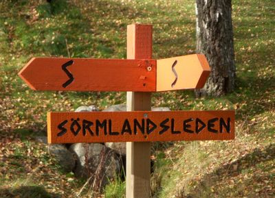
Orange markings on trees and posts guide hikers through 62 main sections and 36 connecting trails, with shelters and water sources positioned along the route.
The trail features Vensbrinksberget, the highest peak in Södermanland, and traverses through Tyresta National Park's ancient forest sections.
Location: Södermanland
Location: Nacka Municipality
Location: Tyresö Municipality
Location: Haninge Municipality
Location: Huddinge Municipality
Location: Nynäshamn Municipality
Location: Botkyrka Municipality
Location: Södertälje Municipality
Location: Gnesta Municipality
Location: Strängnäs Municipality
Location: Flen Municipality
Location: Eskilstuna Municipality
Location: Katrineholm Municipality
Location: Nyköping Municipality
Location: Norrköping Municipality
Location: Oxelösund Municipality
Location: Trosa Municipality
Inception: 1973
Website: https://sormlandsleden.se
GPS coordinates: 59.29188,18.11687
Latest update: May 11, 2025 10:43
Hammarbytornet
1.4 km
Lilla Sickla
870 m
Understenshöjden
540 m
Stockholm County Museum
1.5 km
Fredells
1.2 km
Stora Sickla
1.1 km
Nytorps gärde
501 m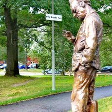
Willy Brandts Park
645 m
Mistral (restaurang)
1.4 km
Sickla strand
1.3 km
Filmstaden Sickla
1.5 km
Torpet Kärrtorp
1 km
Hammarby Depot
1.4 km
Reflexen
879 m
De gamlas vänner
1.3 km
Nobelberget
1.5 km
Sjöstadskapellet
1.4 km
Modellvillan 21, Gamla Tyresövägen 310
1.4 km
Sickla kanalbro
1.2 km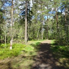
Gränsberget, Kärrtorp
1.3 km
Pumpstation Hammarbybacken
1 km
Fält
1.5 km
Nytorp
628 m
Allébron
1.5 km
Nacka nature reserve, Stockholm
803 m
Kärrtorpsparken
994 m
Finn Malmgrens väg 27-29
824 m
Sickla strandbad
1.2 kmReviews
Visited this place? Tap the stars to rate it and share your experience / photos with the community! Try now! You can cancel it anytime.
Discover hidden gems everywhere you go!
From secret cafés to breathtaking viewpoints, skip the crowded tourist spots and find places that match your style. Our app makes it easy with voice search, smart filtering, route optimization, and insider tips from travelers worldwide. Download now for the complete mobile experience.

A unique approach to discovering new places❞
— Le Figaro
All the places worth exploring❞
— France Info
A tailor-made excursion in just a few clicks❞
— 20 Minutes