Douglas County

Log in to your account

AroundUs is a community-driven map of interesting places, built by curious explorers like you. It grows with every review, story, and photo you share.
Connect to save your favorite spots, contribute locations, and create personalized routes.
Continue with Google
Continue with Apple
Continue with X
Continue with Facebook
Continue with email
By continuing, you accept our Terms and Conditions and our Privacy Policy
Create an account
Add to collection
Map
Suggest a change
Share

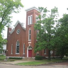
Douglas County, Administrative county seat in east-central Illinois, United States.

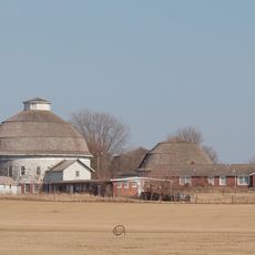
Douglas County is an administrative division in east-central Illinois encompassing roughly 417 square miles. The landscape consists of farmland, small communities, and highways that link the various towns together.

The county was created in 1859 and named after Stephen Douglas, a prominent United States Senator of that era. This naming reflects its connection to significant national events of the 1800s.

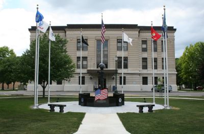
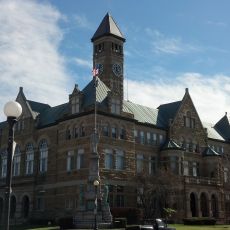
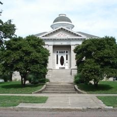
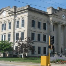
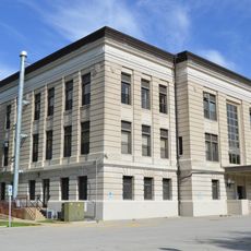
The courthouse in Tuscola serves as the center where the community gathers for legal matters and official proceedings. Its role shapes how people understand local governance and justice in their daily lives.

County offices are open on weekdays and provide services related to civil matters and official administration. Visitors can contact the Circuit Clerk's office for information regarding court-related documents and procedures.

The area experiences dramatic swings in temperature across seasons, from intensely cold winters to very hot summers. These extremes shape farming practices and how residents plan their year-round activities.

Location: Illinois

Inception: 1859

Capital city: Tuscola

Shares border with: Champaign County, Coles County, Moultrie County, Vermilion County, Edgar County, Piatt County

Website: http://douglascountyil.com

GPS coordinates: 39.77000,-88.22000

Latest update: December 7, 2025 20:44

Photos
Around this place
State Farm Center
United States of America

State Farm Center

36.3 km
University of Illinois round barns
United States of America

University of Illinois round barns

36.1 km
University of Illinois Arboretum
United States of America

University of Illinois Arboretum

36.1 km
Airtight Bridge
United States of America

Airtight Bridge

26.4 km
Voorhies Castle
United States of America

Voorhies Castle

32.6 km
Pemberton Hall
United States of America

Pemberton Hall

32.1 km
University of Illinois Experimental Dairy Farm Historic District
United States of America

University of Illinois Experimental Dairy Farm Historic District

36.1 km
Old Main
United States of America

Old Main

32 km
Bryant Cottage State Historic Site
United States of America

Bryant Cottage State Historic Site

34.6 km
Health Education Building
United States of America

Health Education Building

32.3 km
Stone Quarry Bridge
United States of America

Stone Quarry Bridge

29.3 km
Coles County Courthouse
United States of America

Coles County Courthouse

30.9 km
National Museum of Ship Models and Sea History
United States of America

National Museum of Ship Models and Sea History

24.4 km
Alexander Briggs House
United States of America

Alexander Briggs House

30.9 km
Arcola Carnegie Public Library
United States of America

Arcola Carnegie Public Library

11.7 km
Dr. Hiram Rutherford House and Office
United States of America

Dr. Hiram Rutherford House and Office

20.9 km
Unity Church
United States of America

Unity Church

34.8 km
Harrison Street Bridge
United States of America

Harrison Street Bridge

32.6 km
United States Post Office (Mattoon, Illinois)
United States of America

United States Post Office (Mattoon, Illinois)

34.8 km
Richland County Courthouse
United States of America

Richland County Courthouse

12.3 km
Douglas County Courthouse
United States of America

Douglas County Courthouse

6.3 km
Will Rogers Theatre
United States of America

Will Rogers Theatre

30.8 km
McFarland House
United States of America

McFarland House

31.4 km
Burgess-Osborne Memorial Auditorium
United States of America

Burgess-Osborne Memorial Auditorium

34.9 km
Blakeman Bridge
United States of America

Blakeman Bridge

35.4 km
Richard Roytek House
United States of America

Richard Roytek House

35.2 km
Sixth, Seventh, and Tenth Street Stone Arch Bridges
United States of America

Sixth, Seventh, and Tenth Street Stone Arch Bridges

31.1 km
Lumpkin Heights and Elm Ridge Subdivision Historic District
United States of America

Lumpkin Heights and Elm Ridge Subdivision Historic District

34.3 km
Show the full map
Reviews

Visited this place? Tap the stars to rate it and share your experience / photos with the community! Try now! You can cancel it anytime.

« Douglas County - Administrative county seat in east-central Illinois, United States » is provided by Around Us (aroundus.com). Images and texts are derived from Wikimedia project under a Creative Commons license. You are allowed to copy, distribute, and modify copies of this page, under the conditions set by the license, as long as this note is clearly visible.

Discover hidden gems everywhere you go!

From secret cafés to breathtaking viewpoints, skip the crowded tourist spots and find places that match your style. Our app makes it easy with voice search, smart filtering, route optimization, and insider tips from travelers worldwide. Download now for the complete mobile experience.

Around Us App Screenshot

A unique approach to discovering new places

Le Figaro

All the places worth exploring

France Info

A tailor-made excursion in just a few clicks

20 Minutes