Enable Location

We need your location to show you interesting places around you

Discover nearby places

Find interesting locations and hidden gems around you

Precise directions

Get accurate directions and distances to places

Your location is never shared with other users. It's only used when you tap the location button.

Cumberland County

Log in to your account

Start exploring — it's free

Trusted by 62,170 travelers worldwide

Continue with Google
Continue with Apple
or

We will send you a code to connect

By continuing, you accept our Terms and Conditions and our Privacy Policy

Check your inbox

We've sent a pincode in your inbox. Please enter the code below.

Cumberland County, Administrative county in Illinois, United States.

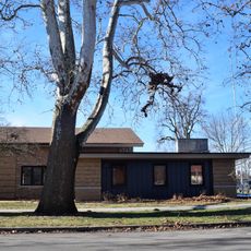
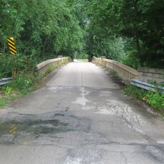
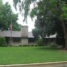
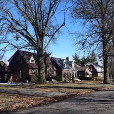
Cumberland County is an administrative division in central Illinois with farmlands, residential communities, and eight distinct townships, with Toledo serving as its capital. The land extends across rolling terrain and agricultural fields that shape daily life for residents.

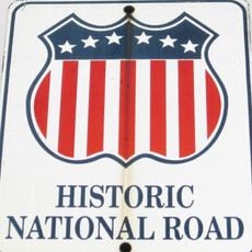
The county was founded in 1843 and named after the National Road, which planners intended to route through the area. This early connection to regional infrastructure shaped how settlements developed.

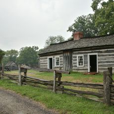
German heritage shows itself in the names of towns and local traditions across the region. You notice these influences in the small communities and in how people have built their lives here.

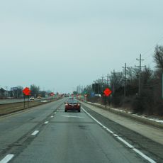
Interstate highways 57 and 70 cross through the county, connecting it directly to larger cities in the region. Visitors can use these main routes to reach destinations farther north, east, or south.

The area is served by two separate school districts that manage different parts of the county. This division reflects how rural administration operates in Illinois with localized systems.

The community of curious travelers

AroundUs brings together thousands of curated places, local tips, and hidden gems, enriched daily by 60,000 contributors worldwide.

Start exploring
Location
Inception
1843
Capital city
Toledo
Shares border with
Shelby County, Effingham County, Jasper County, Coles County, Clark County
GPS coordinates
39.27000,-88.24000
Latest update
December 8, 2025 13:43
Around this place
National Road
United States of America

National Road

20.3 km
Interstate 57
United States of America

Interstate 57

18.9 km
Lincoln Log Cabin State Historic Site
United States of America

Lincoln Log Cabin State Historic Site

12.7 km
Pemberton Hall
United States of America

Pemberton Hall

24.4 km
Old Main
United States of America

Old Main

24.5 km
Cumberland County Courthouse
United States of America

Cumberland County Courthouse

344 m
Health Education Building
United States of America

Health Education Building

24.2 km
Stone Quarry Bridge
United States of America

Stone Quarry Bridge

30.1 km
Coles County Courthouse
United States of America

Coles County Courthouse

25.6 km
Alexander Briggs House
United States of America

Alexander Briggs House

25.5 km
Unity Church
United States of America

Unity Church

26.7 km
Harrison Street Bridge
United States of America

Harrison Street Bridge

26.7 km
United States Post Office (Mattoon, Illinois)
United States of America

United States Post Office (Mattoon, Illinois)

26.3 km
Thornton Ward Estate
United States of America

Thornton Ward Estate

5.2 km
Will Rogers Theatre
United States of America

Will Rogers Theatre

25.7 km
McFarland House
United States of America

McFarland House

25.2 km
Greenup Commercial Historic District
United States of America

Greenup Commercial Historic District

7.2 km
Burgess-Osborne Memorial Auditorium
United States of America

Burgess-Osborne Memorial Auditorium

26.2 km
Blakeman Bridge
United States of America

Blakeman Bridge

22.3 km
Richard Roytek House
United States of America

Richard Roytek House

27.7 km
Sixth, Seventh, and Tenth Street Stone Arch Bridges
United States of America

Sixth, Seventh, and Tenth Street Stone Arch Bridges

25.4 km
Lumpkin Heights and Elm Ridge Subdivision Historic District
United States of America

Lumpkin Heights and Elm Ridge Subdivision Historic District

25.5 km
World's Largest Pitchfork
United States of America

World's Largest Pitchfork

23.1 km
Two-Story Outhouse
United States of America

Two-Story Outhouse

30.4 km
Heart Theater
United States of America

Heart Theater

30.8 km
St Francis Catholic Church
United States of America

St Francis Catholic Church

25.1 km
Gays Water Tower
United States of America

Gays Water Tower

30.4 km
Civilian Conservation Corps Camp Shiloh Encampment Site
United States of America

Civilian Conservation Corps Camp Shiloh Encampment Site

12.6 km
Show the full map
« Cumberland County - Administrative county in Illinois, United States » is provided by Around Us (aroundus.com). Images and texts are derived from Wikimedia project under a Creative Commons license. You are allowed to copy, distribute, and modify copies of this page, under the conditions set by the license, as long as this note is clearly visible.

Discover hidden gems everywhere you go!

From secret cafés to breathtaking viewpoints, skip the crowded tourist spots and find places that match your style. Our app makes it easy with voice search, smart filtering, route optimization, and insider tips from travelers worldwide. Download now for the complete mobile experience.

Around Us App Screenshot

A unique approach to discovering new places

Le Figaro

All the places worth exploring

France Info

A tailor-made excursion in just a few clicks

20 Minutes

Around Us
Travel Guide & Maps
Download

Send to your phone

QR Code
1

Open the camera app on your mobile.

2

Point at the QR code with your camera. A notification will appear.

3

Tap the notification to open the link.