Wabash River, Major river system in Ohio and Indiana, United States.
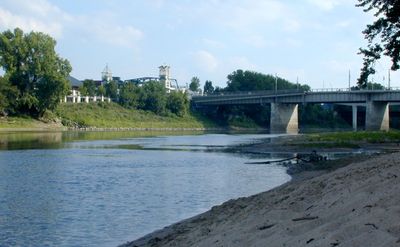
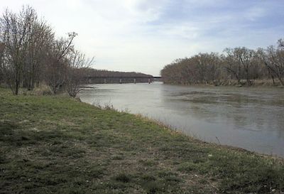
The Wabash River is a waterway that winds through Ohio, Illinois, and Indiana, tracing tight curves across flat farmland. The water flows over a rocky bed lined with wooded banks and sandy shallows in many places.
French fur traders used the river from the late 17th century as a link between the Great Lakes and the Mississippi, setting up trading posts along its many bends. Later, the water marked the boundary between settlement areas and became an important route for flatboats and steamships.
The river takes its name from the Miami word for the white limestone that lies beneath the clear water and shows through when the level drops. These stones still shape the riverbed today and give the water a pale, almost silver color in many stretches.
The water flows mostly calm and works well for canoeing, though the current can pick up noticeably after heavy rain. The banks are accessible in many places through public boat ramps and parks scattered along the entire course.
The river forms the natural border between Indiana and Illinois for roughly 200 miles before it joins the Ohio River. This long boundary line makes it one of the few waterways in the United States that separates two states for such a distance.
The community of curious travelers
AroundUs brings together thousands of curated places, local tips, and hidden gems, enriched daily by 60,000 contributors worldwide.