Nemaha County

Log in to your account

AroundUs is a community-driven map of interesting places, built by curious explorers like you. It grows with every review, story, and photo you share.
Connect to save your favorite spots, contribute locations, and create personalized routes.
Continue with Google
Continue with Apple
Continue with X
Continue with Facebook
Continue with email
By continuing, you accept our Terms and Conditions and our Privacy Policy
Create an account
Add to collection
Map
Suggest a change
Share

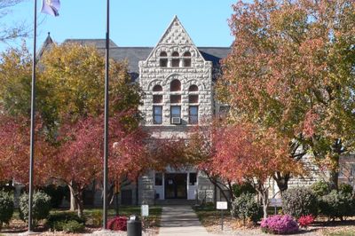
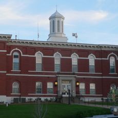
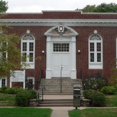
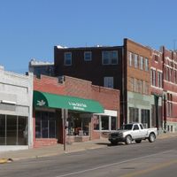
Nemaha County, County administration center in Auburn, Nebraska.

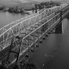
Nemaha County is an administrative division in southeastern Nebraska with its government center in Auburn. The county sits along the Missouri River on its eastern edge and covers rural land with scattered settlements.

The area was established in 1855 by the Nebraska Territorial Legislature, with Auburn chosen as the administrative seat. Since then, it has developed as a farming region shaped by agricultural settlement patterns.

The county keeps its farming roots alive through local fairs and seasonal events that bring people together. You can see this heritage in how the community still celebrates agricultural traditions and gathers for celebrations.

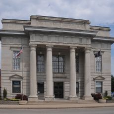
The courthouse in Auburn handles most county services and administrative matters from its downtown location. Visit during regular business hours to take care of paperwork and official transactions.

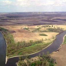
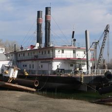
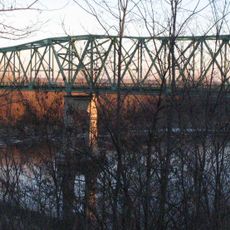
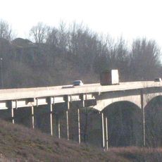
The county borders the Missouri River, creating a unique geographical relationship with the waterway that shapes how the land is measured and surveyed. This boundary position makes it notable among interior regions for its river connections.

Location: Nebraska

Inception: 1855

Capital city: Auburn

Shares border with: Otoe County, Richardson County, Johnson County, Pawnee County, Atchison County, Holt County

Website: http://nemahacounty.ne.gov

GPS coordinates: 40.39000,-95.85000

Latest update: December 10, 2025 15:59

Photos
Around this place
Indian Cave State Park
United States of America

Indian Cave State Park

29.4 km
Arbor Lodge State Historical Park and Arboretum
United States of America

Arbor Lodge State Historical Park and Arboretum

32.5 km
Mayhew Cabin
United States of America

Mayhew Cabin

31.6 km
Waubonsie State Park
United States of America

Waubonsie State Park

34.3 km
McKissick Island
United States of America

McKissick Island

22.7 km
Captain Meriwether Lewis
United States of America

Captain Meriwether Lewis

16.9 km
Brownville Bridge
United States of America

Brownville Bridge

16.8 km
Otoe County Courthouse
United States of America

Otoe County Courthouse

31.9 km
Atchison County Memorial Building
United States of America

Atchison County Memorial Building

28.6 km
Grand Army of the Republic Memorial Hall
United States of America

Grand Army of the Republic Memorial Hall

31.8 km
St. John's Lutheran Church Complex
United States of America

St. John's Lutheran Church Complex

11 km
Morton-James Public Library
United States of America

Morton-James Public Library

31.8 km
Harmony School, School District No. 53
United States of America

Harmony School, School District No. 53

18.2 km
John Holman House
United States of America

John Holman House

25.8 km
Boscobel
United States of America

Boscobel

32.7 km
George F. Lee Octagon Houses
United States of America

George F. Lee Octagon Houses

20.6 km
St. Benedict's Catholic Church
United States of America

St. Benedict's Catholic Church

31.1 km
First United Presbyterian Church
United States of America

First United Presbyterian Church

734 m
John W. Bennett House
United States of America

John W. Bennett House

14.9 km
Hamburg Public Library
United States of America

Hamburg Public Library

29.1 km
John Dickinson Dopf Mansion
United States of America

John Dickinson Dopf Mansion

28.2 km
Wilber T. Reed House
United States of America

Wilber T. Reed House

557 m
Nemaha County Courthouse
United States of America

Nemaha County Courthouse

683 m
Jasper A. Ware House
United States of America

Jasper A. Ware House

31.5 km
River Inn Resort
United States of America

River Inn Resort

17.1 km
Nebraska City Bridge
United States of America

Nebraska City Bridge

31.3 km
Arbor Day Farm
United States of America

Arbor Day Farm

32.4 km
Nebraska City Bridge
United States of America

Nebraska City Bridge

31.3 km
Show the full map
Reviews

Visited this place? Tap the stars to rate it and share your experience / photos with the community! Try now! You can cancel it anytime.

Administrative divisions
« Nemaha County - County administration center in Auburn, Nebraska » is provided by Around Us (aroundus.com). Images and texts are derived from Wikimedia project under a Creative Commons license. You are allowed to copy, distribute, and modify copies of this page, under the conditions set by the license, as long as this note is clearly visible.

Discover hidden gems everywhere you go!

From secret cafés to breathtaking viewpoints, skip the crowded tourist spots and find places that match your style. Our app makes it easy with voice search, smart filtering, route optimization, and insider tips from travelers worldwide. Download now for the complete mobile experience.

Around Us App Screenshot

A unique approach to discovering new places

Le Figaro

All the places worth exploring

France Info

A tailor-made excursion in just a few clicks

20 Minutes