Crawford County

Log in to your account

AroundUs is a community-driven map of interesting places, built by curious explorers like you. It grows with every review, story, and photo you share.
Connect to save your favorite spots, contribute locations, and create personalized routes.
By continuing, you accept our Terms and Conditions and our Privacy Policy
Add to collection
Map
Suggest a change
Share

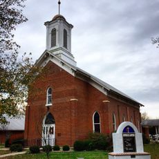
Crawford County, Administrative division in south-central Missouri, United States

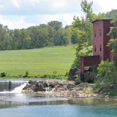
Crawford County is an administrative division in south-central Missouri that spans a substantial area shaped by waterways. The Meramec River and Huzzah River flow through the region, creating the geographical backbone of the county.

This county was established in 1829 and named after William H. Crawford, who held the position of Secretary of War under President James Madison. Its creation reflected the period of regional expansion and administrative reorganization across Missouri.

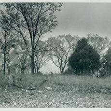
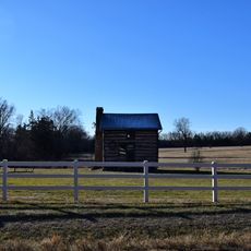
The county maintains records of Native American settlements that preceded European colonization, marking the transition of different populations in this Missouri region.

Local government offices in Steelville are available on weekdays between early morning and late afternoon, providing services to residents. Visitors should check ahead to ensure the specific office they need is open.

The county is crossed by Interstate 44 and several state highways that link together small towns such as Bourbon, Cuba, and Steelville. These road connections define how the scattered communities relate to one another geographically.

Location: Missouri

Inception: January 23, 1829

Capital city: Steelville

Shares border with: Gasconade County, Dent County, Washington County, Iron County, Franklin County, Phelps County

Website: http://crawfordcountymo.net

GPS coordinates: 37.98000,-91.30000

Latest update: December 7, 2025 20:24

Photos
Around this place
Show the full map
Meramec Caverns
United States of America

Meramec Caverns

34.3 km
Onondaga Cave State Park
United States of America

Onondaga Cave State Park

10.7 km
Maramec Spring
United States of America

Maramec Spring

20.6 km
Bell Mountain Wilderness
United States of America

Bell Mountain Wilderness

53.8 km
Meramec State Park
United States of America

Meramec State Park

30.6 km
Dillard Mill State Historic Site
United States of America

Dillard Mill State Historic Site

30.3 km
International Shoe Company Building
United States of America

International Shoe Company Building

49.7 km
Allgood–Bailey Stadium
United States of America

Allgood–Bailey Stadium

42.3 km
Fort Wyman
United States of America

Fort Wyman

42 km
Meramec Conservation Area
United States of America

Meramec Conservation Area

34.4 km
Bootleg Access
United States of America

Bootleg Access

50.4 km
George B. Hamilton House
United States of America

George B. Hamilton House

12.8 km
Rolla Ranger Station Historic District
United States of America

Rolla Ranger Station Historic District

43.2 km
Dent County Courthouse
United States of America

Dent County Courthouse

42.6 km
Phelps County Courthouse
United States of America

Phelps County Courthouse

41.7 km
Hotel Cuba
United States of America

Hotel Cuba

13.7 km
Cuba City Jail
United States of America

Cuba City Jail

12.9 km
Washington County Courthouse
United States of America

Washington County Courthouse

45.2 km
Panhorst Feed Store
United States of America

Panhorst Feed Store

49.4 km
Cuba High School Annex
United States of America

Cuba High School Annex

13.3 km
St. James Chapel
United States of America

St. James Chapel

27.6 km
John Manson Munro House
United States of America

John Manson Munro House

13 km
Caledonia Historic District
United States of America

Caledonia Historic District

52.3 km
Uptown Cuba Historic District
United States of America

Uptown Cuba Historic District

13 km
Harrison Queen House
United States of America

Harrison Queen House

49.4 km
Cuba Lodge No. 312 A.F. and A.M.
United States of America

Cuba Lodge No. 312 A.F. and A.M.

13.2 km
Jesse James Wax Museum
United States of America

Jesse James Wax Museum

36.7 km
Maramec Iron Works
United States of America

Maramec Iron Works

21.1 km
Show the full map
Reviews

Visited this place? Tap the stars to rate it and share your experience / photos with the community! Try now! You can cancel it anytime.

« Crawford County - Administrative division in south-central Missouri, United States » is provided by Around Us (aroundus.com). Images and texts are derived from Wikimedia project under a Creative Commons license. You are allowed to copy, distribute, and modify copies of this page, under the conditions set by the license, as long as this note is clearly visible.

Discover hidden gems everywhere you go!

From secret cafés to breathtaking viewpoints, skip the crowded tourist spots and find places that match your style. Our app makes it easy with voice search, smart filtering, route optimization, and insider tips from travelers worldwide. Download now for the complete mobile experience.

Around Us App Screenshot

A unique approach to discovering new places

Le Figaro

All the places worth exploring

France Info

A tailor-made excursion in just a few clicks

20 Minutes