Chest opened
+${chestReward.xp} XP
Explorer
NOUVEAU ×${chestReward.collectible.quantity}
tapez pour fermer
Chest locked

Open chests in the app

Around Us is built for your phone — chests unlock when you walk, explore and capture nearby places.

Enable Location

We need your location to show you interesting places around you

Discover nearby places

Find interesting locations and hidden gems around you

Precise directions

Get accurate directions and distances to places

Your location is never shared with other users. It's only used when you tap the location button.

Mason–Dixon Line

Log in to your account

Start exploring — it's free

Trusted by 72,982 travelers worldwide

Continue with Google
Continue with Apple
or

We will send you a code to connect

By continuing, you accept our Terms and Conditions and our Privacy Policy

Check your inbox

We've sent a pincode in your inbox. Please enter the code below.

Discussion Reviews 1 Photos
801k Popularity

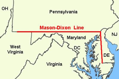
Mason–Dixon Line, Political border between Pennsylvania, Maryland, Delaware, and West Virginia, United States.

The Mason-Dixon Line is a political border between Pennsylvania, Maryland, Delaware, and West Virginia in the United States, stretching for 244 miles (393 kilometers). Limestone markers were placed every mile along its length, while decorated stones indicating territorial boundaries appear every five miles.

English surveyors Charles Mason and Jeremiah Dixon mapped this boundary between 1763 and 1767 to resolve territorial disputes among British colonies. During the Missouri Compromise of 1820, the line came to mark the separation between Northern free states and Southern slave states.

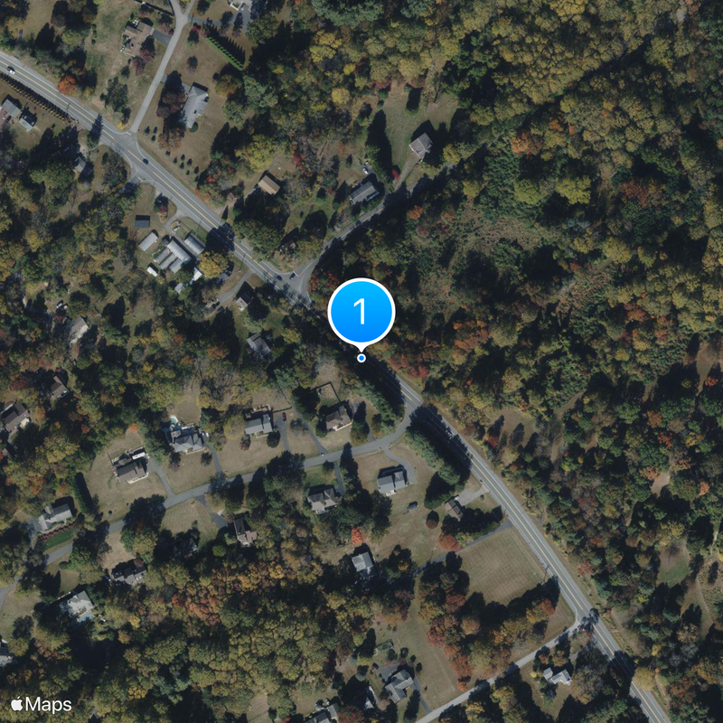
Local communities organize guided walks and historical tours that follow sections of the line through farmland and forest, allowing visitors to see the old boundary markers up close. People often stop to photograph the stones and reflect on how this invisible division once separated very different ways of life.

Modern preservation efforts use GPS technology to locate and document the remaining boundary stones along the entire surveyed route. Some markers are difficult to reach in wooded areas or on private property, though many are visible along roads or on public land.

The survey stones carry a P for Pennsylvania and an M for Maryland carved into opposite faces, making each one readable from both sides of the border. Special crown stones placed at key points display the Penn and Calvert family coats of arms, reminding visitors of the colonial families who once owned these territories.

The community of curious travelers

AroundUs brings together thousands of curated places, local tips, and hidden gems, enriched daily by 60,000 contributors worldwide.

Start exploring
Location
Creator
Charles Mason, Jeremiah Dixon
GPS coordinates
39.71667,-75.78333
Latest update
December 15, 2025 02:47
Around this place
United States Supreme Court Building
United States of America

United States Supreme Court Building

139.7 km
White House
United States of America

White House

141.3 km
The Pentagon
United States of America

The Pentagon

144.5 km
United States Capitol
United States of America

United States Capitol

140.1 km
Camp David
United States of America

Camp David

144.1 km
Washington Monument
United States of America

Washington Monument

141.8 km
Enola Gay
United States of America

Enola Gay

168.8 km
Arlington National Cemetery
United States of America

Arlington National Cemetery

145 km
Northwest Stadium
United States of America

Northwest Stadium

129.5 km
Library of Congress
United States of America

Library of Congress

139.9 km
Number One Observatory Circle
United States of America

Number One Observatory Circle

141.4 km
Tomb of the Unknown Soldier
United States of America

Tomb of the Unknown Soldier

145.2 km
Lincoln Memorial
United States of America

Lincoln Memorial

142.8 km
Resolute desk
United States of America

Resolute desk

141.4 km
Oval Office
United States of America

Oval Office

141.4 km
Mount Vernon
United States of America

Mount Vernon

158.9 km
Vietnam Veterans Memorial
United States of America

Vietnam Veterans Memorial

142.5 km
Washington National Cathedral
United States of America

Washington National Cathedral

141.2 km
National Mall
United States of America

National Mall

141 km
Chesapeake Bay Bridge
United States of America

Chesapeake Bay Bridge

95.3 km
National Archives and Records Administration
United States of America

National Archives and Records Administration

140.8 km
Kryptos
United States of America

Kryptos

144.9 km
National Air and Space Museum
United States of America

National Air and Space Museum

140.9 km
National Gallery of Art
United States of America

National Gallery of Art

140.7 km
Sidwell Friends School
United States of America

Sidwell Friends School

140.9 km
Watergate complex
United States of America

Watergate complex

142.4 km
Capitol Hill
United States of America

Capitol Hill

139.6 km
International Bank for Reconstruction and Development
United States of America

International Bank for Reconstruction and Development

141.6 km
Show the full map
Reviews
Share your experience

No review yet

Discussions
Start a discussion...

No discussion yet

« Mason–Dixon Line - Political border between Pennsylvania, Maryland, Delaware, and West Virginia, United States » is provided by Around Us (aroundus.com). Images and texts are derived from Wikimedia project under a Creative Commons license. You are allowed to copy, distribute, and modify copies of this page, under the conditions set by the license, as long as this note is clearly visible.

Discover hidden gems everywhere you go!

From secret cafés to breathtaking viewpoints, skip the crowded tourist spots and find places that match your style. Our app makes it easy with voice search, smart filtering, route optimization, and insider tips from travelers worldwide. Download now for the complete mobile experience.

Around Us App Screenshot

A unique approach to discovering new places

Le Figaro

All the places worth exploring

France Info

A tailor-made excursion in just a few clicks

20 Minutes

Around Us
Travel Guide & Maps
Download

Send to your phone

QR Code
1

Open the camera app on your mobile.

2

Point at the QR code with your camera. A notification will appear.

3

Tap the notification to open the link.