Chest opened
+${chestReward.xp} XP
Explorer
NOUVEAU ×${chestReward.collectible.quantity}
tapez pour fermer
Chest locked

Open chests in the app

Around Us is built for your phone — chests unlock when you walk, explore and capture nearby places.

Enable Location

We need your location to show you interesting places around you

Discover nearby places

Find interesting locations and hidden gems around you

Precise directions

Get accurate directions and distances to places

Your location is never shared with other users. It's only used when you tap the location button.

Stuarts Draft

Log in to your account

Start exploring — it's free

Trusted by 72,884 travelers worldwide

Continue with Google
Continue with Apple
or

We will send you a code to connect

By continuing, you accept our Terms and Conditions and our Privacy Policy

Check your inbox

We've sent a pincode in your inbox. Please enter the code below.

Discussion Reviews 1 Photos
16.1k Popularity

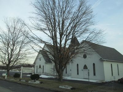
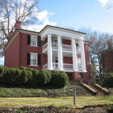
Stuarts Draft, Census-designated place in Augusta County, Virginia.

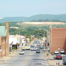
Stuarts Draft is a settlement in Augusta County, Virginia, positioned in a valley surrounded by rolling hills. The area includes residential neighborhoods, roadways, and several large industrial facilities.

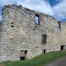
A settler named Thomas Stuart acquired land here in 1749 and started farming near the South River. From these agricultural roots, the place later developed into an industrial center.

The place reflects how farming gave way to food manufacturing over generations. Factories producing snacks and sweets for national brands became central to community identity.

The settlement connects easily to nearby towns and cities through several roads, including Howardsville Turnpike. This makes it simple to access shops, services, and other local attractions from the area.

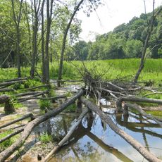
Hemp once grew in these fields to supply rope for naval ships and maritime needs. This historical link to the shipping industry has faded from memory but reflects how the economy shifted over time.

The community of curious travelers

AroundUs brings together thousands of curated places, local tips, and hidden gems, enriched daily by 60,000 contributors worldwide.

Start exploring
Location
Inception
1749
Elevation above the sea
433 m
GPS coordinates
38.03461,-79.03481
Latest update
December 7, 2025 19:28
Around this place
Western State Hospital
United States of America

Western State Hospital

12.7 km
Fishburne Military School
United States of America

Fishburne Military School

13.1 km
Woodrow Wilson Presidential Library
United States of America

Woodrow Wilson Presidential Library

13.2 km
Virginia School for the Deaf and the Blind
United States of America

Virginia School for the Deaf and the Blind

13.1 km
Shenandoah Acres
United States of America

Shenandoah Acres

4 km
Staunton National Cemetery
United States of America

Staunton National Cemetery

11.8 km
Tinkling Spring Presbyterian Church
United States of America

Tinkling Spring Presbyterian Church

7.2 km
Folly Mills Creek Fen Natural Area Preserve
United States of America

Folly Mills Creek Fen Natural Area Preserve

11.3 km
Trinity Episcopal Church
United States of America

Trinity Episcopal Church

13.2 km
Breezy Hill
United States of America

Breezy Hill

13.2 km
United States of America

Tree Streets Historic District

12.5 km
Valley Railroad Stone Bridge
United States of America

Valley Railroad Stone Bridge

7.2 km
Plumb House
United States of America

Plumb House

12.8 km
Augusta County Courthouse
United States of America

Augusta County Courthouse

13.1 km
Stuart House
United States of America

Stuart House

13 km
Bethel Green
United States of America

Bethel Green

12.4 km
Beverley Historic District
United States of America

Beverley Historic District

13.2 km
National Valley Bank
United States of America

National Valley Bank

13.2 km
Mt. Torry Furnace
United States of America

Mt. Torry Furnace

11.7 km
Arista Hoge House
United States of America

Arista Hoge House

13 km
Sears House
United States of America

Sears House

12.8 km
Harper House
United States of America

Harper House

1.5 km
Bare House and Mill
United States of America

Bare House and Mill

5.3 km
Waynesboro Downtown Historic District
United States of America

Waynesboro Downtown Historic District

13.2 km
Rose Cliff
United States of America

Rose Cliff

12 km
Chapel Hill
United States of America

Chapel Hill

4.9 km
Wharf Area Historic District
United States of America

Wharf Area Historic District

13 km
Thomas J. Michie House
United States of America

Thomas J. Michie House

13.1 km
Show the full map
Reviews
Share your experience

No review yet

Discussions
Start a discussion...

No discussion yet

« Stuarts Draft - Census-designated place in Augusta County, Virginia » is provided by Around Us (aroundus.com). Images and texts are derived from Wikimedia project under a Creative Commons license. You are allowed to copy, distribute, and modify copies of this page, under the conditions set by the license, as long as this note is clearly visible.

Discover hidden gems everywhere you go!

From secret cafés to breathtaking viewpoints, skip the crowded tourist spots and find places that match your style. Our app makes it easy with voice search, smart filtering, route optimization, and insider tips from travelers worldwide. Download now for the complete mobile experience.

Around Us App Screenshot

A unique approach to discovering new places

Le Figaro

All the places worth exploring

France Info

A tailor-made excursion in just a few clicks

20 Minutes

Around Us
Travel Guide & Maps
Download

Send to your phone

QR Code
1

Open the camera app on your mobile.

2

Point at the QR code with your camera. A notification will appear.

3

Tap the notification to open the link.