Chest opened
+${chestReward.xp} XP
Explorer
NOUVEAU ×${chestReward.collectible.quantity}
tapez pour fermer
Chest locked

Open chests in the app

Around Us is built for your phone — chests unlock when you walk, explore and capture nearby places.

Enable Location

We need your location to show you interesting places around you

Discover nearby places

Find interesting locations and hidden gems around you

Precise directions

Get accurate directions and distances to places

Your location is never shared with other users. It's only used when you tap the location button.

Chief Mountain

Log in to your account

Start exploring — it's free

Trusted by 72,891 travelers worldwide

Continue with Google
Continue with Apple
or

We will send you a code to connect

By continuing, you accept our Terms and Conditions and our Privacy Policy

Check your inbox

We've sent a pincode in your inbox. Please enter the code below.

Chief Mountain
Discussion Reviews 1 Photos
17.9k Popularity

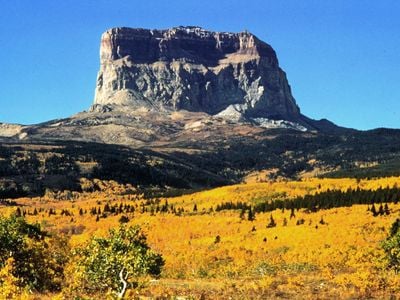
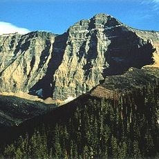
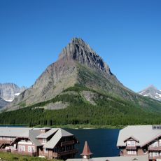
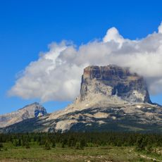
Chief Mountain, Sacred mountain in Glacier County, United States.

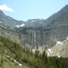
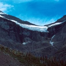
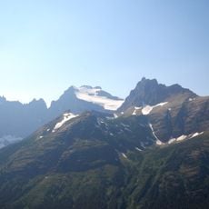
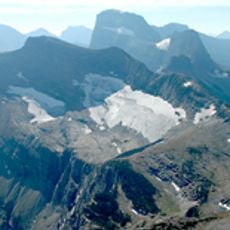
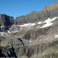
Chief Mountain is a distinctive geological formation standing at the eastern edge of Glacier National Park in Montana, rising sharply from the surrounding plains. The peak has steep rocky faces and a prominent cone shape that is recognizable from a distance.

The mountain has long held religious importance for the Blackfeet and served as a ceremonial site in their traditions. Western explorers began documenting the location in the late 1800s.

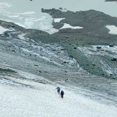
This peak holds sacred meaning for the Blackfeet people, who use it for ceremonies and spiritual practices that continue today. Visitors who climb here notice the deep connection between the community and the land.

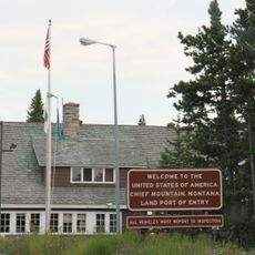
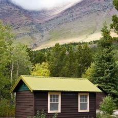
Entry to the mountain requires permission from the Blackfeet tribe, which you can obtain from local lodges or businesses near the park. The route is steep and demanding, so wear good shoes and bring plenty of water.

The rock formation contains some of the oldest material in the region, making it stand out geologically from the newer rock layers around it. This creates an interesting contrast that becomes visible as you climb higher.

The community of curious travelers

AroundUs brings together thousands of curated places, local tips, and hidden gems, enriched daily by 60,000 contributors worldwide.

Start exploring
Location
Elevation above the sea
2,768 m
GPS coordinates
48.93383,-113.61005
Latest update
December 7, 2025 19:23
Around this place
Many Glacier Hotel
United States of America

Many Glacier Hotel

15.7 km
Grinnell Glacier
United States of America

Grinnell Glacier

22 km
Granite Park Chalet
United States of America

Granite Park Chalet

21.7 km
United States of America

Lewis Overthrust

138 m
Mount Cleveland
United States of America

Mount Cleveland

17.4 km
Ptarmigan Tunnel
United States of America

Ptarmigan Tunnel

11.8 km
Great Northern Railway Buildings
United States of America

Great Northern Railway Buildings

21.7 km
The Salamander Glacier
United States of America

The Salamander Glacier

21.7 km
Chief Mountain Border Station and Quarters
United States of America

Chief Mountain Border Station and Quarters

7.9 km
Crypt Falls
Canada

Crypt Falls

18.7 km
Swiftcurrent Fire Lookout
United States of America

Swiftcurrent Fire Lookout

20.1 km
Chaney Glacier
United States of America

Chaney Glacier

18.5 km
Ahern Glacier
United States of America

Ahern Glacier

16.3 km
Old Sun Glacier
United States of America

Old Sun Glacier

14 km
Grinnell Point
United States of America

Grinnell Point

17.1 km
Swiftcurrent Glacier
United States of America

Swiftcurrent Glacier

21 km
Swiftcurrent Auto Camp Historic District
United States of America

Swiftcurrent Auto Camp Historic District

15.8 km
Shepard Glacier
United States of America

Shepard Glacier

19.7 km
Belly River Ranger Station Historic District
United States of America

Belly River Ranger Station Historic District

7.5 km
Many Glacier Campground Camptender's Cabin
United States of America

Many Glacier Campground Camptender's Cabin

16 km
Lee Creek Snowshoe Cabin
United States of America

Lee Creek Snowshoe Cabin

5.9 km
Many Glacier Barn and Bunkhouse
United States of America

Many Glacier Barn and Bunkhouse

14.9 km
Goathaunt Bunkhouse
United States of America

Goathaunt Bunkhouse

21.3 km
Sherburne Ranger Station Historic District
United States of America

Sherburne Ranger Station Historic District

12.6 km
Slide Lake-Otatso Creek Patrol Cabin and Woodshed
United States of America

Slide Lake-Otatso Creek Patrol Cabin and Woodshed

2.7 km
Morning Eagle
United States of America

Morning Eagle

16.9 km
Swiftcurrent Ranger Station Historic District
United States of America

Swiftcurrent Ranger Station Historic District

15.9 km
Chief Mountain
United States of America

Chief Mountain

132 m
Show the full map
Reviews
Share your experience

No review yet

Discussions
Start a discussion...

No discussion yet

« Chief Mountain - Sacred mountain in Glacier County, United States » is provided by Around Us (aroundus.com). Images and texts are derived from Wikimedia project under a Creative Commons license. You are allowed to copy, distribute, and modify copies of this page, under the conditions set by the license, as long as this note is clearly visible.

Discover hidden gems everywhere you go!

From secret cafés to breathtaking viewpoints, skip the crowded tourist spots and find places that match your style. Our app makes it easy with voice search, smart filtering, route optimization, and insider tips from travelers worldwide. Download now for the complete mobile experience.

Around Us App Screenshot

A unique approach to discovering new places

Le Figaro

All the places worth exploring

France Info

A tailor-made excursion in just a few clicks

20 Minutes

Around Us
Travel Guide & Maps
Download

Send to your phone

QR Code
1

Open the camera app on your mobile.

2

Point at the QR code with your camera. A notification will appear.

3

Tap the notification to open the link.