Enable Location

We need your location to show you interesting places around you

Discover nearby places

Find interesting locations and hidden gems around you

Precise directions

Get accurate directions and distances to places

Your location is never shared with other users. It's only used when you tap the location button.

Fort Point State Park

Log in to your account

Start exploring — it's free

Trusted by 63,531 travelers worldwide

Continue with Google
Continue with Apple
or

We will send you a code to connect

By continuing, you accept our Terms and Conditions and our Privacy Policy

Check your inbox

We've sent a pincode in your inbox. Please enter the code below.

Fort Point State Park
Discussion Reviews 1 Photos
2.4k Popularity

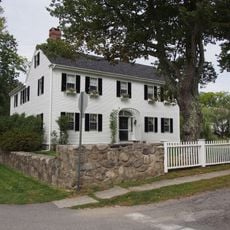
Fort Point State Park, State park in Stockton Springs, United States.

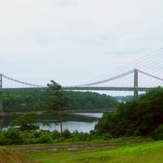
Fort Point State Park is a 120-acre coastal property in Stockton Springs featuring forests, open fields, and rocky shoreline facing the Penobscot Bay. Pathways crisscross the grounds, and a sturdy pier extends into the water for visitors to use.

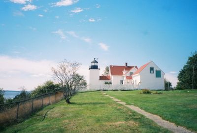
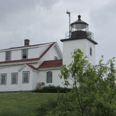
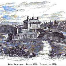
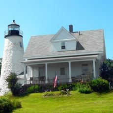
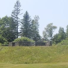
Fort Pownall was built in 1759 when English forces viewed the river as strategically crucial for regional control. The lighthouse appeared decades later to guide vessels safely into the bay.

The lighthouse tower stands as a marker of life at sea, shaping how locals understand their relationship with the water and the seasons.

The park features a sturdy pier suitable for fishing and watching water life, with picnic spots distributed along the shoreline. Trails are well marked throughout, and visitors can bring their own kayaks or explore various waterside activities at their pace.

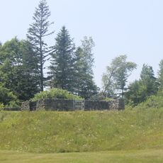
The grounds serve as a living habitat where deer, foxes, porcupines, and seals move through their daily routines in their natural environment. This mix of woodland and open water creates rare conditions that support multiple animal species.

The community of curious travelers

AroundUs brings together thousands of curated places, local tips, and hidden gems, enriched daily by 60,000 contributors worldwide.

Start exploring
Location
Inception
1974
GPS coordinates
44.46674,-68.81892
Latest update
December 13, 2025 11:47
Around this place
Fort Knox
United States of America

Fort Knox

11.1 km
Penobscot Narrows Bridge and Observatory
United States of America

Penobscot Narrows Bridge and Observatory

10.3 km
Bowdoin
United States of America

Bowdoin

9.1 km
Fort George
United States of America

Fort George

8.5 km
Waldo–Hancock Bridge
United States of America

Waldo–Hancock Bridge

10.5 km
Fort Pentagouet
United States of America

Fort Pentagouet

8.9 km
United States of America

Moose Point State Park

10.7 km
Fort Point Light
United States of America

Fort Point Light

577 m
Fort Pownall Memorial
United States of America

Fort Pownall Memorial

581 m
Dice Head Light
United States of America

Dice Head Light

9.4 km
Penobscot Marine Museum
United States of America

Penobscot Marine Museum

8.5 km
Pentagoet Archeological District
United States of America

Pentagoet Archeological District

9.2 km
Wilson Museum
United States of America

Wilson Museum

9.3 km
United States of America

West Brooksville Congregational Church

9.3 km
Stockton Springs Community Church
United States of America

Stockton Springs Community Church

4.1 km
John Perkins House
United States of America

John Perkins House

9.3 km
Cate House
United States of America

Cate House

8.9 km
Capt. William McGilvery House
United States of America

Capt. William McGilvery House

7.6 km
Capt. John McGilvery House
United States of America

Capt. John McGilvery House

7.8 km
Castine Historic District
United States of America

Castine Historic District

8.5 km
Searsport Historic District
United States of America

Searsport Historic District

8.5 km
Nathan G. Hichborn House
United States of America

Nathan G. Hichborn House

4.1 km
East Main Street Historic District
United States of America

East Main Street Historic District

7.7 km
Capt. John P. Nichols House
United States of America

Capt. John P. Nichols House

7.7 km
James G. Pendleton House
United States of America

James G. Pendleton House

9.2 km
Carver Memorial Library
United States of America

Carver Memorial Library

8.3 km
Union Hall
United States of America

Union Hall

8.4 km
Phineas Heywood House
United States of America

Phineas Heywood House

11.9 km
Show the full map
Reviews
Share your experience

No review yet

Discussions
Start a discussion...

No discussion yet

« Fort Point State Park - State park in Stockton Springs, United States » is provided by Around Us (aroundus.com). Images and texts are derived from Wikimedia project under a Creative Commons license. You are allowed to copy, distribute, and modify copies of this page, under the conditions set by the license, as long as this note is clearly visible.

Discover hidden gems everywhere you go!

From secret cafés to breathtaking viewpoints, skip the crowded tourist spots and find places that match your style. Our app makes it easy with voice search, smart filtering, route optimization, and insider tips from travelers worldwide. Download now for the complete mobile experience.

Around Us App Screenshot

A unique approach to discovering new places

Le Figaro

All the places worth exploring

France Info

A tailor-made excursion in just a few clicks

20 Minutes

Around Us
Travel Guide & Maps
Download

Send to your phone

QR Code
1

Open the camera app on your mobile.

2

Point at the QR code with your camera. A notification will appear.

3

Tap the notification to open the link.