Enable Location

We need your location to show you interesting places around you

Discover nearby places

Find interesting locations and hidden gems around you

Precise directions

Get accurate directions and distances to places

Your location is never shared with other users. It's only used when you tap the location button.

Fort George

Log in to your account

Start exploring — it's free

Trusted by 61,945 travelers worldwide

Continue with Google
Continue with Apple
or

We will send you a code to connect

By continuing, you accept our Terms and Conditions and our Privacy Policy

Check your inbox

We've sent a pincode in your inbox. Please enter the code below.

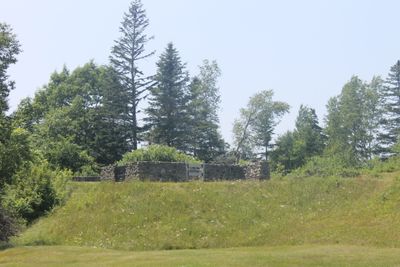
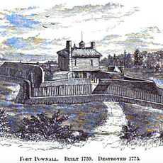
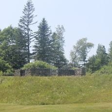
Fort George, Revolutionary War fort in Castine, United States.

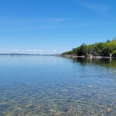
Fort George is a ruined military fortification in Castine built by British forces during the Revolutionary War. The structure features earthen walls with defensive bastions at the corners that overlook Penobscot Bay.

British troops built this fortification in 1779 as a key part of their plan to establish a new colony called New Ireland in the region. The occupation ended when American forces regained control of the area.

In the early 1900s, local school teams played baseball games here, making the fort a gathering place where the community came together.

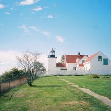
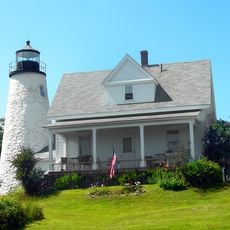
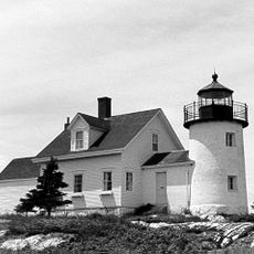
The grounds are open to the public, and visitors can explore the earthen structures and enjoy views of the bay and surrounding landscape. It is good to check local conditions before visiting, as weather can affect access to certain areas.

In a stormy night in June 1781, two officers managed to escape with help from local people, marking a remarkable episode during the occupation. This event is remembered today as an important moment in the area's story of resistance and daring escape.

The community of curious travelers

AroundUs brings together thousands of curated places, local tips, and hidden gems, enriched daily by 60,000 contributors worldwide.

Start exploring
Location
Inception
1779
GPS coordinates
44.39100,-68.80561
Latest update
December 9, 2025 18:43
Around this place
Bowdoin
United States of America

Bowdoin

859 m
Fort Pentagouet
United States of America

Fort Pentagouet

590 m
Fort Point Light
United States of America

Fort Point Light

8.5 km
Fort Point State Park
United States of America

Fort Point State Park

8.5 km
Holbrook Island Sanctuary State Park
United States of America

Holbrook Island Sanctuary State Park

4 km
Fort Pownall Memorial
United States of America

Fort Pownall Memorial

8.6 km
Dice Head Light
United States of America

Dice Head Light

1.4 km
Pumpkin Island Light
United States of America

Pumpkin Island Light

10.4 km
Penobscot Marine Museum
United States of America

Penobscot Marine Museum

12.2 km
Winter Harbor Light
United States of America

Winter Harbor Light

10.4 km
Pentagoet Archeological District
United States of America

Pentagoet Archeological District

736 m
Wilson Museum
United States of America

Wilson Museum

787 m
United States of America

West Brooksville Congregational Church

3.8 km
Stockton Springs Community Church
United States of America

Stockton Springs Community Church

11.9 km
John Perkins House
United States of America

John Perkins House

793 m
Cate House
United States of America

Cate House

518 m
Capt. William McGilvery House
United States of America

Capt. William McGilvery House

11.5 km
Capt. John McGilvery House
United States of America

Capt. John McGilvery House

11.6 km
Castine Historic District
United States of America

Castine Historic District

91 m
Searsport Historic District
United States of America

Searsport Historic District

12.1 km
East Main Street Historic District
United States of America

East Main Street Historic District

11.4 km
James G. Pendleton House
United States of America

James G. Pendleton House

12.2 km
Capt. John P. Nichols House
United States of America

Capt. John P. Nichols House

11.5 km
Nathan G. Hichborn House
United States of America

Nathan G. Hichborn House

11.8 km
Carver Memorial Library
United States of America

Carver Memorial Library

12.1 km
Union Hall
United States of America

Union Hall

12.1 km
Spragues Beach
United States of America

Spragues Beach

6.4 km
Bakeman Beach
United States of America

Bakeman Beach

8.9 km
Show the full map
« Fort George - Revolutionary War fort in Castine, United States » is provided by Around Us (aroundus.com). Images and texts are derived from Wikimedia project under a Creative Commons license. You are allowed to copy, distribute, and modify copies of this page, under the conditions set by the license, as long as this note is clearly visible.

Discover hidden gems everywhere you go!

From secret cafés to breathtaking viewpoints, skip the crowded tourist spots and find places that match your style. Our app makes it easy with voice search, smart filtering, route optimization, and insider tips from travelers worldwide. Download now for the complete mobile experience.

Around Us App Screenshot

A unique approach to discovering new places

Le Figaro

All the places worth exploring

France Info

A tailor-made excursion in just a few clicks

20 Minutes

Around Us
Travel Guide & Maps
Download

Send to your phone

QR Code
1

Open the camera app on your mobile.

2

Point at the QR code with your camera. A notification will appear.

3

Tap the notification to open the link.