Chest opened
+${chestReward.xp} XP
Explorer
NOUVEAU ×${chestReward.collectible.quantity}
tapez pour fermer
Chest locked

Open chests in the app

Around Us is built for your phone — chests unlock when you walk, explore and capture nearby places.

Enable Location

We need your location to show you interesting places around you

Discover nearby places

Find interesting locations and hidden gems around you

Precise directions

Get accurate directions and distances to places

Your location is never shared with other users. It's only used when you tap the location button.

Hoffman Island

Log in to your account

Start exploring — it's free

Trusted by 72,883 travelers worldwide

Continue with Google
Continue with Apple
or

We will send you a code to connect

By continuing, you accept our Terms and Conditions and our Privacy Policy

Check your inbox

We've sent a pincode in your inbox. Please enter the code below.

Hoffman Island
Discussion Reviews 1 Photos
24.4k Popularity

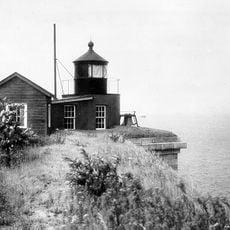
Hoffman Island, Artificial island in Lower New York Bay, United States.

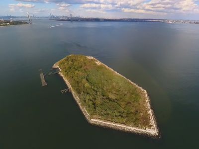
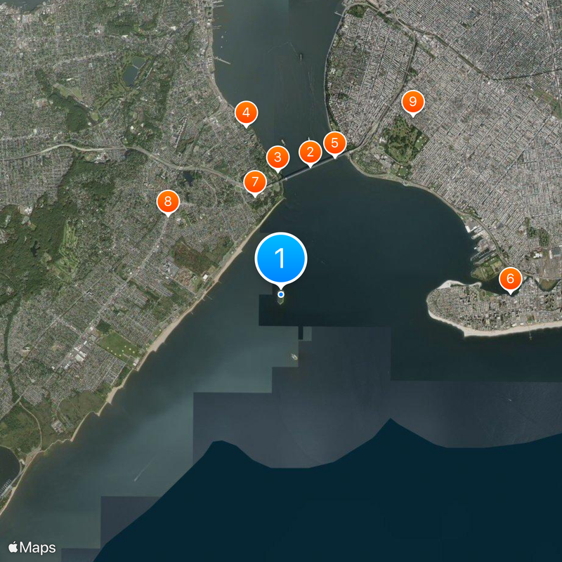
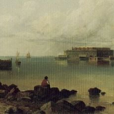
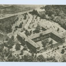
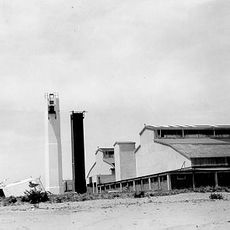
Hoffman Island is an artificial landmass of approximately 11 acres situated off South Beach in Staten Island, created in 1873 through the placement of fill material on Orchard Shoal. The National Park Service now manages it as part of Gateway National Recreation Area with restricted public access.

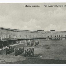
The island was created in 1873 through landfill operations and functioned as a quarantine station from the 1870s through the early 1900s, isolating immigrants with contagious diseases. This medical role was essential during the peak immigration years when arrivals were screened before entering the United States.

The island takes its name from John Thompson Hoffman, a political leader who served as Mayor of New York City and later as Governor of New York State. This naming reflects his importance in the state's governance during the 19th century.

The island is closed to public visits as the National Park Service restricts access to protect nesting birds and wildlife. The best views come from South Beach or boat tours in Lower New York Bay.

During World War II, the island served as an anchorage point for anti-submarine nets that protected New York Bay from enemy attacks. This military infrastructure was part of a broader defense system that guarded the region's vital harbors during wartime.

The community of curious travelers

AroundUs brings together thousands of curated places, local tips, and hidden gems, enriched daily by 60,000 contributors worldwide.

Start exploring
Location
Location
GPS coordinates
40.57872,-74.05375
Latest update
December 20, 2025 12:40
Around this place
Verrazzano-Narrows Bridge
United States of America

Verrazzano-Narrows Bridge

3.2 km
Battery Weed
United States of America

Battery Weed

3 km
Alice Austen House
United States of America

Alice Austen House

4.1 km
Fort Lafayette
United States of America

Fort Lafayette

3.5 km
Coney Island Creek
United States of America

Coney Island Creek

5.5 km
Fort Tompkins
United States of America

Fort Tompkins

2.5 km
United States of America

Old Town, Staten Island

3.3 km
Saitta House
United States of America

Saitta House

5.3 km
Coney Island Light
United States of America

Coney Island Light

3.6 km
Billiou-Stillwell-Perine House
United States of America

Billiou-Stillwell-Perine House

4.3 km
National American Indian Memorial
United States of America

National American Indian Memorial

2.9 km
Garibaldi-Meucci Museum
United States of America

Garibaldi-Meucci Museum

4.4 km
Childs Restaurant
United States of America

Childs Restaurant

5.6 km
United States of America

Rose and Crown Tavern

5.6 km
Harbor Defense Museum
United States of America

Harbor Defense Museum

3.9 km
John J. Carty Park
United States of America

John J. Carty Park

4.2 km
West Bank Light
United States of America

West Bank Light

4.6 km
Our Lady of Mount Carmel Grotto
United States of America

Our Lady of Mount Carmel Grotto

4.1 km
Fort Wadsworth Light
United States of America

Fort Wadsworth Light

3 km
Augustinian Academy
United States of America

Augustinian Academy

5.4 km
New Dorp Light
United States of America

New Dorp Light

5.6 km
Fort Tompkins Light
United States of America

Fort Tompkins Light

3 km
Elm Tree Beacon Light
United States of America

Elm Tree Beacon Light

3.9 km
Boardman–Mitchell House
United States of America

Boardman–Mitchell House

5.4 km
Coney Island Fire Station Pumping Station
United States of America

Coney Island Fire Station Pumping Station

5.2 km
Casemate Fort, Whiting Quadrangle
United States of America

Casemate Fort, Whiting Quadrangle

3.8 km
Dover Patrol Monument
United States of America

Dover Patrol Monument

4 km
Stapleton Library
United States of America

Stapleton Library

5.7 km
Show the full map
Reviews
Share your experience

No review yet

Discussions
Start a discussion...

No discussion yet

« Hoffman Island - Artificial island in Lower New York Bay, United States » is provided by Around Us (aroundus.com). Images and texts are derived from Wikimedia project under a Creative Commons license. You are allowed to copy, distribute, and modify copies of this page, under the conditions set by the license, as long as this note is clearly visible.

Discover hidden gems everywhere you go!

From secret cafés to breathtaking viewpoints, skip the crowded tourist spots and find places that match your style. Our app makes it easy with voice search, smart filtering, route optimization, and insider tips from travelers worldwide. Download now for the complete mobile experience.

Around Us App Screenshot

A unique approach to discovering new places

Le Figaro

All the places worth exploring

France Info

A tailor-made excursion in just a few clicks

20 Minutes

Around Us
Travel Guide & Maps
Download

Send to your phone

QR Code
1

Open the camera app on your mobile.

2

Point at the QR code with your camera. A notification will appear.

3

Tap the notification to open the link.