Enable Location

We need your location to show you interesting places around you

Discover nearby places

Find interesting locations and hidden gems around you

Precise directions

Get accurate directions and distances to places

Your location is never shared with other users. It's only used when you tap the location button.

Adam-ondi-Ahman

Log in to your account

Start exploring — it's free

Trusted by 61,977 travelers worldwide

Continue with Google
Continue with Apple
or

We will send you a code to connect

By continuing, you accept our Terms and Conditions and our Privacy Policy

Check your inbox

We've sent a pincode in your inbox. Please enter the code below.

Adam-ondi-Ahman

Adam-ondi-Ahman, Historic site in Daviess County, Missouri.

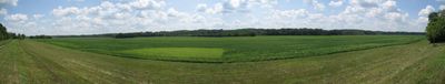
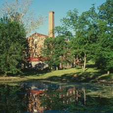
Adam-ondi-Ahman is a historic site in Daviess County, Missouri, set along river bluffs overlooking the Grand River valley. The property covers fields, open meadows, and wooded slopes crossed by footpaths that guide visitors across the rolling countryside.

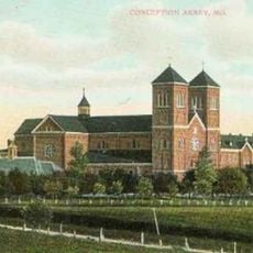
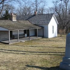
The settlement was founded in 1838 as a Mormon community and grew quickly to about 200 houses before residents fled that same year during armed conflicts in Missouri. During the Civil War a skirmish took place here in 1862 when Union forces tried to stop Confederate reinforcements.

Members of The Church of Jesus Christ of Latter-day Saints view this ground as the valley where Adam gathered his family three years before his death. The name comes from a revealed vision and connects the Missouri bluffs to events described in ancient scripture.

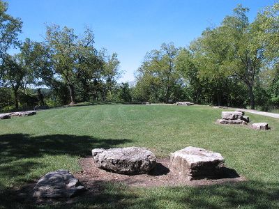
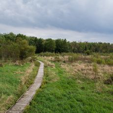
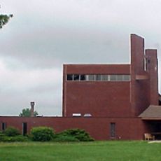
The Church of Jesus Christ of Latter-day Saints maintains the grounds and provides signs explaining the religious background of the place. Visitors can walk the trails freely and enjoy views across the river valley without paying admission.

The site bears a name drawn from a Hebrew root meaning man or ground combined with a term some link to a divine title. The original settlement vanished so quickly that few physical traces remain and only the landscape itself recalls that brief period.

The community of curious travelers

AroundUs brings together thousands of curated places, local tips, and hidden gems, enriched daily by 60,000 contributors worldwide.

Start exploring
Location
GPS coordinates
39.98390,-93.97670
Latest update
December 13, 2025 19:21
Around this place
Conception Abbey
United States of America

Conception Abbey

65.8 km
Watkins Woolen Mill State Park and State Historic Site
United States of America

Watkins Woolen Mill State Park and State Historic Site

69.3 km
Wallace State Park
United States of America

Wallace State Park

41.4 km
James Brothers' House and Farm
United States of America

James Brothers' House and Farm

72.1 km
Locust Creek Covered Bridge State Historic Site
United States of America

Locust Creek Covered Bridge State Historic Site

66.9 km
Pershing State Park
United States of America

Pershing State Park

69.8 km
United States of America

David L. and Sallie Ann Stoutimore House

62.2 km
Gen. John J. Pershing Boyhood Home State Historic Site
United States of America

Gen. John J. Pershing Boyhood Home State Historic Site

72.4 km
Crowder State Park
United States of America

Crowder State Park

29.6 km
A. Taylor Ray House
United States of America

A. Taylor Ray House

7.9 km
J. F. Roberts Octagonal Barn
United States of America

J. F. Roberts Octagonal Barn

66.1 km
Liberty Hall
United States of America

Liberty Hall

71.3 km
Daviess County Rotary Jail and Sheriff's Residence
United States of America

Daviess County Rotary Jail and Sheriff's Residence

7.7 km
Andrew County Courthouse
United States of America

Andrew County Courthouse

72.9 km
Carnegie Library of Albany
United States of America

Carnegie Library of Albany

42.2 km
Courthouse Square Historic District
United States of America

Courthouse Square Historic District

41.9 km
St. Munchin Catholic Church
United States of America

St. Munchin Catholic Church

35.2 km
Daviess County Courthouse
United States of America

Daviess County Courthouse

7.7 km
Trenton High School
United States of America

Trenton High School

33.2 km
Worth County Courthouse
United States of America

Worth County Courthouse

66.9 km
Gentry County Courthouse
United States of America

Gentry County Courthouse

38.4 km
Grace Episcopal Church
United States of America

Grace Episcopal Church

43 km
Chillicothe Commercial Historic District
United States of America

Chillicothe Commercial Historic District

42 km
DeKalb County Courthouse
United States of America

DeKalb County Courthouse

34.3 km
Cheville Chapel
United States of America

Cheville Chapel

70.6 km
Russell Sunflower Patch
United States of America

Russell Sunflower Patch

63.5 km
Linn County Courthouse
United States of America

Linn County Courthouse

68.2 km
Locust Creek Covered Bridge
United States of America

Locust Creek Covered Bridge

66.9 km
Show the full map
« Adam-ondi-Ahman - Historic site in Daviess County, Missouri » is provided by Around Us (aroundus.com). Images and texts are derived from Wikimedia project under a Creative Commons license. You are allowed to copy, distribute, and modify copies of this page, under the conditions set by the license, as long as this note is clearly visible.

Discover hidden gems everywhere you go!

From secret cafés to breathtaking viewpoints, skip the crowded tourist spots and find places that match your style. Our app makes it easy with voice search, smart filtering, route optimization, and insider tips from travelers worldwide. Download now for the complete mobile experience.

Around Us App Screenshot

A unique approach to discovering new places

Le Figaro

All the places worth exploring

France Info

A tailor-made excursion in just a few clicks

20 Minutes

Around Us
Travel Guide & Maps
Download

Send to your phone

QR Code
1

Open the camera app on your mobile.

2

Point at the QR code with your camera. A notification will appear.

3

Tap the notification to open the link.