Enable Location

We need your location to show you interesting places around you

Discover nearby places

Find interesting locations and hidden gems around you

Precise directions

Get accurate directions and distances to places

Your location is never shared with other users. It's only used when you tap the location button.

Assateague Island National Seashore

Log in to your account

Start exploring — it's free

Trusted by 62,369 travelers worldwide

Continue with Google
Continue with Apple
or

We will send you a code to connect

By continuing, you accept our Terms and Conditions and our Privacy Policy

Check your inbox

We've sent a pincode in your inbox. Please enter the code below.

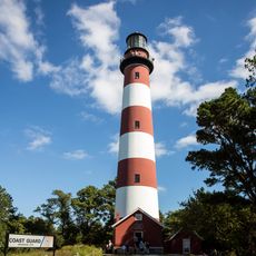
Assateague Island National Seashore, Barrier island in Maryland and Virginia, United States.

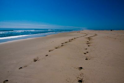
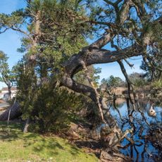
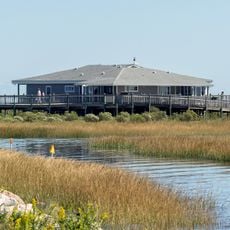
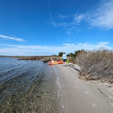
Assateague Island National Seashore is a barrier island along the Atlantic coast spanning parts of Maryland and Virginia with extended sandy shores, salt marshes, and forested areas. The landscape includes bays, dunes, and woodland zones that support diverse coastal ecosystems.

The seashore was established as a protected area in 1962 after a powerful storm disrupted plans for private development on the island. This action preserved the natural landscape and prevented extensive commercial construction.

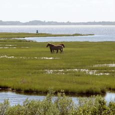
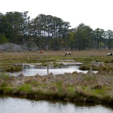
The wild horses have become central to how visitors experience and remember this place. Local communities and travelers alike identify the island through these animals that move freely across the landscape.

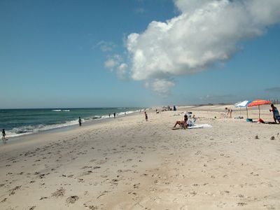
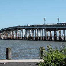
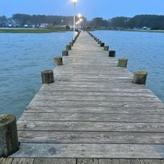
The seashore has separate access points in Maryland and Virginia that remain open year-round. Visitors will find camping grounds, hiking trails, and beach areas at each location, with facilities and experiences varying between the two sides.

A herd of wild horses roams freely on the island, moving between shorelines and marsh areas. These animals have adapted to the particular conditions of the coastal environment and represent a remarkable part of the ecosystem.

The community of curious travelers

AroundUs brings together thousands of curated places, local tips, and hidden gems, enriched daily by 60,000 contributors worldwide.

Start exploring
Location
Location
Fee
Yes
Operator
National Park Service
GPS coordinates
38.08330,-75.20830
Latest update
December 23, 2025 21:08
Places to discover in Maryland: coast lighthouses, wildlife sanctuaries, waterfalls, and gardens

Maryland has many places to see away from the usual crowds. Natural areas fill the state: sanctuaries where birds and mammals live, waterfalls carving through forests, and coastlines with calm views over the water. History is everywhere: white lighthouses that guided ships for centuries, colonial...

Around this place
Assateague State Park
United States of America

Assateague State Park

17.2 km
Chincoteague National Wildlife Refuge
United States of America

Chincoteague National Wildlife Refuge

17.2 km
Assateague Light
United States of America

Assateague Light

23.1 km
Verrazano Bridge
United States of America

Verrazano Bridge

18.8 km
Rackliffe House
United States of America

Rackliffe House

26.4 km
Sun Outdoors Frontier Town
United States of America

Sun Outdoors Frontier Town

23.9 km
Captain Timothy Hill House
United States of America

Captain Timothy Hill House

19.9 km
Merry Sherwood
United States of America

Merry Sherwood

24.8 km
Museum of Chincoteague Island
United States of America

Museum of Chincoteague Island

21.6 km
Burley Manor
United States of America

Burley Manor

26.3 km
Genesar
United States of America

Genesar

17 km
United States of America

Sinepuxent Bay Wildlife Management Area

17.8 km
Berlin Commercial District
United States of America

Berlin Commercial District

26.9 km
Assateague Beach Coast Guard Station
United States of America

Assateague Beach Coast Guard Station

28.2 km
Refuge Waterfowl Museum
United States of America

Refuge Waterfowl Museum

21.8 km
Mansion House
United States of America

Mansion House

10 km
United States of America

Fassitt House

23.2 km
Simpson's Grove
United States of America

Simpson's Grove

22 km
Henry's Grove
United States of America

Henry's Grove

21.3 km
United States of America

Williams Grove

20.3 km
Museum of Chincoteague Island
United States of America

Museum of Chincoteague Island

21.9 km
Maui Jack's Waterpark
United States of America

Maui Jack's Waterpark

21.7 km
Captain Timothy Hill House
United States of America

Captain Timothy Hill House

20 km
Herbert H. Bateman Educational and Administrative Center
United States of America

Herbert H. Bateman Educational and Administrative Center

23.4 km
Toms Cove Visitor Center
United States of America

Toms Cove Visitor Center

24.6 km
United States of America

Stephen Decatur Monument

26.4 km
Little Egging Beach
United States of America

Little Egging Beach

13.8 km
Lighthouse Trail
United States of America

Lighthouse Trail

23.1 km
Show the full map
« Assateague Island National Seashore - Barrier island in Maryland and Virginia, United States » is provided by Around Us (aroundus.com). Images and texts are derived from Wikimedia project under a Creative Commons license. You are allowed to copy, distribute, and modify copies of this page, under the conditions set by the license, as long as this note is clearly visible.

Discover hidden gems everywhere you go!

From secret cafés to breathtaking viewpoints, skip the crowded tourist spots and find places that match your style. Our app makes it easy with voice search, smart filtering, route optimization, and insider tips from travelers worldwide. Download now for the complete mobile experience.

Around Us App Screenshot

A unique approach to discovering new places

Le Figaro

All the places worth exploring

France Info

A tailor-made excursion in just a few clicks

20 Minutes

Around Us
Travel Guide & Maps
Download

Send to your phone

QR Code
1

Open the camera app on your mobile.

2

Point at the QR code with your camera. A notification will appear.

3

Tap the notification to open the link.