Enable Location

We need your location to show you interesting places around you

Discover nearby places

Find interesting locations and hidden gems around you

Precise directions

Get accurate directions and distances to places

Your location is never shared with other users. It's only used when you tap the location button.

Panticosa

Log in to your account

Start exploring — it's free

Trusted by 63,924 travelers worldwide

Continue with Google
Continue with Apple
or

We will send you a code to connect

By continuing, you accept our Terms and Conditions and our Privacy Policy

Check your inbox

We've sent a pincode in your inbox. Please enter the code below.

Discussion Reviews 1 Photos
19.4k Popularity

Panticosa, municipality of Spain

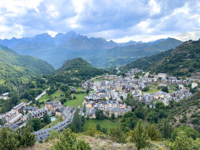
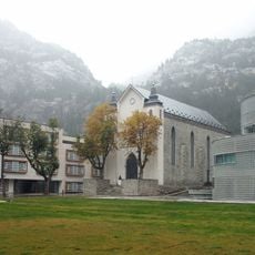
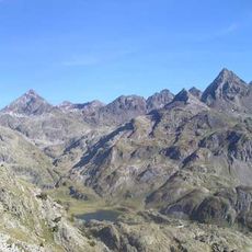
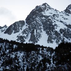
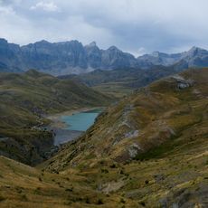
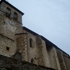
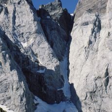
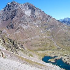
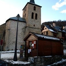
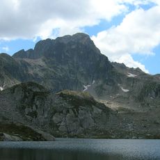
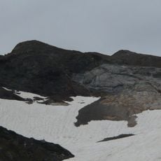
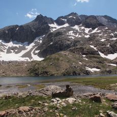
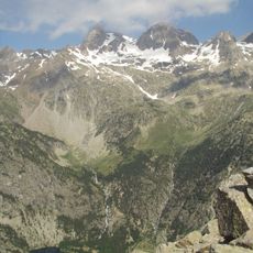
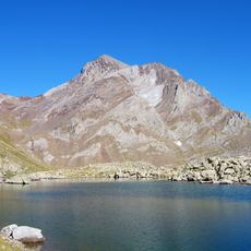
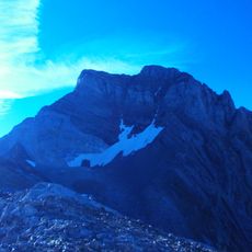
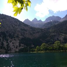
Panticosa is a small municipality located in the Tena valley within Huesca Province in Aragon, surrounded by mountains exceeding 3000 meters and dotted with numerous lakes. The streets are steep and narrow, lined with large traditional stone houses, with a 13th-century Romanesque church standing as a key landmark.

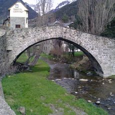
Panticosa was first mentioned in the early 1300s, though Roman coins found in the area suggest it was inhabited long before. In the 16th century, the stone Caldarés bridge with its single large arch was built to replace an older wooden crossing.

Residents speak Panticuto, a variation of Aragonese that has survived for centuries and connects people to their ancestors and traditions. You may hear this language during local festivals or among older residents, where it remains a living part of daily life.

Traveling to Panticosa by car is straightforward using road A-136, which winds through the mountains with views of forests and rocky slopes. Buses also connect the town to nearby places like Jaca and Sabiñánigo, with a bus stop in the town center for easy visits without a car.

A local legend tells of a giant living in the surrounding mountains with whom villagers made a pact to live in peace. When snow came early and the giant descended, residents reportedly donned masks to frighten him away, and some say you can still see signs of the giant in the mountains on certain nights.

The community of curious travelers

AroundUs brings together thousands of curated places, local tips, and hidden gems, enriched daily by 60,000 contributors worldwide.

Start exploring
Location
Capital city
Panticosa
Elevation above the sea
1,184 m
Part of
Mancomunitat del Quiñón de Panticosa
Shares border with
Torla-Ordesa, Yésero, Biescas, Hoz de Jaca, Sallent de Gállego, Cauterets
GPS coordinates
42.72417,-0.28444
Latest update
February 16, 2026 22:40
Reviews
Share your experience

No review yet

Discussions
Start a discussion...

No discussion yet

« Panticosa - municipality of Spain » is provided by Around Us (aroundus.com). Images and texts are derived from Wikimedia project under a Creative Commons license. You are allowed to copy, distribute, and modify copies of this page, under the conditions set by the license, as long as this note is clearly visible.

Discover hidden gems everywhere you go!

From secret cafés to breathtaking viewpoints, skip the crowded tourist spots and find places that match your style. Our app makes it easy with voice search, smart filtering, route optimization, and insider tips from travelers worldwide. Download now for the complete mobile experience.

Around Us App Screenshot

A unique approach to discovering new places

Le Figaro

All the places worth exploring

France Info

A tailor-made excursion in just a few clicks

20 Minutes

Around Us
Travel Guide & Maps
Download

Send to your phone

QR Code
1

Open the camera app on your mobile.

2

Point at the QR code with your camera. A notification will appear.

3

Tap the notification to open the link.