Enable Location

We need your location to show you interesting places around you

Discover nearby places

Find interesting locations and hidden gems around you

Precise directions

Get accurate directions and distances to places

Your location is never shared with other users. It's only used when you tap the location button.

Pic du Milieu

Log in to your account

Save your favorite places
Create custom travel routes
Rate and review places
Access the full interactive map
Continue with Google
Continue with Apple
Continue with email
By continuing, you accept our Terms and Conditions and our Privacy Policy
Create an account

Pic du Milieu

Add to collection
Map
Suggest a change
Share

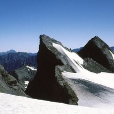
Pic du Milieu, Mountain summit in Hautes-Pyrénées, France

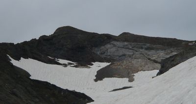
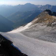
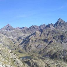
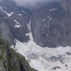
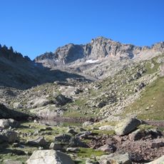
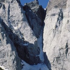
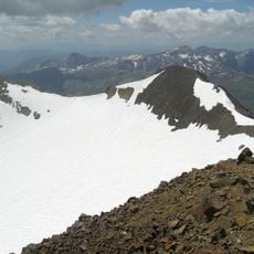
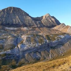
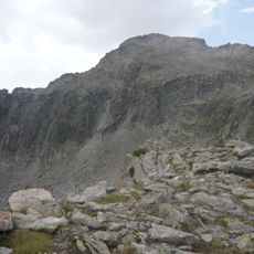
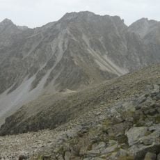
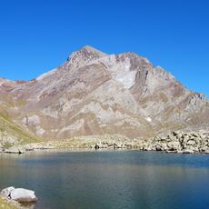
Pic du Milieu is a mountain summit on the France-Spain border in the Hautes-Pyrénées, reaching 3,130 meters within the Vignemale range. The peak is made of limestone and features steep rocky slopes that present a significant climbing challenge for experienced mountaineers.

The peak was first climbed on August 1, 1883, by mountaineer Henry Russell along with guides Haurine and Pierre Pujo. This ascent marked an important moment in the exploration and mountaineering history of the Vignemale range.

The peak goes by different names across the border regions, including Cabieto de ra Labaza in Aragonese, reflecting how communities on both sides of the Pyrenees have their own ways of speaking about their shared landscape. These local variations show how geography connects rather than divides the people living in these mountain valleys.

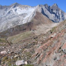
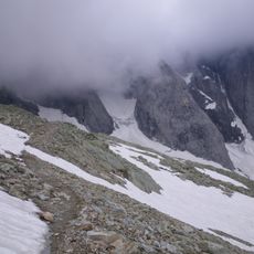
Reaching the summit requires climbing experience, proper technical equipment, and good judgment in changing mountain conditions. Visitors should start early, monitor weather carefully, and approach the steep limestone slopes with caution.

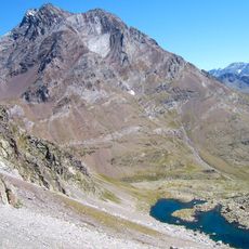
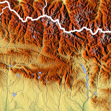
The summit marks the watershed divide between two major river basins, with water flowing toward the Atlantic on one side and the Mediterranean on the other. This geographic line shows how a single mountain ridge separates two entirely different hydrological systems.

Location: Torla-Ordesa

Location: Hautes-Pyrénées

Elevation above the sea: 3,130 m

Made from material: limestone

GPS coordinates: 42.76158,-0.13641

Latest update: December 14, 2025 20:25

Photos
Reviews

Visited this place? Tap the stars to rate it and share your experience / photos with the community! Try now! You can cancel it anytime.

« Pic du Milieu - Mountain summit in Hautes-Pyrénées, France » is provided by Around Us (aroundus.com). Images and texts are derived from Wikimedia project under a Creative Commons license. You are allowed to copy, distribute, and modify copies of this page, under the conditions set by the license, as long as this note is clearly visible.

Discover hidden gems everywhere you go!

From secret cafés to breathtaking viewpoints, skip the crowded tourist spots and find places that match your style. Our app makes it easy with voice search, smart filtering, route optimization, and insider tips from travelers worldwide. Download now for the complete mobile experience.

Around Us App Screenshot

A unique approach to discovering new places

Le Figaro

All the places worth exploring

France Info

A tailor-made excursion in just a few clicks

20 Minutes