Enable Location

We need your location to show you interesting places around you

Discover nearby places

Find interesting locations and hidden gems around you

Precise directions

Get accurate directions and distances to places

Your location is never shared with other users. It's only used when you tap the location button.

Épaule Chausenque

Log in to your account

Start exploring — it's free

Trusted by 62,995 travelers worldwide

Continue with Google
Continue with Apple
or

We will send you a code to connect

By continuing, you accept our Terms and Conditions and our Privacy Policy

Check your inbox

We've sent a pincode in your inbox. Please enter the code below.

Épaule Chausenque
Discussion Reviews 1 Photos
100+ Popularity

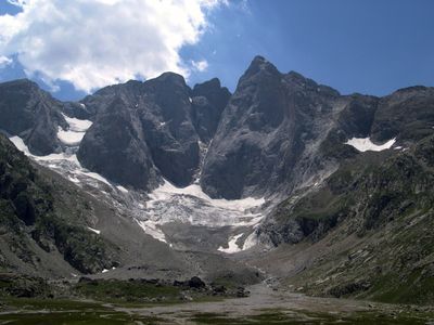
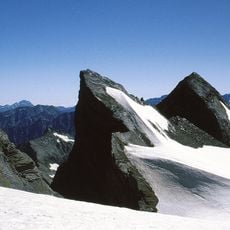
Épaule Chausenque, Mountain summit in Hautes-Pyrénées, France.

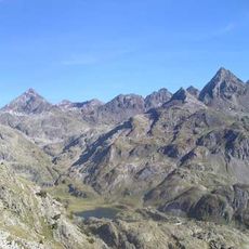
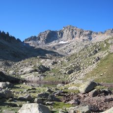
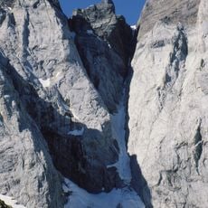
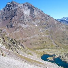
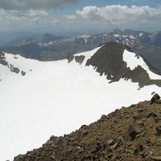
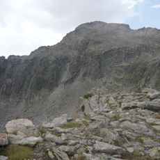
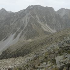
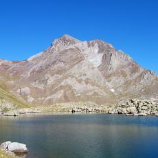
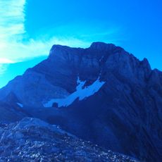
Épaule Chausenque is a mountain peak standing at 3,154 meters that forms part of the Vignemale massif in the French Pyrenees. The summit sits between two other notable peaks and occupies a central position within this high alpine range.

The peak was first recorded climbed in 1822 during exploration of the surrounding range. This early ascent marked a milestone in the alpine exploration of the Vignemale area.

The peak is named after a French mountaineer who explored and mapped many Pyrenean summits. This name reflects the region's tradition of honoring those who discovered and studied its mountains.

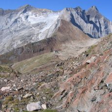
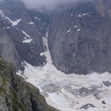
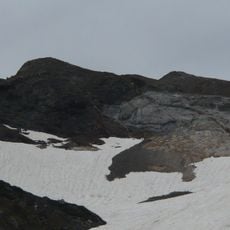
Climbing this peak requires experience with rock scrambling and rope work on steep terrain. Good weather conditions and proper fitness are essential, as the high elevation demands solid mountain preparation.

The peak sits in a strategic position between two larger mountains and serves as a connecting point on several high mountain routes. Its location makes it an important waypoint for climbers targeting multiple 3,000-meter summits in the massif.

The community of curious travelers

AroundUs brings together thousands of curated places, local tips, and hidden gems, enriched daily by 60,000 contributors worldwide.

Start exploring
Elevation above the sea
3,154 m
GPS coordinates
42.77329,-0.14002
Latest update
December 15, 2025 13:28
Reviews
Share your experience

No review yet

Discussions
Start a discussion...

No discussion yet

« Épaule Chausenque - Mountain summit in Hautes-Pyrénées, France » is provided by Around Us (aroundus.com). Images and texts are derived from Wikimedia project under a Creative Commons license. You are allowed to copy, distribute, and modify copies of this page, under the conditions set by the license, as long as this note is clearly visible.

Discover hidden gems everywhere you go!

From secret cafés to breathtaking viewpoints, skip the crowded tourist spots and find places that match your style. Our app makes it easy with voice search, smart filtering, route optimization, and insider tips from travelers worldwide. Download now for the complete mobile experience.

Around Us App Screenshot

A unique approach to discovering new places

Le Figaro

All the places worth exploring

France Info

A tailor-made excursion in just a few clicks

20 Minutes

Around Us
Travel Guide & Maps
Download

Send to your phone

QR Code
1

Open the camera app on your mobile.

2

Point at the QR code with your camera. A notification will appear.

3

Tap the notification to open the link.