·

Enable Location

We need your location to show you interesting places around you

Discover nearby places

Find interesting locations and hidden gems around you

Precise directions

Get accurate directions and distances to places

Your location is never shared with other users. It's only used when you tap the location button.

Embalse del Encinarejo

Log in to your account

Start exploring — it's free

Trusted by 62,647 travelers worldwide

Continue with Google
Continue with Apple
or

We will send you a code to connect

By continuing, you accept our Terms and Conditions and our Privacy Policy

Check your inbox

We've sent a pincode in your inbox. Please enter the code below.

Embalse del Encinarejo

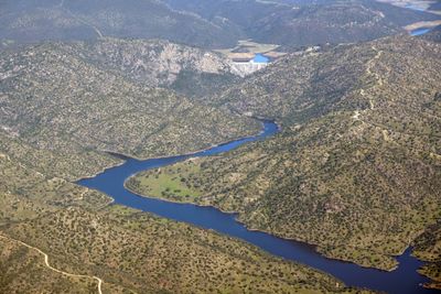
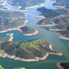
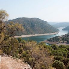
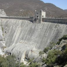
Embalse del Encinarejo, embalse de 15 hectómetros cúbicos de capacidad, situado en el Parque natural de la Sierra de Andújar, provincia de Jaén, España

Embalse del Encinarejo is a large reservoir near Andújar in southern Spain, surrounded by green forests and open land. The concrete dam holds back the water to supply agriculture and local communities while also managing river flow during rainy periods.

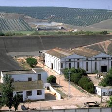
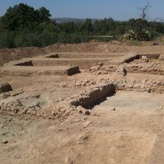
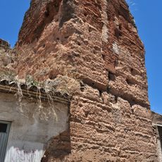
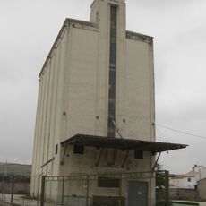
The reservoir was built in the 1920s to harness the Jándula River and secure water and power for the region. The construction effort led to the creation of a workers' settlement called La Lancha, whose ruins remain visible near the dam today.

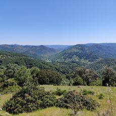
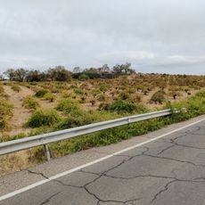
The name Encinarejo refers to the cork oak forests that frame the area. Visitors come to fish, walk the paths, and watch for wildlife, making it a place where locals and travelers connect with nature and take a break from daily routines.

The area is easily accessible from Andújar by forest roads with adequate parking near the dam. Visitors should bring comfortable shoes, plenty of water, and sun protection, especially when planning to walk the paths around the water.

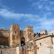
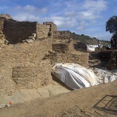
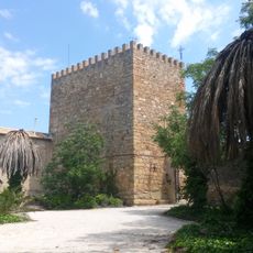
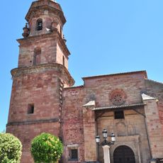
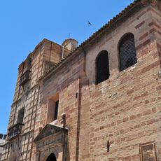
The ruins of La Lancha, a workers' settlement near the dam, reveal remnants of houses, a church, a cinema, and a hospital built during construction. This abandoned village offers a rare glimpse into daily life during the 1920s building project.

The community of curious travelers

AroundUs brings together thousands of curated places, local tips, and hidden gems, enriched daily by 60,000 contributors worldwide.

Start exploring
Location
Elevation above the sea
252 m
GPS coordinates
38.16528,-3.99167
Latest update
February 9, 2026 08:20
« Embalse del Encinarejo » is provided by Around Us (aroundus.com). Images and texts are derived from Wikimedia project under a Creative Commons license. You are allowed to copy, distribute, and modify copies of this page, under the conditions set by the license, as long as this note is clearly visible.

Discover hidden gems everywhere you go!

From secret cafés to breathtaking viewpoints, skip the crowded tourist spots and find places that match your style. Our app makes it easy with voice search, smart filtering, route optimization, and insider tips from travelers worldwide. Download now for the complete mobile experience.

Around Us App Screenshot

A unique approach to discovering new places

Le Figaro

All the places worth exploring

France Info

A tailor-made excursion in just a few clicks

20 Minutes

Around Us
Travel Guide & Maps
Download

Send to your phone

QR Code
1

Open the camera app on your mobile.

2

Point at the QR code with your camera. A notification will appear.

3

Tap the notification to open the link.