Enable Location

We need your location to show you interesting places around you

Discover nearby places

Find interesting locations and hidden gems around you

Precise directions

Get accurate directions and distances to places

Your location is never shared with other users. It's only used when you tap the location button.

Caherconnell Stone Fort

Log in to your account

Start exploring — it's free

Trusted by 61,821 travelers worldwide

Continue with Google
Continue with Apple
or

We will send you a code to connect

By continuing, you accept our Terms and Conditions and our Privacy Policy

Check your inbox

We've sent a pincode in your inbox. Please enter the code below.

Caherconnell Stone Fort

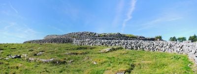
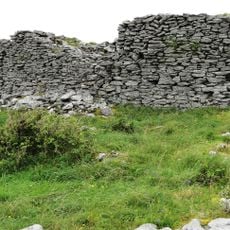
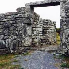
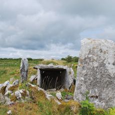
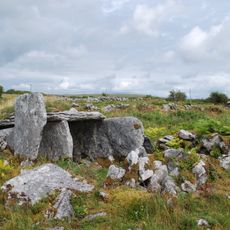
Caherconnell Stone Fort, Ring fort in the Burren region, Ireland

Description

Caherconnell is a ring fort in the Burren region, enclosed by sturdy stone walls that form a circular defensive structure. The fort features a practical layout that would have housed residential and working spaces for a farming family or small community.

History

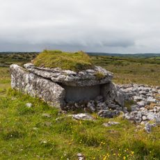
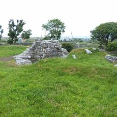
The fort was established in the early medieval period and served as a dwelling for local families over several centuries. Archaeological findings show evidence of craft production and an economy based on farming and livestock raising within the settlement.

Culture

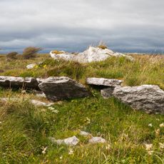
The name derives from Irish heritage and reflects the importance this settlement held for the surrounding community. Today visitors can explore the ruins and experience how people adapted to life within these stone walls.

Practical

The site is accessible on foot and best explored at a leisurely pace to take in all the details of the stone structure. A visitor center on the grounds provides additional context and information about what you are seeing during your visit.

Did you know?

Active archaeological work continues at the site, meaning visitors may encounter ongoing research and excavations during their visit. This ongoing investigation helps reveal more details about how people actually lived within these walls over the centuries.

Location
West Clare Municipal District
GPS coordinates
53.04092,-9.13988
Latest update
December 10, 2025 20:00

AroundUs brings together thousands of curated places, local tips, and hidden gems, enriched daily by 60,000 contributors worldwide. Discover all places nearby (West Clare Municipal District).

« Caherconnell Stone Fort - Ring fort in the Burren region, Ireland » is provided by Around Us (aroundus.com). Images and texts are derived from Wikimedia project under a Creative Commons license. You are allowed to copy, distribute, and modify copies of this page, under the conditions set by the license, as long as this note is clearly visible.

Discover hidden gems everywhere you go!

From secret cafés to breathtaking viewpoints, skip the crowded tourist spots and find places that match your style. Our app makes it easy with voice search, smart filtering, route optimization, and insider tips from travelers worldwide. Download now for the complete mobile experience.

Around Us App Screenshot

A unique approach to discovering new places

Le Figaro

All the places worth exploring

France Info

A tailor-made excursion in just a few clicks

20 Minutes

Around Us
Travel Guide & Maps
Download

Send to your phone

QR Code
1

Open the camera app on your mobile.

2

Point at the QR code with your camera. A notification will appear.

3

Tap the notification to open the link.