Enable Location

We need your location to show you interesting places around you

Discover nearby places

Find interesting locations and hidden gems around you

Precise directions

Get accurate directions and distances to places

Your location is never shared with other users. It's only used when you tap the location button.

Gimmigela Chuli

Log in to your account

Start exploring — it's free

Trusted by 64,520 travelers worldwide

Continue with Google
Continue with Apple
or

We will send you a code to connect

By continuing, you accept our Terms and Conditions and our Privacy Policy

Check your inbox

We've sent a pincode in your inbox. Please enter the code below.

Gimmigela Chuli
Discussion Reviews 1 Photos
3.4k Popularity

Gimmigela Chuli, Himalayan summit in Taplejung, India.

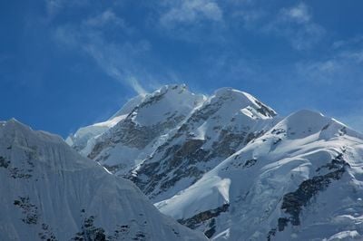
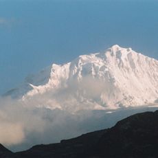
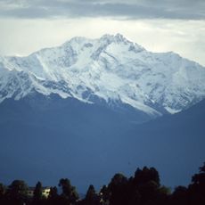
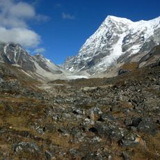
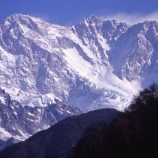
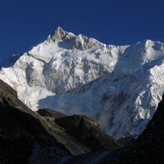
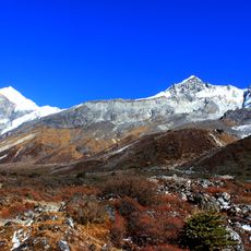
Gimmigela Chuli is a Himalayan summit in Taplejung that sits on the border between Nepal and the Indian state of Sikkim, reaching 7,350 meters (24,114 feet). The mountain has two separate peaks, and its upper slopes and ridges are covered by glaciers and large snowfields.

The first ascent of the peak was completed in October 1994 by Japanese climbers Taroh Tanigawa, Koji Nagakubo, and Yuichi Yoshida. Several earlier attempts had been made before this success, and some of them ended in tragedy.

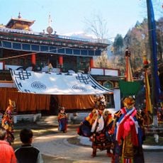
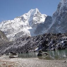
The name Gimmigela Chuli comes from Nepali and is used by communities living in the valleys on both sides of the border. For people in this part of the eastern Himalaya, the peak is a familiar landmark that shapes the way they relate to the surrounding land.

Reaching this peak demands solid high-altitude mountaineering experience and technical skills for moving on glaciers and ice. Anyone planning an attempt should allow plenty of time for acclimatization and be ready for severe conditions at elevation.

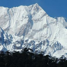
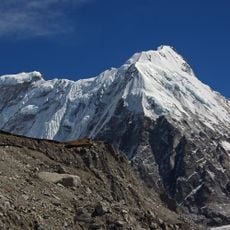
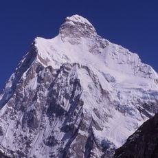
Gimmigela II, a secondary peak at 7,005 meters (22,982 feet), lies entirely within Indian territory and is known among climbers as the mountain's sister. This nearby top is sometimes used as a separate goal by teams who are getting used to the altitude on the massif.

The community of curious travelers

AroundUs brings together thousands of curated places, local tips, and hidden gems, enriched daily by 60,000 contributors worldwide.

Start exploring
Location
Elevation above the sea
7,350 m
GPS coordinates
27.74101,88.15830
Latest update
March 3, 2026 13:59
Reviews
Share your experience

No review yet

Discussions
Start a discussion...

No discussion yet

« Gimmigela Chuli - Himalayan summit in Taplejung, India » is provided by Around Us (aroundus.com). Images and texts are derived from Wikimedia project under a Creative Commons license. You are allowed to copy, distribute, and modify copies of this page, under the conditions set by the license, as long as this note is clearly visible.

Discover hidden gems everywhere you go!

From secret cafés to breathtaking viewpoints, skip the crowded tourist spots and find places that match your style. Our app makes it easy with voice search, smart filtering, route optimization, and insider tips from travelers worldwide. Download now for the complete mobile experience.

Around Us App Screenshot

A unique approach to discovering new places

Le Figaro

All the places worth exploring

France Info

A tailor-made excursion in just a few clicks

20 Minutes

Around Us
Travel Guide & Maps
Download

Send to your phone

QR Code
1

Open the camera app on your mobile.

2

Point at the QR code with your camera. A notification will appear.

3

Tap the notification to open the link.