Enable Location

We need your location to show you interesting places around you

Discover nearby places

Find interesting locations and hidden gems around you

Precise directions

Get accurate directions and distances to places

Your location is never shared with other users. It's only used when you tap the location button.

Manaita Bridge

Log in to your account

Start exploring — it's free

Trusted by 62,622 travelers worldwide

Continue with Google
Continue with Apple
or

We will send you a code to connect

By continuing, you accept our Terms and Conditions and our Privacy Policy

Check your inbox

We've sent a pincode in your inbox. Please enter the code below.

Manaita Bridge

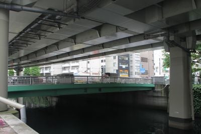
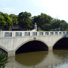
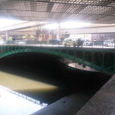
Manaita Bridge, Transportation bridge in Chiyoda-ku, Japan.

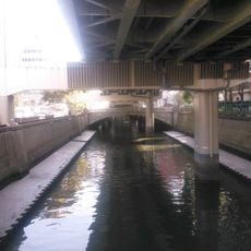
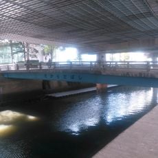
Manaita Bridge connects road sections across the Nihonbashi River in the government district of Chiyoda-ku in central Tokyo. The structure is an earthen bridge spanning between two waterways near the East Gardens of the Imperial Palace.

The original bridge was built between 1624 and 1627 and served as a strategic link between the gates of Edo Castle. It played an important role in the infrastructure of Japan's power center at that time.

The bridge carries a name rooted in traditional food preparation practices, reflecting how ordinary daily activities shaped the city's geography in earlier times. This naming pattern reveals the practical nature of how communities organized their surroundings.

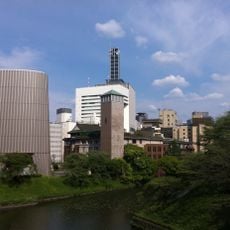
The bridge is easily reached on foot and sits just a short walk from two nearby train stations. The location is well integrated into central Tokyo's transportation system and straightforward to find.

The bridge preserves its earthen construction, a rare building method among modern urban bridges in Tokyo. This traditional approach to bridge building is rarely seen in the city today and makes it stand out.

The community of curious travelers

AroundUs brings together thousands of curated places, local tips, and hidden gems, enriched daily by 60,000 contributors worldwide.

Start exploring
Location
GPS coordinates
35.69564,139.75278
Latest update
December 9, 2025 18:43
« Manaita Bridge - Transportation bridge in Chiyoda-ku, Japan » is provided by Around Us (aroundus.com). Images and texts are derived from Wikimedia project under a Creative Commons license. You are allowed to copy, distribute, and modify copies of this page, under the conditions set by the license, as long as this note is clearly visible.

Discover hidden gems everywhere you go!

From secret cafés to breathtaking viewpoints, skip the crowded tourist spots and find places that match your style. Our app makes it easy with voice search, smart filtering, route optimization, and insider tips from travelers worldwide. Download now for the complete mobile experience.

Around Us App Screenshot

A unique approach to discovering new places

Le Figaro

All the places worth exploring

France Info

A tailor-made excursion in just a few clicks

20 Minutes

Around Us
Travel Guide & Maps
Download

Send to your phone

QR Code
1

Open the camera app on your mobile.

2

Point at the QR code with your camera. A notification will appear.

3

Tap the notification to open the link.