Mount Komochi

Log in to your account

AroundUs is a community-driven map of interesting places, built by curious explorers like you. It grows with every review, story, and photo you share.
Connect to save your favorite spots, contribute locations, and create personalized routes.
Continue with Google
Continue with Apple
Continue with X
Continue with Facebook
Continue with email
By continuing, you accept our Terms and Conditions and our Privacy Policy
Create an account

Mount Komochi

Add to collection
Map
Suggest a change
Share

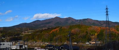
Mount Komochi, Stratovolcano in Gunma Prefecture, Japan

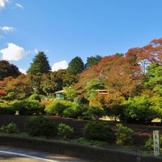
Mount Komochi is a stratovolcano in Gunma Prefecture that reaches about 1,296 meters (4,250 feet) with steep slopes and challenging terrain throughout its ascent. A distinctive rock formation called Shishi Rock stands along the hiking trails and serves as a notable landmark.

The mountain gained prominence when it was recognized as one of the 100 Famous Mountains of the Kanto region and the 100 Famous Mountains of Gunma, establishing its regional significance. This designation marked a turning point that drew increasing attention from the hiking community over time.

The mountain holds deep roots in the local community, with hikers regularly exploring its trails and maintaining traditional climbing practices passed down through generations. People from neighboring towns feel a strong connection to the place and value it as part of their regional identity.

The hike demands careful attention on steep sections, particularly around Shishi Rock where chains and ladders help with safe passage. Good weather conditions and proper gear make a significant difference in tackling these challenging parts of the route.

A surprising feature is a musical road near the mountain that plays the melody of When You Wish Upon a Star when vehicles drive at specific speeds. This unexpected addition blends modern creativity with the natural mountain setting in an entertaining way.

Location: Gunma Prefecture

Location: Shibukawa

Location: Numata

Location: Takayama

Elevation above the sea: 1,296.1 m

Part of: 100 Famous Kantō Mountains, 100 Famous Gunma Mountains

GPS coordinates: 36.59194,138.99761

Latest update: December 10, 2025 16:23

Photos
Reviews

Visited this place? Tap the stars to rate it and share your experience / photos with the community! Try now! You can cancel it anytime.

« Mount Komochi - Stratovolcano in Gunma Prefecture, Japan » is provided by Around Us (aroundus.com). Images and texts are derived from Wikimedia project under a Creative Commons license. You are allowed to copy, distribute, and modify copies of this page, under the conditions set by the license, as long as this note is clearly visible.

Discover hidden gems everywhere you go!

From secret cafés to breathtaking viewpoints, skip the crowded tourist spots and find places that match your style. Our app makes it easy with voice search, smart filtering, route optimization, and insider tips from travelers worldwide. Download now for the complete mobile experience.

Around Us App Screenshot

A unique approach to discovering new places

Le Figaro

All the places worth exploring

France Info

A tailor-made excursion in just a few clicks

20 Minutes