Chest opened
+${chestReward.xp} XP
Explorer
NOUVEAU ×${chestReward.collectible.quantity}
tapez pour fermer

See the monuments around you in AR Open chests in the app

Around Us is built for your phone — point your camera at the streets and discover the monuments and places around you in augmented reality. Around Us is built for your phone — chests unlock when you walk, explore and capture nearby places.

•

Enable Location

We need your location to show you interesting places around you

Discover nearby places

Find interesting locations and hidden gems around you

Precise directions

Get accurate directions and distances to places

Your location is never shared with other users. It's only used when you tap the location button.

Makio Dam

Log in to your account

Start exploring — it's free

Trusted by 95,302 travelers worldwide

Continue with Google
Continue with Apple
or

We will send you a code to connect

By continuing, you accept our Terms and Conditions and our Privacy Policy

Check your inbox

We've sent a pincode in your inbox. Please enter the code below.

Makio Dam

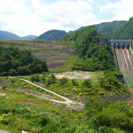
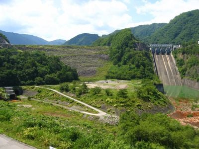
Makio Dam, Rock-fill dam in Nagano Prefecture, Japan.

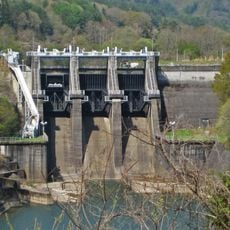
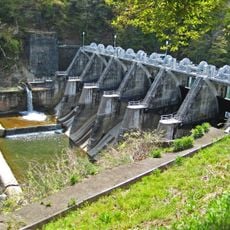
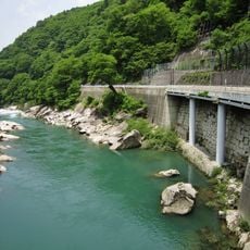
Makio Dam is a rock-fill dam on the Otaki River in Nagano Prefecture that creates a reservoir for the region. The structure manages water from both the Otaki and Kiso River systems to serve multiple needs.

Built between 1957 and 1961 with World Bank financing, Makio Dam was not a flood-control project: it supplies irrigation, municipal and industrial water to the Owari hills and Chita Peninsula through the Aichi Irrigation Scheme, and feeds Kansai Electric Power's Miо pumped-storage plant. The 1984 Western Nagano earthquake damaged crest paving and shoulders and sent landslides into the reservoir, requiring sediment removal over four phases and nine years.

The reservoir behind the dam is named Ontake Lake after Mount Ontake, the 3,067 m volcano rising nearby. The lake's shores hold hot springs and ski areas, and the herbal medicine Ontake Hyakusogan is made in the surrounding area.

Spring through autumn offers the best conditions for visiting, when access roads are clear and the surroundings are easier to navigate. There are viewpoints around the site where you can see the structure and the reservoir without needing specialized equipment.

The 1984 Western Nagano earthquake sent landslides and debris flows from the Matsukoshi area and Nigorigawa Onsen into the reservoir, and dredging was carried out over four phases and nine years. Sediment is still being excavated under a redevelopment project.

The community of curious travelers

AroundUs brings together thousands of curated places, local tips, and hidden gems, enriched daily by 95,302 contributors worldwide.
Start exploring
Location
Location
Inception
1961
GPS coordinates
35.82417,137.60278
Latest update
October 31, 2026 10:15
Reviews
Share your experience

No review yet

Discussions
Start a discussion...

No discussion yet

« Makio Dam - Rock-fill dam in Nagano Prefecture, Japan » is provided by Around Us (aroundus.com). Images and texts are derived from Wikimedia project under a Creative Commons license. You are allowed to copy, distribute, and modify copies of this page, under the conditions set by the license, as long as this note is clearly visible.

Discover hidden gems everywhere you go!

From secret cafés to breathtaking viewpoints, skip the crowded tourist spots and find places that match your style. Our app makes it easy with voice search, smart filtering, route optimization, and insider tips from travelers worldwide. Download now for the complete mobile experience.

Around Us App Screenshot
❝

A unique approach to discovering new places❞

— Le Figaro

❝

All the places worth exploring❞

— France Info

❝

A tailor-made excursion in just a few clicks❞

— 20 Minutes

Around Us
Travel Guide & Maps
Download

Send to your phone

QR Code
1

Open the camera app on your mobile.

2

Point at the QR code with your camera. A notification will appear.

3

Tap the notification to open the link.