Chest opened
+${chestReward.xp} XP
Explorer
NOUVEAU ×${chestReward.collectible.quantity}
tapez pour fermer
Chest locked

Open chests in the app

Around Us is built for your phone — chests unlock when you walk, explore and capture nearby places.

Enable Location

We need your location to show you interesting places around you

Discover nearby places

Find interesting locations and hidden gems around you

Precise directions

Get accurate directions and distances to places

Your location is never shared with other users. It's only used when you tap the location button.

Täteş

Log in to your account

Start exploring — it's free

Trusted by 72,887 travelers worldwide

Continue with Google
Continue with Apple
or

We will send you a code to connect

By continuing, you accept our Terms and Conditions and our Privacy Policy

Check your inbox

We've sent a pincode in your inbox. Please enter the code below.

Discussion Reviews 2 Photos
25.4k Popularity

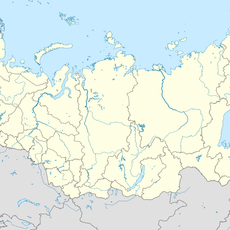
Täteş, Administrative center in Tetyushsky District, Republic of Tatarstan, Russia

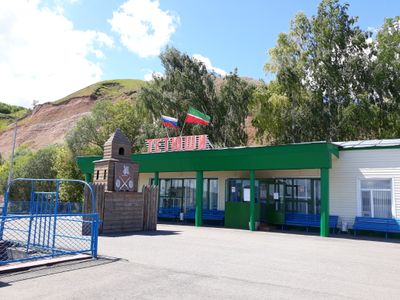
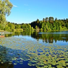
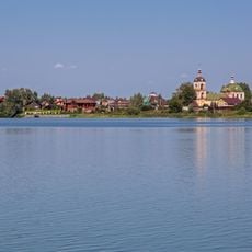
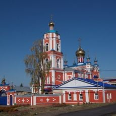
Täteş is the administrative center of Tetyushsky District in Tatarstan, situated at an elevation of about 160 meters above sea level. The town spreads along a river valley and serves as a focal point for surrounding settlements and regional business.

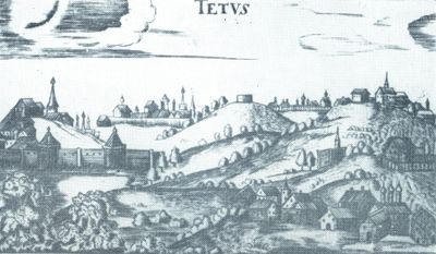
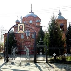
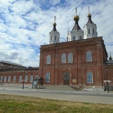
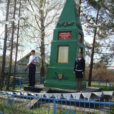
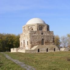
The settlement was founded in 1578 during Russian territorial expansion as a military outpost protecting frontier regions. Over centuries, it transformed into an administrative center that helped organize the district's development and local affairs.

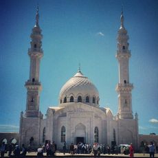
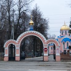
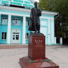
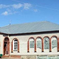
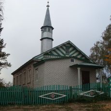
Daily life blends Tatar and Russian customs that are woven into the community's traditions and celebrations. Local residents come together for seasonal festivities where traditional crafts, music, and gatherings shape the social calendar throughout the year.

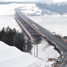
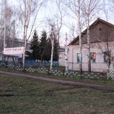
Regional highways and bus services connect the town to nearby settlements and larger centers throughout Tatarstan. Visitors should expect modest local amenities and plan their visits during the warmer months for comfortable travel.

Oil extraction operations in the surrounding area have become part of the region's modern economy and landscape. Few visitors realize how this industrial presence has quietly shaped the town's growth and employment patterns over recent decades.

The community of curious travelers

AroundUs brings together thousands of curated places, local tips, and hidden gems, enriched daily by 60,000 contributors worldwide.

Start exploring
Inception
1578
Elevation above the sea
160 m
GPS coordinates
54.93333,48.83333
Latest update
December 7, 2025 09:27
Around this place
President Bridge
Russian Federation

President Bridge

68.6 km
Bolghar Gord
Russian Federation

Bolghar Gord

14.9 km
Emperor Bridge
Russian Federation

Emperor Bridge

73.2 km
Volzhsko-Kamsky Nature Reserve
Russian Federation

Volzhsko-Kamsky Nature Reserve

36.9 km
Мост через Волгу (М12)
Russian Federation

Мост через Волгу (М12)

72.2 km
White Mosque
Russian Federation

White Mosque

15 km
Resurrection church, Ulyanovsk
Russian Federation

Resurrection church, Ulyanovsk

72.8 km
Yurievskaya Cave
Russian Federation

Yurievskaya Cave

41.9 km
Old cemetery, Ulyanovsk
Russian Federation

Old cemetery, Ulyanovsk

74 km
Bolgar Historical and Archaeological Complex
Russian Federation

Bolgar Historical and Archaeological Complex

15.1 km
Russian Federation

Bogdan Khitrovo monument in Ulyanovsk

73.8 km
Russian Federation

Simbir suv tashuvchisi

73.4 km
Arkhiyereyskoye Lake
Russian Federation

Arkhiyereyskoye Lake

71.5 km
Church of the Resurrection of Christ, Ulyanovsk
Russian Federation

Church of the Resurrection of Christ, Ulyanovsk

73.9 km
Undorsky Mineral Spring
Russian Federation

Undorsky Mineral Spring

47.3 km
Undory Paleontology museum
Russian Federation

Undory Paleontology museum

46 km
Syukeyevo Caves
Russian Federation

Syukeyevo Caves

21.5 km
Храм Рождества Христова (Ульяновск)
Russian Federation

Храм Рождества Христова (Ульяновск)

73.9 km
Kul Gali haykali, Ulyanovsk
Russian Federation

Kul Gali haykali, Ulyanovsk

72.2 km
Gipsy-1
Russian Federation

Gipsy-1

42 km
Собор Николая Чудотворца (Лаишево)
Russian Federation

Собор Николая Чудотворца (Лаишево)

68.5 km
Танкеевский могильник
Russian Federation

Танкеевский могильник

23.6 km
Церковь Троицы Живоначальной (Тетюши)
Russian Federation

Церковь Троицы Живоначальной (Тетюши)

1.1 km
Бөек Ватан сугышы геройларына һәйкәл (Иске Чәчкаб)
Russian Federation

Бөек Ватан сугышы геройларына һәйкәл (Иске Чәчкаб)

69.7 km
170 км (разъезд)
Russian Federation

170 км (разъезд)

63.4 km
Black chamber
Russian Federation

Black chamber

15.1 km
Педер Хузангай музее
Russian Federation

Педер Хузангай музее

68.1 km
İske Çäçqap Mosque
Russian Federation

İske Çäçqap Mosque

69.6 km
Show the full map
Reviews
Share your experience

No review yet

Discussions
Start a discussion...

No discussion yet

« Täteş - Administrative center in Tetyushsky District, Republic of Tatarstan, Russia » is provided by Around Us (aroundus.com). Images and texts are derived from Wikimedia project under a Creative Commons license. You are allowed to copy, distribute, and modify copies of this page, under the conditions set by the license, as long as this note is clearly visible.

Discover hidden gems everywhere you go!

From secret cafés to breathtaking viewpoints, skip the crowded tourist spots and find places that match your style. Our app makes it easy with voice search, smart filtering, route optimization, and insider tips from travelers worldwide. Download now for the complete mobile experience.

Around Us App Screenshot

A unique approach to discovering new places

Le Figaro

All the places worth exploring

France Info

A tailor-made excursion in just a few clicks

20 Minutes

Around Us
Travel Guide & Maps
Download

Send to your phone

QR Code
1

Open the camera app on your mobile.

2

Point at the QR code with your camera. A notification will appear.

3

Tap the notification to open the link.