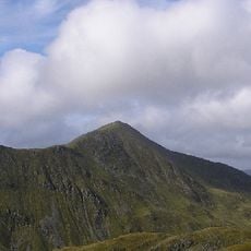
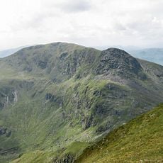
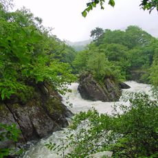
Ben Ledi, Mountain summit in Trossachs, Scotland
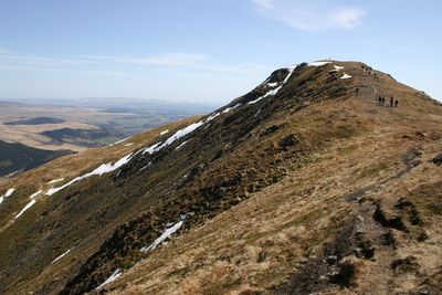
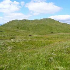
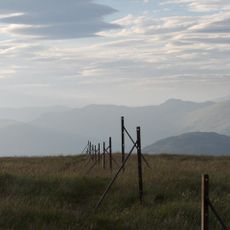
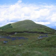
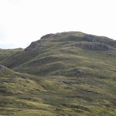
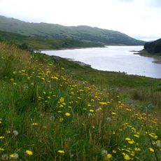
Ben Ledi is a mountain in the Trossachs near Callander that rises to approximately 879 meters at its highest point. The peak offers views across the surrounding landscape and is accessible via established walking trails from the lower elevations.
The mountain's name arose from a mistranslation by a local scholar who misinterpreted its original meaning. Over time, this incorrect version became the accepted name across maps and local usage.
The summit holds meaning for visitors seeking connection with the Scottish landscape, serving as a landmark that frames the identity of the surrounding Trossachs region. Local walking routes reinforce its role as a central gathering point for outdoor enthusiasts throughout the year.
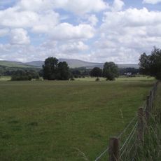
The walk starts from parking near the A84 road and follows maintained paths up the hillside. The ascent suits anyone with general fitness levels and takes several hours to complete the round trip.
An iron cross near the summit commemorates a mountain rescue worker who died during a rescue operation in the 1980s. This quiet memorial reflects the risks faced by those who help others in these rugged highlands.
Location: Stirling
Elevation above the sea: 879 m
GPS coordinates: 56.25861,-4.32212
Latest update: December 10, 2025 15:57
Trossachs
6.9 km
Ben Vorlich
11.3 km
Bracklinn Falls
8.4 km
Stùc a' Chroin
9.4 km
Bicycle Tree
4.1 km
Loch Drunkie
5.8 km
Cambusmore
9.5 km
Falls of Leny
3.1 km
Benvane
4.8 km
Claish Farm, palisaded enclosures and timber hall 250m W of
7.9 km
Callander, South Church Street, St Bride's Church
7 km
Achray Church
5.7 km
Callander, Bridge Street, River Teith, Callander Bridge
6.7 km
Callander, Roman Camp Hotel
7.2 km
Bioran na Circe
2 km
Forth Bridge, Aberfoyle
9.8 km
Sgiath a' Chaise
7.5 km
Stuc Odhar
1.5 km
Kilmahog Bridge
4.8 km
Go Ape Aberfoyle
9.3 km
Cobleland Bridge
11.5 km
Burial Ground, Little Leny, Callendar
6.3 km
Cobleland, pillbox 140m NE of
11.4 km
Forth Viaduct
11.9 km
Bridge Near Ballimore Farm Over Calair Burn On Road To Immeroin, Glen Buckie
8.4 km
Aberfoyle, David Marshal Lodge And Indicator
9.4 km
Gartrenich Bridge
11.9 km
Glen Finglas Reservoir
3.9 kmVisited this place? Tap the stars to rate it and share your experience / photos with the community! Try now! You can cancel it anytime.
Discover hidden gems everywhere you go!
From secret cafés to breathtaking viewpoints, skip the crowded tourist spots and find places that match your style. Our app makes it easy with voice search, smart filtering, route optimization, and insider tips from travelers worldwide. Download now for the complete mobile experience.
A unique approach to discovering new places❞
— Le Figaro
All the places worth exploring❞
— France Info
A tailor-made excursion in just a few clicks❞
— 20 Minutes