·

Enable Location

We need your location to show you interesting places around you

Discover nearby places

Find interesting locations and hidden gems around you

Precise directions

Get accurate directions and distances to places

Your location is never shared with other users. It's only used when you tap the location button.

Chûn Castle

Log in to your account

Start exploring — it's free

Trusted by 62,654 travelers worldwide

Continue with Google
Continue with Apple
or

We will send you a code to connect

By continuing, you accept our Terms and Conditions and our Privacy Policy

Check your inbox

We've sent a pincode in your inbox. Please enter the code below.

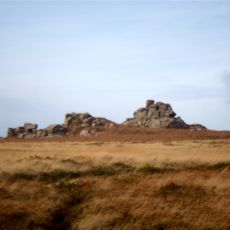
Chûn Castle, Iron Age hillfort in Madron, England

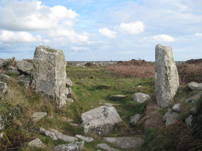
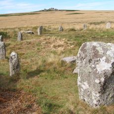
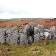
Chûn Castle is an Iron Age hillfort in Cornwall with stone walls forming concentric circles of inner and outer defensive structures. The ruins show a characteristic design of two defensive rings layered across the hilltop in a pattern roughly 50 meters across.

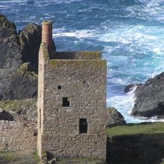
The fort was built around 2,500 years ago as a defensive structure and remained in use until the first century AD. Later, it saw temporary reoccupation during tin mining activities in the area.

The name comes from Cornish 'Chi an Woon', meaning house on the downs, showing the Celtic language traditions rooted in this region. This naming choice reflects how early settlers understood and described their highland surroundings.

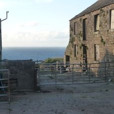
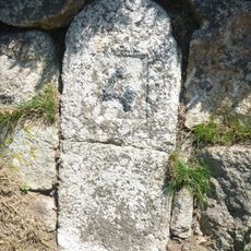
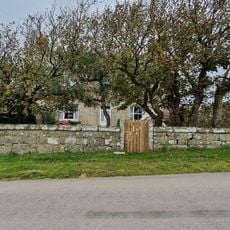
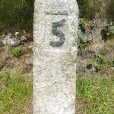
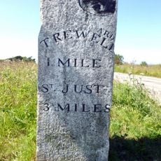
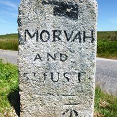
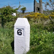
The fort is reached via a marked path beginning at the farmyard and following a white stone marker where pasture meets scrubland. The ground is open moorland with little shelter from wind and weather, so visitors should dress appropriately for exposed conditions.

A carefully built stone well with original steps sits within the fort and supplied water to residents until the 1940s. Notably, this well maintained water even during extended dry periods, making it a crucial advantage for defenders of the site.

The community of curious travelers

AroundUs brings together thousands of curated places, local tips, and hidden gems, enriched daily by 60,000 contributors worldwide.

Start exploring
Location
Location
Location
Location
Part of
Chun Downs prehistoric landscape complex, incorporating Chun Cromlech, Chun Castle, and barrow 200yds (180m) SW of Chun Farm
GPS coordinates
50.14870,-5.63370
Latest update
December 8, 2025 21:02
Around this place
Mên-an-Tol
United Kingdom

Mên-an-Tol

2.4 km
Lanyon Quoit
United Kingdom

Lanyon Quoit

2.5 km
Chûn Quoit
United Kingdom

Chûn Quoit

289 m
Tregeseal East stone circle
United Kingdom

Tregeseal East stone circle

2.4 km
Mên Scryfa
United Kingdom

Mên Scryfa

2.6 km
Aire Point to Carrick Du SSSI
United Kingdom

Aire Point to Carrick Du SSSI

2.8 km
Pendeen Vau
United Kingdom

Pendeen Vau

2.7 km
St Bridget's Church, Morvah
United Kingdom

St Bridget's Church, Morvah

1.5 km
Boswens Menhir
United Kingdom

Boswens Menhir

1.2 km
Bosiliack Barrow
United Kingdom

Bosiliack Barrow

2.6 km
West Lanyon Quoit
United Kingdom

West Lanyon Quoit

1.8 km
Tregeseal holed stones
United Kingdom

Tregeseal holed stones

2 km
Portheras Cove
United Kingdom

Portheras Cove

2.5 km
Milestone 150M South-East Of Morvah Church
United Kingdom

Milestone 150M South-East Of Morvah Church

1.4 km
Church of St John the Baptist
United Kingdom

Church of St John the Baptist

2.3 km
Milestone Approximately 198M East Of Wheal Bal Farm
United Kingdom

Milestone Approximately 198M East Of Wheal Bal Farm

2 km
Pendeen Manor House Adjoining Wall To South East Of Pendeen Manor House
United Kingdom

Pendeen Manor House Adjoining Wall To South East Of Pendeen Manor House

2.6 km
Lanyon Farmhouse, Front Garden Walls, Cartshed And Mounting Block
United Kingdom

Lanyon Farmhouse, Front Garden Walls, Cartshed And Mounting Block

2.1 km
St Just Mining District
United Kingdom

St Just Mining District

2.1 km
Milestone Approximately 15M North-East Of Chy Lowena Cottage
United Kingdom

Milestone Approximately 15M North-East Of Chy Lowena Cottage

1.8 km
Milestone At Sw 41682 34555, 110M North-East Of Bosullow
United Kingdom

Milestone At Sw 41682 34555, 110M North-East Of Bosullow

1.3 km
Milestone At Sw397327
United Kingdom

Milestone At Sw397327

1.5 km
Guide Stone At Junction Of Pendeen And Trewellard Roads
United Kingdom

Guide Stone At Junction Of Pendeen And Trewellard Roads

1.3 km
Wayside cross immediately north east of St John the Baptist's Church
United Kingdom

Wayside cross immediately north east of St John the Baptist's Church

2.2 km
Guidepost Approximately 350M North-West Of Bosullow Cottage
United Kingdom

Guidepost Approximately 350M North-West Of Bosullow Cottage

1.3 km
Milestone 22M South-West Of Springs Bungalow
United Kingdom

Milestone 22M South-West Of Springs Bungalow

1.6 km
Guide Post At Sw406317
United Kingdom

Guide Post At Sw406317

2.2 km
Guide Post At Sw407318
United Kingdom

Guide Post At Sw407318

2.1 km
Show the full map
« Chûn Castle - Iron Age hillfort in Madron, England » is provided by Around Us (aroundus.com). Images and texts are derived from Wikimedia project under a Creative Commons license. You are allowed to copy, distribute, and modify copies of this page, under the conditions set by the license, as long as this note is clearly visible.

Discover hidden gems everywhere you go!

From secret cafés to breathtaking viewpoints, skip the crowded tourist spots and find places that match your style. Our app makes it easy with voice search, smart filtering, route optimization, and insider tips from travelers worldwide. Download now for the complete mobile experience.

Around Us App Screenshot

A unique approach to discovering new places

Le Figaro

All the places worth exploring

France Info

A tailor-made excursion in just a few clicks

20 Minutes

Around Us
Travel Guide & Maps
Download

Send to your phone

QR Code
1

Open the camera app on your mobile.

2

Point at the QR code with your camera. A notification will appear.

3

Tap the notification to open the link.