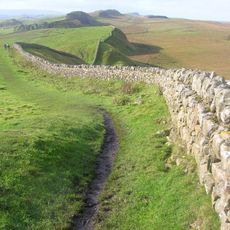
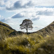
Housesteads Roman Fort, Ancient Roman fort in Bardon Mill, United Kingdom
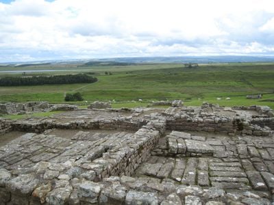
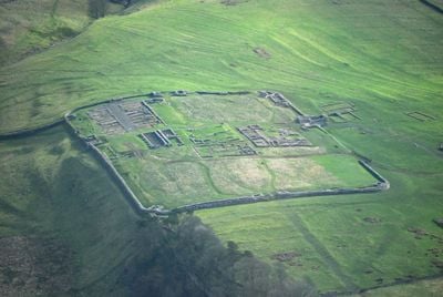
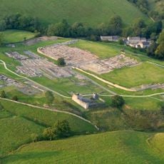
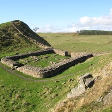
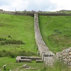
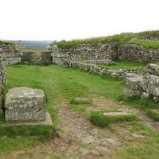
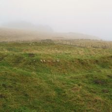
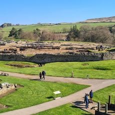
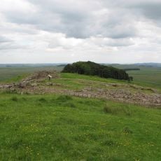
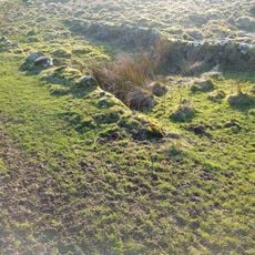
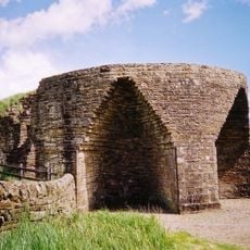
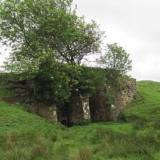
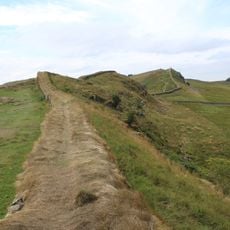
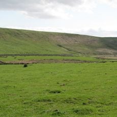
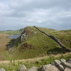
Housesteads Roman Fort is an ancient garrison set on a high ridge above Hadrian's Wall, with surviving stone walls, barracks buildings, storage granaries, and a prominent headquarters structure. These ruins reveal how a Roman military installation was laid out and organized across the sloping terrain.
Known to Romans as Vercovicium, the fort was built in 124 AD and operated for roughly three centuries under successive military units. The garrison underwent changes in size and function as Rome's needs in Britain shifted over this long period.
The fort served as a working Roman garrison where soldiers shared meals, drilled together, and lived in separate quarters depending on rank. The layout of buildings reveals how daily routines were organized and the clear divisions between officers and ordinary troops.
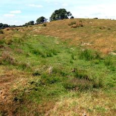
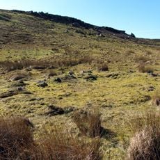
The site is open daily and accessed via marked pathways, though the terrain is uneven and slopes noticeably uphill. An on-site museum displays Roman artifacts and offers context to help you understand the layout and remains you encounter.
The fort still displays stone-built water tanks and communal latrines, revealing how Romans engineered water systems and sanitation in this exposed hilltop location. These practical innovations were essential for sustaining a large garrison in such demanding conditions.
Location: Bardon Mill
Part of: Housesteads fort, section of Wall and vallum between the field boundary west of milecastle 36 and the field boundary west of turret 37a in wall miles 36 and 37, Hadrian's Wall
Phone: +441434344525
Website: https://nationaltrust.org.uk/hadrians-wall-and-housesteads-fort
GPS coordinates: 55.01300,-2.33100
Latest update: December 7, 2025 19:30
Hadrian's Wall
2.8 km
Vindolanda
3.4 km
Castra Vindolanda
3 km
Sycamore Gap Tree
2.9 km
Milecastle 39
3 km
Knag Burn Gateway
238 m
Milecastle 37
431 m
Milecastle 38
1.8 km
Vindolanda Museum
2.9 km
Milecastle 35
2.1 km
Milecastle 34
3.3 km
Vindolanda Museum
3.2 km
Housesteads Mithraeum
325 m
Bardon Mill
1.6 km
East Stonefields Farmhouse And Attached Farmbuildings And Walls
2.1 km
Round cairn, 120m south of King's Crags
2.5 km
Round cairn, 150m east of Kingscrag Gate
2.2 km
Round cairn, 120m ENE of Kingscrag Gate
2.2 km
Crindledykes Lime Kiln
2 km
Lime Kiln 800 Metres West Of Town Shields Farmhouse
3.1 km
Stone circle, 380m east of King's Crags
2.7 km
Housesteads fort, section of Wall and vallum between the field boundary west of milecastle 36 and the field boundary west of turret 37a in wall miles 36 and 37
236 m
Uninscribed Roman milestone at Codley Gate (Vindolanda)
2.9 km
Stone circle, defended settlement, Romano-British farmstead and field system, Roman camp and group of shielings immediately sout
1.6 km
Roman quarry inscription on Queen's Crags, 680m south east of East Hotbank
1.9 km
Hadrian's Wall and associated features between the field boundary west of turret 37a and the road to Steel Rigg car park in wall
2.7 km
Milestone, E of Housesteads Roman Fort; at entrance to "Beggarbog"
804 m
Round cairn, 150m ESE of Kingscrag Gate
2.2 kmVisited this place? Tap the stars to rate it and share your experience / photos with the community! Try now! You can cancel it anytime.
Discover hidden gems everywhere you go!
From secret cafés to breathtaking viewpoints, skip the crowded tourist spots and find places that match your style. Our app makes it easy with voice search, smart filtering, route optimization, and insider tips from travelers worldwide. Download now for the complete mobile experience.
A unique approach to discovering new places❞
— Le Figaro
All the places worth exploring❞
— France Info
A tailor-made excursion in just a few clicks❞
— 20 Minutes