Enable Location

We need your location to show you interesting places around you

Discover nearby places

Find interesting locations and hidden gems around you

Precise directions

Get accurate directions and distances to places

Your location is never shared with other users. It's only used when you tap the location button.

Milecastle 39

Log in to your account

Start exploring — it's free

Trusted by 62,557 travelers worldwide

Continue with Google
Continue with Apple
or

We will send you a code to connect

By continuing, you accept our Terms and Conditions and our Privacy Policy

Check your inbox

We've sent a pincode in your inbox. Please enter the code below.

Milecastle 39

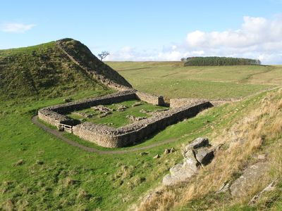
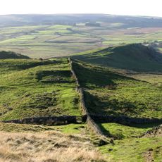
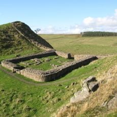
Milecastle 39, Roman fortification at Hadrian's Wall, England

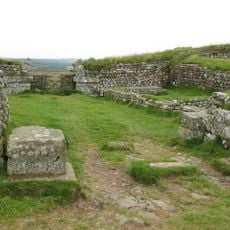
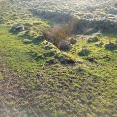
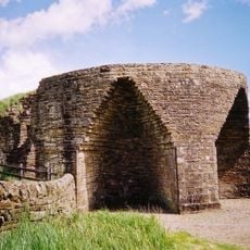
Milecastle 39, also known as Castle Nick, is a small Roman fortification along Hadrian's Wall featuring stone walls and a gateway for controlling passage along the frontier. The site preserves remains of soldier quarters and a cooking area, showing how troops were housed and supplied.

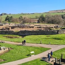
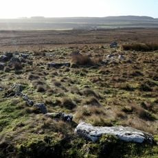
The fort was built by Romans after 122 AD as part of the frontier defense system. Excavations starting in the 1800s revealed the foundations and layout of this ancient garrison, adding to knowledge of Roman Britain.

This milecastle demonstrates Roman military engineering through its rectangular design, stone oven placement in the southeast corner, and garrison quarters in the southwest section.

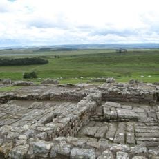
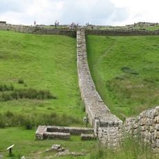
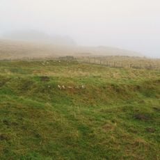
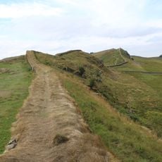
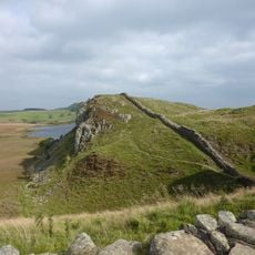
The site sits on a steep hillside and can be viewed from the adjacent walking path. Visitors should wear sturdy footwear since the ground is uneven and often wet underfoot.

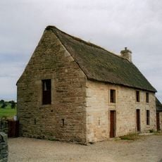
An 18th-century milking house was constructed inside the western corner of the ancient ruins, showing how people reused old structures for new purposes. This discovery reveals the site remained useful for local residents long after the Romans left.

The community of curious travelers

AroundUs brings together thousands of curated places, local tips, and hidden gems, enriched daily by 60,000 contributors worldwide.

Start exploring
Location
Part of
Hadrian's Wall
GPS coordinates
55.00360,-2.37576
Latest update
December 11, 2025 11:02
Around this place

Vindolanda
United Kingdom

Vindolanda

1.7 km
Sycamore Gap Tree
United Kingdom

Sycamore Gap Tree

120 m
Housesteads Roman Fort
United Kingdom

Housesteads Roman Fort

3 km
Knag Burn Gateway
United Kingdom

Knag Burn Gateway

3.3 km
Milecastle 37
United Kingdom

Milecastle 37

2.6 km
Milecastle 38
United Kingdom

Milecastle 38

1.3 km
Vindolanda Museum
United Kingdom

Vindolanda Museum

1.8 km
Milecastle 40
United Kingdom

Milecastle 40

1.5 km
Milecastle 41
United Kingdom

Milecastle 41

3.1 km
Church of All Hallows
United Kingdom

Church of All Hallows

3.4 km
Vindolanda Museum
United Kingdom

Vindolanda Museum

1.8 km
Bardon Mill signal box
United Kingdom

Bardon Mill signal box

3.7 km
Housesteads Mithraeum
United Kingdom

Housesteads Mithraeum

3.1 km
Bardon Mill War Memorial
United Kingdom

Bardon Mill War Memorial

3.8 km
Uninscribed Roman milestone at Codley Gate (Vindolanda)
United Kingdom

Uninscribed Roman milestone at Codley Gate (Vindolanda)

1.7 km
Ring cairn and shieling immediately west of Chatley Crags
United Kingdom

Ring cairn and shieling immediately west of Chatley Crags

2.7 km
Crindledykes Lime Kiln
United Kingdom

Crindledykes Lime Kiln

2.1 km
East Stonefields Farmhouse And Attached Farmbuildings And Walls
United Kingdom

East Stonefields Farmhouse And Attached Farmbuildings And Walls

3.3 km
Bardon Mill
United Kingdom

Bardon Mill

2.6 km
Housesteads fort, section of Wall and vallum between the field boundary west of milecastle 36 and the field boundary west of turret 37a in wall miles 36 and 37
United Kingdom

Housesteads fort, section of Wall and vallum between the field boundary west of milecastle 36 and the field boundary west of turret 37a in wall miles 36 and 37

2.9 km
Stone circle, defended settlement, Romano-British farmstead and field system, Roman camp and group of shielings immediately sout
United Kingdom

Stone circle, defended settlement, Romano-British farmstead and field system, Roman camp and group of shielings immediately sout

2.3 km
Hadrian's Wall and associated features between the field boundary west of turret 37a and the road to Steel Rigg car park in wall
United Kingdom

Hadrian's Wall and associated features between the field boundary west of turret 37a and the road to Steel Rigg car park in wall

336 m
Milestone, Winshields
United Kingdom

Milestone, Winshields

2.5 km
Hadrians Wall Milecastle And Turret
United Kingdom

Hadrians Wall Milecastle And Turret

3 km
Hadrians Wall Milecastles And Turrets
United Kingdom

Hadrians Wall Milecastles And Turrets

1.3 km
Causeway House And Loose Box Adjoining On East
United Kingdom

Causeway House And Loose Box Adjoining On East

1.4 km
Roman milestone, E of Chesterholm Fort
United Kingdom

Roman milestone, E of Chesterholm Fort

1.7 km
Show the full map
« Milecastle 39 - Roman fortification at Hadrian's Wall, England » is provided by Around Us (aroundus.com). Images and texts are derived from Wikimedia project under a Creative Commons license. You are allowed to copy, distribute, and modify copies of this page, under the conditions set by the license, as long as this note is clearly visible.

Discover hidden gems everywhere you go!

From secret cafés to breathtaking viewpoints, skip the crowded tourist spots and find places that match your style. Our app makes it easy with voice search, smart filtering, route optimization, and insider tips from travelers worldwide. Download now for the complete mobile experience.

Around Us App Screenshot

A unique approach to discovering new places

Le Figaro

All the places worth exploring

France Info

A tailor-made excursion in just a few clicks

20 Minutes

Around Us
Travel Guide & Maps
Download

Send to your phone

QR Code
1

Open the camera app on your mobile.

2

Point at the QR code with your camera. A notification will appear.

3

Tap the notification to open the link.