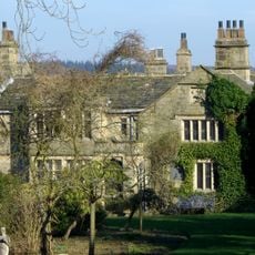
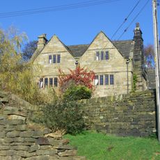
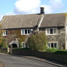
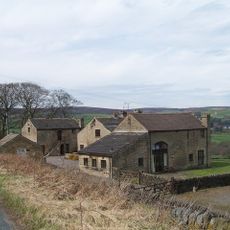
Fair House Farmhouse, Grade II* listed farmhouse in Bradfield, England
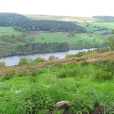
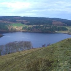
The three-story farmhouse features locally sourced gritstone blocks, stone slate roofing, and multiple four-light windows overlooking the Dale Dike valley.
Originally named Swinden House in the 1630s, the farmhouse contains internal paneling dated 1687 and withstood the Great Sheffield Flood of 1864.
The farmhouse exemplifies traditional English agricultural architecture through its practical layout, local material usage, and preserved historical features.
The property maintains its original oak staircase, stone steps, and interior wall panels, requiring special permits for any modifications due to its protected status.
The building's main facade faces away from Annet Lane, with Grade II listed stable and garage structures extending westward at right angles.
Location: Bradfield
GPS coordinates: 53.42270,-1.60980
Latest update: March 11, 2025 08:52
Dale Dike Reservoir
1.7 km
Church of St Nicholas, Bradfield
986 m
Strines Reservoir
3.4 km
Sugworth Hall
3.6 km
Hallfield House
2.6 km
Monastery of The Holy Spirit, Sheffield
2.5 km
Onesacre Hall
4 km
Moscar Cross
4.5 km
Sugworth Tower
3.6 km
Edgefield Monument
963 m
Guidepillar At Junction With Lumb Lane, Onesmoor Bottom And Onesacre Road On West Side Of Junction
2.7 km
64, Towngate Road
4.6 km
Guide Pillar At Junction With Brightholmlee Road On South West Side Of Junction
4.4 km
Mile Post Approximately 90 Metres West Of Driveway To Swinglee Ford
4.4 km
Guide Pillar At Junction With Brightolmlee Road And Peat Pits Lane On South Side Of Junction
2.6 km
Guide Pillar At Junction With Burnt Hill Lane, East Side Of Junction
2.8 km
Guide Pillar At Junction With Walker Edge, Green Lane And White Lee Lane, On South West Side Of Junction
3.2 km
Fox Holes Farmhouse, Attached Farmbuildings And Linking Walls
755 m
Glen Howe Packhorse Bridge, Approximately 100 Metres Upstream Of Cottage
4 km
Take Off Stone Approx 85 Metres To North Of Strines Public House
3.9 km
Guide Pillar At Junction With Onesmoor Road On West Side Of Junction
2.7 km
Wayside cross on Bradfield Moor known as New Cross
4.5 km
Guide Pillar At Junction With Mortimer Road On South Side Of Junction
3.3 km
Mile Post Approximately 140 Metres East Of Black Rock
4.2 km
Guide Pillar At Junction With Peat Pits Lane, On North East Side Of Junction
2 km
Guide Pillar At Handsome Cross On North Side Of Road
2.3 km
Guidestone, Wet Shaw Lane, jct with Stake Hill Road
2.1 km
Damflask Reservoir
2 kmReviews
Visited this place? Tap the stars to rate it and share your experience / photos with the community! Try now! You can cancel it anytime.
Discover hidden gems everywhere you go!
From secret cafés to breathtaking viewpoints, skip the crowded tourist spots and find places that match your style. Our app makes it easy with voice search, smart filtering, route optimization, and insider tips from travelers worldwide. Download now for the complete mobile experience.
A unique approach to discovering new places❞
— Le Figaro
All the places worth exploring❞
— France Info
A tailor-made excursion in just a few clicks❞
— 20 Minutes