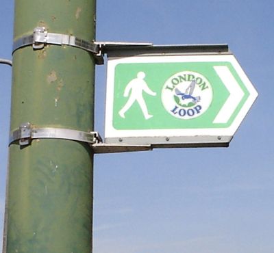
London Outer Orbital Path, signed walk along public footpaths
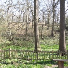
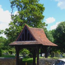
The London Outer Orbital Path is a long-distance trail that circles the outer edge of London, connecting several boroughs through a continuous route. The path passes through parks, green spaces, and woodlands that sit beyond the city's inner core.
The route was developed over time as a way to offer walkers a circular path around London's expanding outer areas. It came together through linking existing paths and creating new sections to form a complete loop.
The trail requires solid walking experience and good physical fitness because of its length. It is best walked in stages over multiple days, and navigation tools or apps help keep you on course.
Many walkers are surprised to discover that the trail passes through lesser-known neighborhoods and hidden green spaces that are not visible from typical tourist routes. These quieter areas reveal a different side of London far from the usual crowds.
Location: London Borough of Bexley
Location: London Borough of Richmond upon Thames
Location: London Borough of Croydon
Operator: TfL Transport for London
Part of: Walk London Network
Website: https://tfl.gov.uk/modes/walking/loop-walk
GPS coordinates: 51.48314,0.17797
Latest update: December 15, 2025 13:27
Lesnes Abbey
3.5 km
Tilda
2.1 km
The Diver
1.6 km
Lesnes Abbey Woods
3.5 km
Rainham Marshes Nature Reserve
3.3 km
Erith Playhouse
326 m
Abbey Wood SSSI
3.4 km
Our Lady of the Angels Church, Erith
1.3 km
One Bell
3.3 km
Bexley Civic Offices
3.5 km
Crossness Nature Reserve
2.9 km
Church of St Paulinus, Crayford
3.2 km
Parish Church of St John the Baptist
726 m
Parish Church of All Saints
2.1 km
Christ Church
394 m
Erith Old Library
198 m
St Paul's
1.7 km
Coal Duty Boundary Marker (On Foreshore, At Mouth Of River Darenth, West Bank)
2.7 km
Erith (Christ Church) War Memorial
373 m
28 And 30, Erith High Street
290 m
St Peter's
3.4 km
Crayford War Memorial
2.8 km
Government Powder Magazine
3.6 km
Orchard House
3.5 km
The Long Shed (Part Of David Evans Limited Factory At Number 71)
3.5 km
World War II Heavy Anti-Aircraft (Haa) Battery
2.1 km
Crayford Manor House
2.8 km
Lychgate to West of Parish Church of St Paulinus
3.2 kmVisited this place? Tap the stars to rate it and share your experience / photos with the community! Try now! You can cancel it anytime.
Discover hidden gems everywhere you go!
From secret cafés to breathtaking viewpoints, skip the crowded tourist spots and find places that match your style. Our app makes it easy with voice search, smart filtering, route optimization, and insider tips from travelers worldwide. Download now for the complete mobile experience.
A unique approach to discovering new places❞
— Le Figaro
All the places worth exploring❞
— France Info
A tailor-made excursion in just a few clicks❞
— 20 Minutes